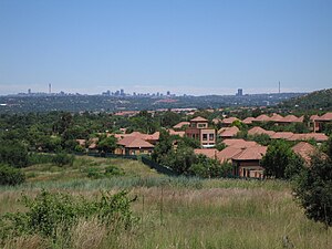
Country:
Region:
City:
Latitude and Longitude:
Time Zone:
Postal Code:
IP information under different IP Channel
ip-api
Country
Region
City
ASN
Time Zone
ISP
Blacklist
Proxy
Latitude
Longitude
Postal
Route
Luminati
Country
ASN
Time Zone
Africa/Johannesburg
ISP
Web4Africa
Latitude
Longitude
Postal
IPinfo
Country
Region
City
ASN
Time Zone
ISP
Blacklist
Proxy
Latitude
Longitude
Postal
Route
db-ip
Country
Region
City
ASN
Time Zone
ISP
Blacklist
Proxy
Latitude
Longitude
Postal
Route
ipdata
Country
Region
City
ASN
Time Zone
ISP
Blacklist
Proxy
Latitude
Longitude
Postal
Route
Popular places and events near this IP address

Randburg
Place in Gauteng, South Africa
Distance: Approx. 839 meters
Latitude and longitude: -26.09361111,28.00638889
Randburg is an area located in the Gauteng province of South Africa. Formerly a separate municipality, its administration devolved to the newly created City of Johannesburg Metropolitan Municipality, along with neighbouring Sandton and Roodepoort, in the late 1990s. During the transitional period of 1996–2000, Randburg was part of the Northern Metropolitan Local Council (MLC).
Beverley Gardens
Place in Gauteng, South Africa
Distance: Approx. 1739 meters
Latitude and longitude: -26.07416667,27.99277778
Beverley Gardens is a suburb of Johannesburg, South Africa. It is located in Region 3.
Bordeaux, Gauteng
Place in Gauteng, South Africa
Distance: Approx. 1629 meters
Latitude and longitude: -26.0975,28.01416667
Bordeaux is a suburb of Johannesburg, South Africa. Found north of the Johannesburg CBD, it is next to the suburbs of Ferndale, Blairgowrie and Hurlingham. It is located in Region B of the City of Johannesburg Metropolitan Municipality.
Bryanbrink
Place in Gauteng, South Africa
Distance: Approx. 573 meters
Latitude and longitude: -26.08166667,28.00166667
Bryanbrink is a suburb of Johannesburg, South Africa. It is located in Region B of the City of Johannesburg Metropolitan Municipality. Kensington B forms part of ward 104 of the City of Johannesburg represented by Counselor Mike Woods.
Bryanston West, Gauteng
Place in Gauteng, South Africa
Distance: Approx. 1652 meters
Latitude and longitude: -26.07861111,28.01722222
Bryanston West is a suburb of Johannesburg, South Africa. It is located in Region B of the City of Johannesburg Metropolitan Municipality.
Cramerview
Place in Gauteng, South Africa
Distance: Approx. 1746 meters
Latitude and longitude: -26.073,28.012
Cramerview is a suburb of Johannesburg, South Africa. It is located in Region B of the City of Johannesburg Metropolitan Municipality.
Daniel Brink Park
Place in Gauteng, South Africa
Distance: Approx. 1441 meters
Latitude and longitude: -26.074,28
Daniel Brink Park is a suburb of Johannesburg, South Africa, in Region B of the City of Johannesburg Metropolitan Municipality.
Lyme Park, Gauteng
Place in Gauteng, South Africa
Distance: Approx. 1049 meters
Latitude and longitude: -26.083,28.013
Lyme Park is a suburb of Johannesburg, South Africa. It is located in Region B of the City of Johannesburg Metropolitan Municipality.
Baptist Theological College of Southern Africa
Theological college in Randburg, South Africa
Distance: Approx. 1444 meters
Latitude and longitude: -26.09936,28.00071
The Baptist Theological College of Southern Africa (BTC) is a Baptist theological institute located in Randburg, South Africa. The college's current principal is Prof. 'Piff' G. C. Pereira who succeeded Prof.
St Stithians College
Private & boarding school in Johannesburg, Gauteng, South Africa
Distance: Approx. 1378 meters
Latitude and longitude: -26.08638889,28.01708333
St Stithians College (colloquially known as Saints) is a private Methodist school situated in the suburb of Lyme Park in the border of Sandton and Randburg in the Gauteng province of South Africa. Founded in 1953 by Albert Collins, William Mountstephens and Gilbert Tucker, it has consistently ranked amongst the top performing independent schools in South Africa. It follows a co-ordinate educational model within a village of schools consisting of boys' and girls' colleges, boys' and girls' preparatory schools, and a junior preparatory.
Kensington B
Place in Gauteng, South Africa
Distance: Approx. 1093 meters
Latitude and longitude: -26.076806,28.002505
Kensington B is a suburb in Randburg, which is an area located in northern Johannesburg, Gauteng, South Africa. Kensington B is part of ward 104 of the City of Johannesburg represented by Counselor Mike Woods. The area forms part of the KenBrink Residents Association which represents the interests of residents living in the suburb.

Randburg Library
Library in Johannesburg, South Africa
Distance: Approx. 1087 meters
Latitude and longitude: -26.0962,28.0053
The Randburg Library is one of the regional libraries in the city of Johannesburg, South Africa. The Library serves the township of Cosmo City and the surrounding suburbs; it is situated within the Randburg Civic Centre. It falls under the City of Johannesburg's Region B libraries.
Weather in this IP's area
clear sky
18 Celsius
18 Celsius
17 Celsius
19 Celsius
1018 hPa
76 %
1018 hPa
851 hPa
10000 meters
0.89 m/s
0.89 m/s
136 degree
05:10:55
18:34:34