102.65.5.57 - IP Lookup: Free IP Address Lookup, Postal Code Lookup, IP Location Lookup, IP ASN, Public IP
Country:
Region:
City:
Location:
Time Zone:
Postal Code:
ISP:
ASN:
language:
User-Agent:
Proxy IP:
Blacklist:
IP information under different IP Channel
ip-api
Country
Region
City
ASN
Time Zone
ISP
Blacklist
Proxy
Latitude
Longitude
Postal
Route
db-ip
Country
Region
City
ASN
Time Zone
ISP
Blacklist
Proxy
Latitude
Longitude
Postal
Route
IPinfo
Country
Region
City
ASN
Time Zone
ISP
Blacklist
Proxy
Latitude
Longitude
Postal
Route
IP2Location
102.65.5.57Country
Region
western cape
City
paarl
Time Zone
Africa/Johannesburg
ISP
Language
User-Agent
Latitude
Longitude
Postal
ipdata
Country
Region
City
ASN
Time Zone
ISP
Blacklist
Proxy
Latitude
Longitude
Postal
Route
Popular places and events near this IP address

Paarl
Town in Western Cape, South Africa
Distance: Approx. 2089 meters
Latitude and longitude: -33.72416667,18.95583333
Paarl (; Afrikaans: [ˈpæːrəl]; derived from parel, meaning "pearl" in Dutch) is a town with 285,574 inhabitants in the Western Cape province of South Africa. It is the largest town in the Cape Winelands. Due to the growth of the Mbekweni township, it is now a de facto urban unit with Wellington.
Afrikaans Language Monument
Monument in Paarl, Western Cape, South Africa
Distance: Approx. 4667 meters
Latitude and longitude: -33.76576,18.94257
The Afrikaans Language Monument (Afrikaans: Afrikaanse Taalmonument) is located on a hill overlooking Paarl, Western Cape Province, South Africa. Officially opened on 10 October 1975, it commemorates the semicentenary of Afrikaans being declared an official language of South Africa separate from Dutch. Also, it was erected on the 100th anniversary of the founding of Genootskap van Regte Afrikaners (the Society of Real Afrikaners) in Paarl, the organisation that helped strengthen Afrikaners' identity and pride in their language.

Boland Park
Cricket stadium
Distance: Approx. 2302 meters
Latitude and longitude: -33.74138889,18.99833333
Boland Park is a multi-purpose stadium in Paarl, South Africa. It is currently used mostly for cricket matches and hosted three matches during the 2003 Cricket World Cup. Boland cricket team and the Paarl Royals both stage home matches at the ground.
Paarl Boys' High School
Boys' school in South Africa
Distance: Approx. 1505 meters
Latitude and longitude: -33.73916667,18.96027778
Paarl Boys' High School, known in Afrikaans as Hoër Jongenskool Paarl (or Boishaai), is a public dual-medium high school for boys and is one of the oldest schools in South Africa, built in 1868. The school is situated in Paarl, a town in the Western Cape province of South Africa. The first headmaster of the school was George Jeffreys.
Paarl Gimnasium
Public & boarding school in Paarl, Western Cape, South Africa
Distance: Approx. 2150 meters
Latitude and longitude: -33.7203,18.9586
Paarl Gimnasium is a public Afrikaans medium co-educational high school situated in the city of Paarl in the Western Cape province of South Africa.
Fairview Wine and Cheese
Distance: Approx. 6431 meters
Latitude and longitude: -33.7725,18.92361111
Fairview Wine and Cheese farm is a South African producer of wines and cheeses based in the Paarl region of the Western Cape province. It is owned and run by Charles Back, who also owns The Goats do Roam Wine Company and The Spice Route Winery.
Huguenot railway station (South Africa)
Railway station in Paarl, South Africa
Distance: Approx. 444 meters
Latitude and longitude: -33.73,18.97666667
Huguenot railway station is the main passenger railway station in the town of Paarl, Western Cape, South Africa. It is served by Metrorail commuter trains on the Northern Line. It is also the second stop out of Cape Town for Shosholoza Meyl inter-city trains originating or terminating there.
La Rochelle Girls' High School
School in Paarl, Western Cape, South Africa
Distance: Approx. 1190 meters
Latitude and longitude: -33.7374,18.9631
La Rochelle Girls' High School, (Afrikaans: Hoër Meisieskool La Rochelle) in Paarl is the oldest girls' school in South Africa (tied with Rhenish Girls' High School in Stellenbosch).
Mbekweni
Place in Western Cape, South Africa
Distance: Approx. 6144 meters
Latitude and longitude: -33.68,18.99
Mbekweni is a township situated between Wellington and Paarl in the Western Cape province of South Africa. As of 2011 it had a population of 30,875 residents in 8,339 households. Paarl, Mbekweni and Wellington form a continuous urban area within the Drakenstein Municipality.
Spice Route Paarl
Tourist destination in Paarl, South Africa
Distance: Approx. 6148 meters
Latitude and longitude: -33.7635,18.9192
The Spice Route Paarl is a tourist destination located in the city of Paarl, South Africa. The farm is open 7 days a week but each vendor adheres to their own operating hours. The name Spice Route dates back to the historical mariners who used to trade Eastern spices to Europe along the "Spice Route" for spice trade in the 15th century.

Drakenstein Lion Park
Zoo in Western Cape, South Africa
Distance: Approx. 9142 meters
Latitude and longitude: -33.79538333,18.90984167
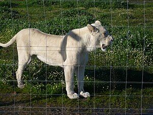
Drakenstein Lion Park is a zoological park in Drakenstein, Western Cape, South Africa. It was established in 1998 to keep lions which could not be rehabilitated into the wilderness, and was meant to replace the now-defunct Tygerberg Zoo, which housed possible descendants of the Cape lion, amongst other animals. Other animals included chimpanzees and tigers, including from Novosibirsk Zoo, from where Tygerberg's director John Spence managed to obtain his lions.
Val de Vie Estate
Estate in Paarl, Western Cape, South Africa
Distance: Approx. 8427 meters
Latitude and longitude: -33.80926667,18.96797778
Val de Vie Estate (from French "Valley of Life") is a residential estate occupying 917 hectares (2,270 acres), situated between Stellenbosch, Paarl and Franschhoek in the Cape Winelands of South Africa. The estate encompasses various neighbourhoods each with its own characteristics, surrounded by vineyards, polo fields, natural fynbos vegetation, parks, lakes and mountains. The estate is known for its world class polo facilities, Jack Nicklaus Signature Golf Course, mountain bike trails and L'Huguenot wine cellar.
Weather in this IP's area
broken clouds
20 Celsius
20 Celsius
20 Celsius
20 Celsius
1013 hPa
82 %
1013 hPa
1000 hPa
10000 meters
3.27 m/s
4.3 m/s
331 degree
78 %


