102.65.1.74 - IP Lookup: Free IP Address Lookup, Postal Code Lookup, IP Location Lookup, IP ASN, Public IP
Country:
Region:
City:
Location:
Time Zone:
Postal Code:
ISP:
ASN:
language:
User-Agent:
Proxy IP:
Blacklist:
IP information under different IP Channel
ip-api
Country
Region
City
ASN
Time Zone
ISP
Blacklist
Proxy
Latitude
Longitude
Postal
Route
db-ip
Country
Region
City
ASN
Time Zone
ISP
Blacklist
Proxy
Latitude
Longitude
Postal
Route
IPinfo
Country
Region
City
ASN
Time Zone
ISP
Blacklist
Proxy
Latitude
Longitude
Postal
Route
IP2Location
102.65.1.74Country
Region
western cape
City
fish hoek
Time Zone
Africa/Johannesburg
ISP
Language
User-Agent
Latitude
Longitude
Postal
ipdata
Country
Region
City
ASN
Time Zone
ISP
Blacklist
Proxy
Latitude
Longitude
Postal
Route
Popular places and events near this IP address

Fish Hoek
Place in Western Cape, South Africa
Distance: Approx. 519 meters
Latitude and longitude: -34.136,18.43
Fish Hoek (Afrikaans: Vishoek, meaning either Fish Corner or Fish Glen) is a coastal suburb of Cape Town at the eastern end of the Fish Hoek Valley on the False Bay side of the Cape Peninsula in the Western Cape, South Africa. Previously a separate municipality, Fish Hoek is now part of the City of Cape Town.

Bible Institute of South Africa
Distance: Approx. 2121 meters
Latitude and longitude: -34.1302,18.4473
The Bible Institute of South Africa is an evangelical Bible college located on the False Bay coastline in Kalk Bay, Cape Town in South Africa. The college has students from across Africa, as well as from Europe, Asia and North America. BISA is a non-denominational bible training college.
Kalk Bay
Fishing village on the coast of False Bay, and a suburb of Cape Town, Western Cape, South Africa
Distance: Approx. 2283 meters
Latitude and longitude: -34.12777778,18.44833333
Kalk Bay (Afrikaans: Kalkbaai) is a fishing village and suburb of Cape Town. It lies on the west coast of False Bay. Much of the town is built on the slopes of mountains which border the sea, with peaks of Table Mountain Sandstone forming valleys.
Capri Village
Suburb of Cape Town, South Africa
Distance: Approx. 3516 meters
Latitude and longitude: -34.13527778,18.38666667
Capri Village is a small suburb forming part of the greater area of Noordhoek on the Cape Peninsula, South Africa, situated between Kommetjie, De Oude Weg, Fish Hoek and Noordhoek.
Fish Hoek Valley
Distance: Approx. 2859 meters
Latitude and longitude: -34.125,18.39583333
The Fish Hoek Valley is situated in the Cape Peninsula, eighteen miles south of Cape Town, South Africa. It takes its name from the town of Fish Hoek on the False Bay coast. The valley is bound by mountains (including Chapman's Peak, Spitskop, Silvermine Mountain, and Ridge Peak) on the north; Fish Hoek Bay and False Bay on the east; mountains (including Elsie's Peak, Rooikrans, and Slangkop) on the south; and Chapman's Bay and the Atlantic Ocean on the west.

St James, Cape Town
Seaside suburb of South Africa
Distance: Approx. 3596 meters
Latitude and longitude: -34.11888889,18.45916667
St James is a seaside village on the Cape Peninsula, South Africa, situated on the False Bay coast between Muizenberg and Kalk Bay. The village is situated between the rocky shore and a steep mountain, and measures about 200m by 2 km. Its name derives from the early St James Catholic Church, built circa 1880.
Glencairn Wetland
Nature reserve in South Africa
Distance: Approx. 2547 meters
Latitude and longitude: -34.15694444,18.42777778
Glencairn Wetland is a small 20-hectare (49-acre) reserve on the Cape Peninsula, in the southern areas of Greater Cape Town, South Africa. Located next to the village of Glencairn, this reserve protects the indigenous Cape wetland of the lower Else River, with its abundance of plant and animal life. The wetland is managed by the City of Cape Town with local volunteers, and it now includes a figure-of-eight system of footpaths, with hiking trails and stepping stones to cross waterways.
St. James Church, Cape Town
Church in Cape Town, South Africa
Distance: Approx. 3358 meters
Latitude and longitude: -34.1197461,18.4567848
The St. James Church is a Roman Catholic parish and church, located in St James, Cape Town, South Africa. The large church building was built in c. 1900.

Glencairn, Cape Town
Seaside suburb of Cape Town in Western Cape, South Africa
Distance: Approx. 3275 meters
Latitude and longitude: -34.16333333,18.42972222
Glencairn is a small seaside village located on the Cape Peninsula, South Africa. It is situated about 4 km north of Simonstown, on the shore of False Bay. Access can be made from Fish Hoek or Simonstown via the M4, or from Noordhoek via the M6.
Da Gama Park
Suburb of the City of Cape Toen, Western Cape, South Africa
Distance: Approx. 3596 meters
Latitude and longitude: -34.161,18.403
Da Gama Park is a suburb of the City of Cape Town in the Western Cape province of South Africa. Da Gama Park was founded as a township in the former Simon's Town district, north-west of the town. Situated in the Else River Valley, it was established for men of the Navy and their families.
Clovelly, Cape Town
Place in Western Cape, South Africa
Distance: Approx. 2104 meters
Latitude and longitude: -34.11666667,18.43333333
Clovelly is a suburb in the Cape Peninsula area of Cape Town in South Africa. In biology, Clovelly is home to several seaweeds found only around the Cape Peninsula, including Chaetomorpha, Cladophora and Laurenciophila minima.

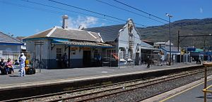
Fish Hoek railway station
Railway station in Cape Town, South Africa
Distance: Approx. 771 meters
Latitude and longitude: -34.1371,18.4324
Fish Hoek railway station is a railway station in Fish Hoek, Cape Town, South Africa. The station opened on 1 December 1890 as the first station on the extension from Kalk Bay to Simon's Town, the present-day terminus. It was electrified in 1928.
Weather in this IP's area
clear sky
20 Celsius
19 Celsius
20 Celsius
21 Celsius
1018 hPa
48 %
1018 hPa
1016 hPa
10000 meters
13.36 m/s
17.1 m/s
144 degree
