102.50.243.151 - IP Lookup: Free IP Address Lookup, Postal Code Lookup, IP Location Lookup, IP ASN, Public IP
Country:
Region:
City:
Location:
Time Zone:
Postal Code:
ISP:
ASN:
language:
User-Agent:
Proxy IP:
Blacklist:
IP information under different IP Channel
ip-api
Country
Region
City
ASN
Time Zone
ISP
Blacklist
Proxy
Latitude
Longitude
Postal
Route
db-ip
Country
Region
City
ASN
Time Zone
ISP
Blacklist
Proxy
Latitude
Longitude
Postal
Route
IPinfo
Country
Region
City
ASN
Time Zone
ISP
Blacklist
Proxy
Latitude
Longitude
Postal
Route
IP2Location
102.50.243.151Country
Region
souss-massa
City
inezgane
Time Zone
Africa/Casablanca
ISP
Language
User-Agent
Latitude
Longitude
Postal
ipdata
Country
Region
City
ASN
Time Zone
ISP
Blacklist
Proxy
Latitude
Longitude
Postal
Route
Popular places and events near this IP address

Agadir
City in Souss-Massa, Morocco
Distance: Approx. 8594 meters
Latitude and longitude: 30.42138889,-9.58305556
Agadir (Arabic: أكادير or أڭادير, romanized: ʾagādīr, pronounced [ʔaɡaːdiːr]; Tachelhit: ⴰⴳⴰⴷⵉⵔ) is a major city in Morocco, on the shore of the Atlantic Ocean near the foot of the Atlas Mountains, just north of the point where the Souss River flows into the ocean, and 509 kilometres (316 mi) south of Casablanca. Agadir is the capital of the Agadir Ida-U-Tanan Prefecture and of the Souss-Massa economic region. Agadir is one of the major urban centres of Morocco.

Adrar Stadium
Sports venue in Agadir, Morocco
Distance: Approx. 8001 meters
Latitude and longitude: 30.4272,-9.5404
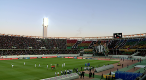
Adrar Stadium (Arabic: ملعب آدرار; Berber languages: ⴰⴱⴰⵔⴰⵣ ⵏ ⵓⴷⵔⴰⵔ (Adrar means mountain in Tamazight); French: Grand Stade d'Agadir), is a multi-use stadium in Agadir, in the Souss-Massa region in the country of Morocco, near the Atlas Mountains, in North Africa, and is used as a home venue by the local football team, Hassania Agadir. It is also sometimes used for the Moroccan national team and for other FIFA and CAF international football matches as a neutral venue. The construction project began on paper in 2003, with the idea of building the stadium for Morocco's failed 2006 FIFA World Cup bid.

Al Inbiâate Stadium
Football stadium in Morocco
Distance: Approx. 8722 meters
Latitude and longitude: 30.41497222,-9.59560278
Al Inbiâate Stadium is a multi-use stadium in Agadir, Morocco. It is currently used mostly for football matches and hosts the home games of Hassania Agadir. The stadium can hold up to 10,000 people.

Inezgane
City in Souss-Massa, Morocco
Distance: Approx. 1170 meters
Latitude and longitude: 30.36583333,-9.53805556
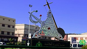
Inezgane (Arabic: إنزكان) is the capital of Inezgane-Aït Melloul Prefecture located on the north bank of the Sous River, about 11.5 km (7.1 mi) south of Agadir, on the Atlantic Ocean coast of Morocco. It is in some ways a suburb to the larger Agadir, but unlike the tourism-centered Agadir, Inezgane is a typical Moroccan city. Located where the N1, N8 and N10 highways meet, Inezgane is an important transport hub in the region of Souss-Massa.

Aït Melloul
City in Souss-Massa, Morocco
Distance: Approx. 4461 meters
Latitude and longitude: 30.33416667,-9.49722222
Aït Melloul (Arabic: أيت ملول) is a city on the west coast of Morocco. It is located in the suburban area of Agadir just southeast of Inezgane, on the southern bank of the Sous River. According to the 2014 population census, the city is home to 171,847 inhabitants and 39,697 households.

Lqliâa
Place in Souss-Massa, Morocco
Distance: Approx. 9876 meters
Latitude and longitude: 30.29083333,-9.46611111
Lqliâa (Arabic: القليعة) is a city in Morocco, situated in the suburban area of Agadir. According to the 2014 Moroccan census it had a population of 83,235 inhabitants, up from the 46,432 inhabitants recorded in the 2004 census.
Drarga
Rural commune and town in Souss-Massa, Morocco
Distance: Approx. 6087 meters
Latitude and longitude: 30.38,-9.48
Drarga or Drargua (Arabic: الدراركة) is a rural commune and town in western Morocco, situated in the suburban area of Agadir, in the Souss-Massa region. The 2004 census recorded a population of 17,059 inhabitants in the urban centre, which increased to 50,946 inhabitants in the 2014 census. The commune as a whole recorded a population of 126000 in the 2014 census.

Aït Melloul Prison
Prison facility in Morocco
Distance: Approx. 6464 meters
Latitude and longitude: 30.324,-9.48
Aït Melloul Prison is a prison located in the city of Aït Melloul, near Agadir. It consists of two facilities, the first opened in 2003, while the second was opened in 2016. It is the biggest prison in the Souss-Massa region.

Dcheira El Jihadia
Distance: Approx. 1950 meters
Latitude and longitude: 30.3728,-9.5389
Dcheira El Jihadia (Arabic: الدشيرة الجهادية) is a city in southern Morocco. It is located in the prefecture of Inezgane-Aït Melloul in Morocco's Souss-Massa region, 10 km south of the region's largest city of Agadir. The 2014 Moroccan census recorded 100,336 people living in Dcheira El Jihadia, up from 89,367 people in 2004.
Olhão Garden
Distance: Approx. 9666 meters
Latitude and longitude: 30.42472222,-9.59722222
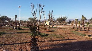
Olhão Garden is a park in New Talborj in the city of Agadir, Morocco. It was inaugurated on 2 March 1992 during the celebration of the Throne Day. It is named after Olhão, a coastal city in southern Portugal that is twinned with Agadir.
Crocoparc Agadir
Zoological park in Agadir, Morocco
Distance: Approx. 6270 meters
Latitude and longitude: 30.388384,-9.483677
Crocoparc Agadir is a crocodile zoological park located in the town of Drarga, in the suburbs of Agadir, Morocco. The park opened in May 2015. The park has 325 Nile crocodiles (Crocodylus niloticus) as well as giant tortoises (Centrochelys sulcata), green iguanas, giant pythons, anacondas, and marmosets.
Weather in this IP's area
broken clouds
14 Celsius
13 Celsius
14 Celsius
14 Celsius
1022 hPa
84 %
1022 hPa
1006 hPa
10000 meters
1.34 m/s
2.58 m/s
44 degree
51 %

