Country:
 Morocco
Region:
City:
Latitude and Longitude:
Time Zone:
Postal Code:
IP information under different IP Channel
ip-api
Country
Region
City
ASN
Time Zone
ISP
Blacklist
Proxy
Latitude
Longitude
Postal
Route
IPinfo
Country
Region
City
ASN
Time Zone
ISP
Blacklist
Proxy
Latitude
Longitude
Postal
Route
MaxMind
Country
Region
City
ASN
Time Zone
ISP
Blacklist
Proxy
Latitude
Longitude
Postal
Route
Luminati
Country
MARegion
01
City
tangier
ASN
Time Zone
Africa/Casablanca
ISP
Itissalat Al-MAGHRIB
Latitude
Longitude
Postal
db-ip
Country
Region
City
ASN
Time Zone
ISP
Blacklist
Proxy
Latitude
Longitude
Postal
Route
ipdata
Country
Region
City
ASN
Time Zone
ISP
Blacklist
Proxy
Latitude
Longitude
Postal
Route
Popular places and events near this IP address

Marrakesh
City in Morocco
Distance: Approx. 969 meters
Latitude and longitude: 31.63,-8.00888889
Marrakesh or Marrakech ( or ; Arabic: مراكش, romanized: murrākuš, pronounced [murraːkuʃ]) is the fourth-largest city in Morocco. It is one of the four imperial cities of Morocco and is the capital of the Marrakesh–Safi region. The city lies west of the foothills of the Atlas Mountains.

Majorelle Garden
Art museum, garden in Marrakesh, Morocco
Distance: Approx. 999 meters
Latitude and longitude: 31.64277778,-8.00305556
The Majorelle Garden (French: Jardin Majorelle, Arabic: حديقة ماجوريل, romanized: hadiqat mmajuril, Berber languages: ⵓⵔⵜⵉ ⵎⴰⵊⵓⵔⵉⵍ, romanized: urti majuril) is a one-hectare (two-acre) botanical garden and artist's landscape garden in Marrakesh, Morocco. It was created by the French Orientalist artist Jacques Majorelle over almost forty years, starting in 1923, and features a Cubist villa designed by French architect Paul Sinoir in the 1930s. The property was the residence of the artist and his wife from 1923 until their divorce in the 1950s.
Battle of Marrakesh
Distance: Approx. 969 meters
Latitude and longitude: 31.63,-8.00888889
The Battle of Marrakesh was a central battle in the Hafidiya, in which Abd al-Hafid seized power from his brother Abd al-Aziz, fought outside Marrakesh, Morocco on August 19, 1908. A battalion led by Abd al-Aziz departed from Rabat and was ambushed and defeated on its approach to Marrakesh by forces loyal to Abd al-Hafid.

Dar el Bacha
Art museum in Marrakech, Morocco
Distance: Approx. 772 meters
Latitude and longitude: 31.631573,-7.992403
Dar el Bacha (Arabic: دار الباشا, lit. 'House of the Pasha') is a palace located in the old medina of Marrakesh, Morocco. It currently houses the Museum of Confluences.

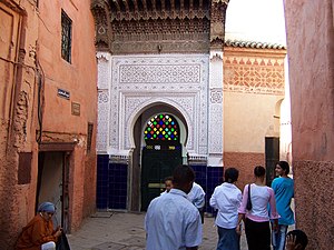
Bab Doukkala Mosque
Mosque in Marrakesh, Morocco
Distance: Approx. 525 meters
Latitude and longitude: 31.63111111,-7.99575
The Bab Doukkala Mosque (Arabic: مسجد باب دكالة) or Mosque of Bab Doukkala is a major neighbourhood mosque (a Friday mosque) in Marrakesh, Morocco, dating from the 16th century. It is named after the nearby city gate, Bab Doukkala, in the western city walls. It is also known as the al-Hurra Mosque (or Mosque of the Free One, in reference to its founder, Massa'uda al-Wizkitiya).
Zawiya of Sidi Abd el-Aziz
Religious building in Marrakesh, Morocco
Distance: Approx. 1058 meters
Latitude and longitude: 31.63208333,-7.98905556
The Zawiya of Sidi Abd el-Aziz (alternate spellings include Zaouia of Sidi Abdelaziz) is an Islamic religious complex (zawiya) in Marrakesh, Morocco. It is centered around the tomb of the Muslim scholar and Sufi saint Sidi Abu Faris Abd al-Aziz Abd al-Haq at-Tabba', who died in Marrakesh in 1508. Sidi Abd el-Aziz is considered one of the Seven Saints of Marrakesh, and his tomb was a prominent stop for pilgrims to Marrakesh.

Zawiya of Sidi Muhammad Ben Sliman al-Jazuli
Religious building in Marrakesh, Morocco
Distance: Approx. 804 meters
Latitude and longitude: 31.63641667,-7.99186111
The Zawiya of Sidi Muhammad Ben Sliman al-Jazuli (also Zaouia of Sidi Ben Slimane al-Jazouli or Zawiya al-Jazuliya, among other variations) is an Islamic religious complex (zawiya) in Marrakesh, Morocco. It is centered around the tomb of the 15th-century Muslim scholar and Sufi saint Muhammad al-Jazuli (also known as Imam al-Jazuli, full name: Abū 'Abdullah Muḥammad ibn Sulaymān ibn Abū Bakr al-Jazūli al-Simlālī), who is one of the Seven Saints of Marrakesh.

Zawiya of Sidi Bel Abbes
Religious building in Marrakesh, Morocco
Distance: Approx. 990 meters
Latitude and longitude: 31.63891667,-7.99108333
The Zawiya of Sidi Bel Abbes or Zaouia of Sidi Bel-Abbès (Arabic: زاوية سيدي بلعباس, Berber: ⵣⴰⵡⵉⵢⴰ ⵙⵉⴷⵉ ⴱⵍⵄⴻⴱⴰⵙ) is an Islamic religious complex (zawiya) in Marrakesh, Morocco. The complex is centered around the mausoleum of Abu al-Abbas as-Sabti (or Sidi Bel Abbes), a Sufi teacher who died in 1204. He is the most venerated of the Seven Saints of Marrakesh, generally considered the "patron saint" of the city.: 107 The zawiya's architecture dates in part to the late Saadian period (early 17th century) but has been modified and restored multiple times since then.

Walls of Marrakesh
Fortifications in Marrakesh, Morocco
Distance: Approx. 1043 meters
Latitude and longitude: 31.6318,-7.9893
The Walls of Marrakesh are a set of defensive ramparts which enclose the historic medina districts of Marrakesh, Morocco. They were first laid out in the early 12th century by the Almoravid dynasty which founded the city in 1070 CE as their new capital. The walls have since been expanded several times by the addition of the Kasbah to the south at the end of the 12th century and by a later extension to encompass the northern neighbourhood around the Zawiya of Sidi Bel Abbes.
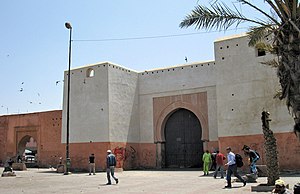
Bab Doukkala
City gate in Marrakesh, Morocco
Distance: Approx. 94 meters
Latitude and longitude: 31.63394444,-7.999
Bab Doukkala (Arabic: باب دكالة, lit. 'gate of the Doukkala') is the main northwestern gate of the medina (historic walled city) of Marrakesh, Morocco.

Dar Cherifa
Historic house in Marrakesh, Morocco
Distance: Approx. 1085 meters
Latitude and longitude: 31.62916667,-7.99013889
Dar Cherifa, historically known as Dar Ijimi, is a late 16th-century house in the medina (old city) of Marrakesh, Morocco. It is located in the Mouassine neighbourhood and is one of the few well-preserved houses from the Saadian period in the city. In recent years it has been restored and is now used as a café and art gallery.

Mouassine Fountain
Historic monument in Marrakesh, Morocco
Distance: Approx. 1099 meters
Latitude and longitude: 31.63,-7.98944444
The Mouassine Fountain is a part of the 16th-century religious complex of the Mouassine Mosque in Marrakesh, Morocco. The tradition of building public fountains in Marrakesh is old but took on a very monumental character in the Saadian era.
Weather in this IP's area
scattered clouds
27 Celsius
28 Celsius
27 Celsius
27 Celsius
1016 hPa
54 %
1016 hPa
964 hPa
10000 meters
4.63 m/s
280 degree
40 %
07:32:22
19:04:36