102.49.211.95 - IP Lookup: Free IP Address Lookup, Postal Code Lookup, IP Location Lookup, IP ASN, Public IP
Country:
Region:
City:
Location:
Time Zone:
Postal Code:
ISP:
ASN:
language:
User-Agent:
Proxy IP:
Blacklist:
IP information under different IP Channel
ip-api
Country
Region
City
ASN
Time Zone
ISP
Blacklist
Proxy
Latitude
Longitude
Postal
Route
db-ip
Country
Region
City
ASN
Time Zone
ISP
Blacklist
Proxy
Latitude
Longitude
Postal
Route
IPinfo
Country
Region
City
ASN
Time Zone
ISP
Blacklist
Proxy
Latitude
Longitude
Postal
Route
IP2Location
102.49.211.95Country
Region
draa-tafilalet
City
ksar el kebir
Time Zone
Africa/Casablanca
ISP
Language
User-Agent
Latitude
Longitude
Postal
ipdata
Country
Region
City
ASN
Time Zone
ISP
Blacklist
Proxy
Latitude
Longitude
Postal
Route
Popular places and events near this IP address

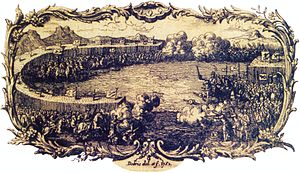
Battle of Alcácer Quibir
1578 battle in Morocco
Distance: Approx. 1727 meters
Latitude and longitude: 35.01666667,-5.9
The Battle of Alcácer Quibir (also known as "Battle of Three Kings" (Arabic: معركة الملوك الثلاثة) or "Battle of Wadi al-Makhazin" (Arabic: معركة وادي المخازن) in Morocco) was fought in northern Morocco, near the town of Ksar-el-Kebir (variant spellings: Ksar El Kebir, Alcácer-Quivir, Alcazarquivir, Alcassar, etc.) and Larache, on 4 August 1578. A Moroccan victory, the battle has been described as "the greatest military disaster the Portuguese ever suffered in the course of their overseas expansion." It marked an end to Portuguese attempts to reconquer territories it had lost in Morocco. The combatants were the army of the deposed Moroccan Sultan Abu Abdallah Mohammed II, with his ally, the King of Portugal Sebastian I, against a large Moroccan army under the new Sultan of Morocco (and uncle of Abu Abdallah Mohammed II) Abd Al-Malik I. The Christian king Sebastian I had planned a crusade after Abu Abdallah asked him to help recover his throne.
Ksar el-Kebir
City in Tanger-Tetouan-Al Hoceima, Morocco
Distance: Approx. 941 meters
Latitude and longitude: 35.009,-5.9
Ksar el-Kebir (Arabic: القصر الكبير, romanized: al-Qaṣr al-Kabīr), also known as al-Qasr al-Kabir, is a city in northwestern Morocco, about 160 km north of Rabat, 32 km east of Larache and 110 km south of Tangier. It recorded a population of 126,617 in the 2014 Moroccan census. The name means "the big castle".
Oued El Makhazine
Rural commune and town in Rabat-Salé-Kénitra, Morocco
Distance: Approx. 9145 meters
Latitude and longitude: 34.93333333,-5.85
Oued El Makhazine is a small town and rural commune in Kénitra Province of the Rabat-Salé-Kénitra region of Morocco. At the time of the 2004 census, the commune had a total population of 8384 people living in 1704 households.
Ksar Bjir
Rural commune and town in Tanger-Tetouan-Al Hoceima, Morocco
Distance: Approx. 5676 meters
Latitude and longitude: 34.9516,-5.9163
Ksar Bjir is a small town and rural commune in Larache Province of the Tanger-Tetouan-Al Hoceima region of Morocco. At the time of the 2004 census, the commune had a total population of 14,876 people living in 2583 households.
Weather in this IP's area
clear sky
6 Celsius
6 Celsius
6 Celsius
6 Celsius
1024 hPa
70 %
1024 hPa
1013 hPa
10000 meters
1.09 m/s
1.19 m/s
149 degree
1 %
