102.49.207.170 - IP Lookup: Free IP Address Lookup, Postal Code Lookup, IP Location Lookup, IP ASN, Public IP
Country:
Region:
City:
Location:
Time Zone:
Postal Code:
ISP:
ASN:
language:
User-Agent:
Proxy IP:
Blacklist:
IP information under different IP Channel
ip-api
Country
Region
City
ASN
Time Zone
ISP
Blacklist
Proxy
Latitude
Longitude
Postal
Route
db-ip
Country
Region
City
ASN
Time Zone
ISP
Blacklist
Proxy
Latitude
Longitude
Postal
Route
IPinfo
Country
Region
City
ASN
Time Zone
ISP
Blacklist
Proxy
Latitude
Longitude
Postal
Route
IP2Location
102.49.207.170Country
Region
tanger-tetouan-al hoceima
City
tetouan
Time Zone
Africa/Casablanca
ISP
Language
User-Agent
Latitude
Longitude
Postal
ipdata
Country
Region
City
ASN
Time Zone
ISP
Blacklist
Proxy
Latitude
Longitude
Postal
Route
Popular places and events near this IP address

Tétouan
City and municipality in Tanger-Tetouan-Al Hoceima, Morocco
Distance: Approx. 703 meters
Latitude and longitude: 35.56666667,-5.36666667
Tétouan (Arabic: تطوان, romanized: tiṭwān or taṭwān, [titˤwaːn] or [tatˤwaːn]) is a city in northern Morocco. It lies along the Martil Valley and is one of the two major ports of Morocco on the Mediterranean Sea, a few miles south of the Strait of Gibraltar, and about 60 kilometres (37 mi) E.S.E. of Tangier. In the 2014 Moroccan census, the city recorded a population of 380,787 inhabitants.

Tamuda
Ancient Berber city and Roman military camp in Morocco
Distance: Approx. 3683 meters
Latitude and longitude: 35.55833333,-5.40972222
Tamuda was an ancient Berber city and military camp in Mauretania Tingitana. It is located 6 km (4 miles) west of the present-day Tetouan in northern Morocco. Stone ruins from the site are found by the south bank of the Martil Valley.

Saniat Rmel Stadium
Distance: Approx. 2142 meters
Latitude and longitude: 35.5725,-5.34861111
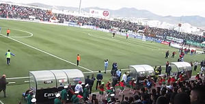
Saniat Rmel Stadium (formerly known as La Hìpica) is a football stadium in Tétouan, Morocco. It is the home ground of Moghreb Athletic Tétouan.

Tétouan Province
Province in the Moroccan region of Tanger-Tétouan-Al Hoceïma
Distance: Approx. 699 meters
Latitude and longitude: 35.5667,-5.3667
Tétouan (Arabic: تطوان) is a province in the Moroccan region of Tanger-Tétouan-Al Hoceïma. Its population in 2004 was 613,506.
Abdelmalek Essaâdi University
Distance: Approx. 1312 meters
Latitude and longitude: 35.562,-5.363
Abdelmalek Essaâdi University (Arabic: جامعة عبدالمالك السعدي) is a Moroccan public university created in 1989. It is considered to be the main university in the North of the Morocco. This university is made up of 15 institutions, including schools and establishments spread across the Tanger-Tétouan-AL Hoceima region and in the city of Larache.

École nationale des sciences appliquées de Tétouan
Distance: Approx. 1251 meters
Latitude and longitude: 35.56176646,-5.36451461
The École nationale des sciences appliquées de Tétouan (National school of applied sciences of Tetouan) is a public engineering school in Morocco established in September, 2008. The school is located in Tetouan, Morocco. It is part of the National Schools of Applied Sciences-ENSA and Abdelmalek Essaâdi University.

Isaac Ben Walid Synagogue
Orthodox synagogue in Tetuan, Morocco
Distance: Approx. 472 meters
Latitude and longitude: 35.57003194,-5.36715694
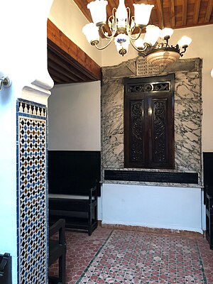
The Isaac Ben Walid Synagogue (Hebrew: בית הכנסת של יצחק בן וואליד; Arabic: كنيس إسحاق بن الوليد; Spanish: Sinagoga Isaac Bengualid), is an Orthodox Jewish congregation and synagogue, located in the mellah of Tetuan, Morocco.
Medina of Tétouan
Medina quarter in Tétouan, Morocco
Distance: Approx. 500 meters
Latitude and longitude: 35.57080556,-5.36669444
The Medina of Tetouan is a Medina quarter in Tetouan, Morocco. It was designated by the UNESCO a World Heritage Site in 1985.

Royal Palace of Tétouan
Distance: Approx. 372 meters
Latitude and longitude: 35.5709,-5.3681
The Royal Palace of Tétouan is a palace of the Moroccan Monarchy in Tétouan, Morocco, and the former main seat of political authority of the Spanish protectorate in Morocco from 1913 to 1956. It encloses both the former governor's palace and the former Spanish consulate, which in the protectorate era respectively housed the Khalifa or personal representative of the Sultan of Morocco on the compound's northwestern side, and the Spanish High Commissioner on its southeastern side. The palace is located on Hassan II Square, a historic urban space also traditionally known as the Feddan, in the Medina of Tétouan.

Tetouan Archaeological Museum
Archaeological Museum in Tetouan, Morocco
Distance: Approx. 172 meters
Latitude and longitude: 35.5706,-5.3704
The Tetouan Archaeological Museum in Tétouan is considered one of the most prominent cultural and historical museums in Morocco, as its historical legacy extends back more than a century. It is located in the heart of the city of Tetouan in the northwest of the country.

Tetouan Ethnographic Museum
Ethnographic Museum in Tétouan, Morocco
Distance: Approx. 748 meters
Latitude and longitude: 35.5703,-5.364
The Tetouan Ethnographic Museum or Bab El Oqla Museum is an ethnographic museum located east of the old medina of Tétouan in Morocco, and is named after one of the seven historic gates of the city.

Bombing of Tetouan
Distance: Approx. 502 meters
Latitude and longitude: 35.57083333,-5.36666667
On 18 July 1936 the Moroccan city of Tetouan was the target of an aerial bombardment, carried out by Spanish aircraft loyal to the Second Spanish Republic, barely hours after the beginning of the rebellion that triggered the Spanish Civil War.
Weather in this IP's area
clear sky
4 Celsius
3 Celsius
4 Celsius
4 Celsius
1023 hPa
75 %
1023 hPa
988 hPa
10000 meters
1.54 m/s