102.49.204.210 - IP Lookup: Free IP Address Lookup, Postal Code Lookup, IP Location Lookup, IP ASN, Public IP
Country:
Region:
City:
Location:
Time Zone:
Postal Code:
IP information under different IP Channel
ip-api
Country
Region
City
ASN
Time Zone
ISP
Blacklist
Proxy
Latitude
Longitude
Postal
Route
Luminati
Country
Region
04
City
temara
ASN
Time Zone
Africa/Casablanca
ISP
Itissalat Al-MAGHRIB
Latitude
Longitude
Postal
IPinfo
Country
Region
City
ASN
Time Zone
ISP
Blacklist
Proxy
Latitude
Longitude
Postal
Route
IP2Location
102.49.204.210Country
Region
rabat-sale-kenitra
City
sale
Time Zone
Africa/Casablanca
ISP
Language
User-Agent
Latitude
Longitude
Postal
db-ip
Country
Region
City
ASN
Time Zone
ISP
Blacklist
Proxy
Latitude
Longitude
Postal
Route
ipdata
Country
Region
City
ASN
Time Zone
ISP
Blacklist
Proxy
Latitude
Longitude
Postal
Route
Popular places and events near this IP address

Bou Regreg
River in Morocco
Distance: Approx. 1501 meters
Latitude and longitude: 34.0319,-6.83083
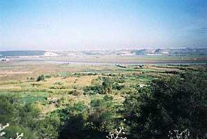
The Bou Regreg (Arabic: أبو رقراق) is a river located in western Morocco which discharges into the Atlantic Ocean between the cities of Rabat and Salé. The estuary of this river is termed Wadi Sala. The river is 240 kilometres long, with a tidal estuary of approximately 24 kilometres extending upriver.
Hajja, Morocco
Settlement in western coastal Morocco
Distance: Approx. 1633 meters
Latitude and longitude: 34.03333333,-6.83333333
Hajja is a settlement located in the western coastal region of Morocco, near Rabat. The earliest recorded history of the general vicinity is associated with the now-ruined Chellah, situated along the estuarine portion of the Oued Bou Regreg. Chellah was originally settled by the Phoenicians and later became a Roman settlement.

Rabat-Salé-Zemmour-Zaer
Region in Morocco
Distance: Approx. 1633 meters
Latitude and longitude: 34.03333333,-6.83333333
Rabat-Salé-Zemmour-Zaër (French pronunciation: [ʁaba sale zemuʁ zaɛʁ]; Arabic: الرباط سلا زمور زعير, alribat salaa zumur zaeir, Berber: Errbaṭ-Sla-Zemmur-Zɛir) was formerly one of the sixteen regions of Morocco from 1997 to 2015. It was situated in north-western Morocco. It covered an area of 9,580 km2, and had a population of 2,676,754 (2014 census).

Roman Catholic Archdiocese of Rabat
Catholic archdiocese in Morocco
Distance: Approx. 1632 meters
Latitude and longitude: 34.0333,-6.8333
The Roman Catholic Archdiocese of Rabat (Latin: Archidioecesis Rabatensis) is an ecclesiastical territory or diocese of the Roman Catholic Church in Morocco. It was erected as the Apostolic Vicariate of Rabat on July 2, 1923, by Pope Pius XI, and promoted to the rank of an archdiocese by Pope Pius XII on September 14, 1955. The archdiocese's mother church and seat of its archbishop is St.

Republic of Salé
17th-century city-state in North Africa
Distance: Approx. 714 meters
Latitude and longitude: 34.03944444,-6.82472222
The Republic of Salé, also known as the Bou Regreg Republic and the Republic of the Two Banks, was a city-state maritime corsair republic based at Salé in Morocco during the 17th century, located at the mouth of the Bou Regreg river. It was founded by Moriscos from the town of Hornachos, in western Spain. The Moriscos were the descendants of Muslims who were nominally converted to Christianity, and were subject to mass deportation during Philip III's reign, following the expulsion of the Moriscos decrees.

Bombardment of Salé
Naval attack
Distance: Approx. 1204 meters
Latitude and longitude: 34.04,-6.83
The Bombardment of Salé was a French naval attack against the Moroccan city of Salé that took place between 26 and 27 November 1851. After seven hours of fighting, the Moroccan artillery suffered severe damage, and the French bombarded the city through the night, damaging the city's infrastructure and the Great Mosque of Salé. The bombardment occurred outside any state of war, and regarded an incident from 1 April 1851 in which the residents of Salé looted a cache of goods which had been rescued from a capsized French merchant ship.

Great Mosque of Salé
Mosque in Salé, Morocco
Distance: Approx. 975 meters
Latitude and longitude: 34.04,-6.8275
The Great Mosque of Salé (Arabic: الجامع الأعظم, romanized: al-Jama' al-A'dam), also known as the Masjid al-Tal'a, is a historic mosque in Salé, Morocco. It is the main mosque of the old city. Covering an area of 5,070 m2 (54,600 sq ft), it is the third-largest mosque in Morocco.

Bab el-Mrissa
Distance: Approx. 728 meters
Latitude and longitude: 34.03305556,-6.82027778
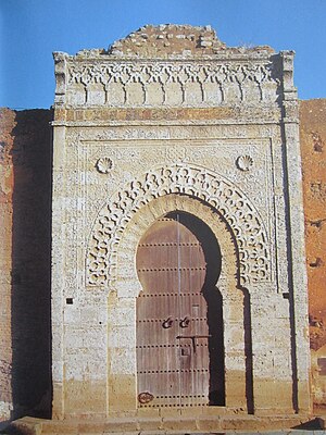
Bab el-Mrissa (Arabic: باب المريسة), also known as Bab al-Mellah (Arabic: باب الملاح), is a gate in the city of Salé, Morocco. The gate was commissioned by the Marinid sultan Abu Yusuf Yaqub ibn Abd Al-Haqq between 1270—1280. It is one of the largest as well as the oldest gates in Morocco, and the main landmarks of the city.
Zawiya al-Nussak
Historic monument in Salé, Morocco
Distance: Approx. 477 meters
Latitude and longitude: 34.03586111,-6.81347222
The Zawiya al-Nussak (Arabic: زاوية النساك; also transliterated as Zaouiat en-Noussak) is a historic zawiya (religious complex and residence) located just outside the old city walls of Salé, Morocco.

Madrasa of Abu al-Hasan
Madrasa in Salé, Morocco
Distance: Approx. 950 meters
Latitude and longitude: 34.03986111,-6.82725
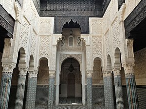
The Madrasa of Abu al-Hasan, also referred to as the Marinid Madrasa (of Salé), is a medieval madrasa located within the old city of Salé, Morocco. It was built in the 14th century by the Marinid sultan Abu al-Hasan next to the Grand Mosque of Salé and it is notable for its rich decoration.

Salé-City railway station
Railway station in Morocco
Distance: Approx. 149 meters
Latitude and longitude: 34.0385,-6.8155
Salé-City railway station or Gare de Salé-Ville (Arabic: محطة سلا المدينة) is a train terminal administered by ONCF in Salé, Morocco. The station is the biggest train station in Salé in terms of traffic, and is considered as the main train station of the city. It is directly connected with the Rabat–Salé tramway.

Grand Theatre of Rabat
Performing arts center in Rabat, Morocco
Distance: Approx. 1478 meters
Latitude and longitude: 34.02580556,-6.81519444
The Grand Theatre of Rabat (French: Grand Théâtre de Rabat; Arabic: المسرح الكبير للرباط, lit. 'The Great Theatre of Rabat') is a large performing arts center under construction in Rabat, the capital city of Morocco. The building is designed by Zaha Hadid and her architectural firm Zaha Hadid Architects. Planning began for the project in 2010 and construction officially started on October 7, 2014.
Weather in this IP's area
fog
12 Celsius
12 Celsius
12 Celsius
14 Celsius
1023 hPa
100 %
1023 hPa
1020 hPa
300 meters
1.54 m/s
200 degree
40 %
