102.40.0.130 - IP Lookup: Free IP Address Lookup, Postal Code Lookup, IP Location Lookup, IP ASN, Public IP
Country:
Region:
City:
Location:
Time Zone:
Postal Code:
IP information under different IP Channel
ip-api
Country
Region
City
ASN
Time Zone
ISP
Blacklist
Proxy
Latitude
Longitude
Postal
Route
Luminati
Country
Region
kb
City
alubur
ASN
Time Zone
Africa/Cairo
ISP
TE Data
Latitude
Longitude
Postal
IPinfo
Country
Region
City
ASN
Time Zone
ISP
Blacklist
Proxy
Latitude
Longitude
Postal
Route
IP2Location
102.40.0.130Country
Region
al isma'iliyah
City
ismailia
Time Zone
Africa/Cairo
ISP
Language
User-Agent
Latitude
Longitude
Postal
db-ip
Country
Region
City
ASN
Time Zone
ISP
Blacklist
Proxy
Latitude
Longitude
Postal
Route
ipdata
Country
Region
City
ASN
Time Zone
ISP
Blacklist
Proxy
Latitude
Longitude
Postal
Route
Popular places and events near this IP address

Ismailia
City in Egypt
Distance: Approx. 2396 meters
Latitude and longitude: 30.58333333,32.26666667
Ismailia (Arabic: الإسماعيلية al-Ismāʻīlīyah, Egyptian Arabic: [lesmæʕiˈlejjæ]) is a city in north-eastern Egypt. Situated on the west bank of the Suez Canal, it is the capital of the Ismailia Governorate. The city had an estimated population of about 1,430,000 in 2024 (about 750,000, if including surrounding rural areas).

Ismailia Governorate
Governorate of Egypt
Distance: Approx. 1160 meters
Latitude and longitude: 30.6,32.28333333
Ismailia Governorate (Arabic: محافظة الإسماعيلية) is one of the Canal Zone governorates of Egypt. Located in the northeastern part of the country, its capital is the city of Ismailia. It was named after Ismail Pasha, who as Ottoman Viceroy of Egypt, oversaw the country during the building of the Suez Canal.

Suez Canal Stadium
Distance: Approx. 2331 meters
Latitude and longitude: 30.592667,32.292528
The Suez Canal Authority Stadium is located in Ismailia, Egypt. It is used by Olympic El Qanah. The stadium was demolished and was completely reconstructed between 2019 and 2022.

El Ferdan Railway Bridge
Bridge in Egypt
Distance: Approx. 8315 meters
Latitude and longitude: 30.65694444,32.33388889
The El Ferdan Railway Bridge is a swing bridge that spans the western shipping lane of the Suez Canal near Ismailia, Egypt. It is the longest swing bridge in the world, with a span of 1,100 feet (340 m). The bridge was not functional for a while due to the expansion of the Suez Canal completed in 2015 which added a parallel shipping lane just east of the existing bridge, cutting off the railway into Sinai.

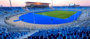
Ismailia Stadium
Football stadium in Ismailia, Egypt
Distance: Approx. 377 meters
Latitude and longitude: 30.60111111,32.27361111
The Ismailia Stadium (Arabic: ملعب الاسماعيلية) is located in Ismailia, Egypt, and has a total capacity of 18,525 after the remodelation in 2009, then it was upgraded to 30,000 seats after the remodelation in 2019 for the 2019 Africa Cup of Nations, It is used by Ismaily SC, and was one of six stadiums used in the 2006 African Cup of Nations and 2019 Africa Cup of Nations, held in Egypt.

Suez Canal Authority
Egyptian government agency that owns, operates, and maintains the Suez Canal
Distance: Approx. 2028 meters
Latitude and longitude: 30.58833333,32.2825
Suez Canal Authority (SCA) is an Egyptian state-owned authority which owns, operates and maintains the Suez Canal. It was set up by the Egyptian government to replace the Suez Canal Company in the 1950s which resulted in the Suez Crisis. After the United Nations intervened, the three invading countries (France, Israel, and the United Kingdom) were forced to withdraw.

Lake Timsah
Lake in Egypt
Distance: Approx. 4320 meters
Latitude and longitude: 30.56667,32.28333
Lake Timsah, also known as Crocodile Lake (Arabic: بُحَيْرة التِّمْسَاح); is a lake in Egypt on the Nile delta. It lies in a basin developed along a fault extending from the Mediterranean Sea to the Gulf of Suez through the Bitter Lakes region. In 1800, a flood filled the Wadi Tumilat, which caused Timsah's banks to overflow and moved water south into the Bitter Lakes about nine miles (14 km) away.
Suez Canal University
Egyptian public university
Distance: Approx. 2073 meters
Latitude and longitude: 30.62277778,32.275
The Suez Canal University is an Egyptian public university serving the Suez Canal region. Its faculties are located in the three governorates of the Suez Canal Region (Port Said, Ismailia & Suez). It was established in 1974.

Ismailia Air Base
Egyptian airforce helicopter base
Distance: Approx. 3457 meters
Latitude and longitude: 30.59826389,32.23690556
Ismailia Air Base El Qūwāt El Gawīyä El Maṣrīyä is an air base of the Egyptian Air Force located approximately 4 kilometres (2.5 mi) west-northwest of the city of Ismailia; 116 kilometres (72 mi) northeast of Cairo, Egypt.
Weather in this IP's area
clear sky
18 Celsius
17 Celsius
18 Celsius
18 Celsius
1015 hPa
45 %
1015 hPa
1014 hPa
10000 meters
5.14 m/s
260 degree