102.39.255.93 - IP Lookup: Free IP Address Lookup, Postal Code Lookup, IP Location Lookup, IP ASN, Public IP
Country:
Region:
City:
Location:
Time Zone:
Postal Code:
IP information under different IP Channel
ip-api
Country
Region
City
ASN
Time Zone
ISP
Blacklist
Proxy
Latitude
Longitude
Postal
Route
Luminati
Country
Region
wc
City
capetown
ASN
Time Zone
Africa/Johannesburg
ISP
Vox-Telecom
Latitude
Longitude
Postal
IPinfo
Country
Region
City
ASN
Time Zone
ISP
Blacklist
Proxy
Latitude
Longitude
Postal
Route
IP2Location
102.39.255.93Country
Region
western cape
City
mfuleni
Time Zone
Africa/Johannesburg
ISP
Language
User-Agent
Latitude
Longitude
Postal
db-ip
Country
Region
City
ASN
Time Zone
ISP
Blacklist
Proxy
Latitude
Longitude
Postal
Route
ipdata
Country
Region
City
ASN
Time Zone
ISP
Blacklist
Proxy
Latitude
Longitude
Postal
Route
Popular places and events near this IP address

Cape Flats
Area of Cape Town, South Africa
Distance: Approx. 596 meters
Latitude and longitude: -34,18.66666667
The Cape Flats (Afrikaans: Die Kaapse Vlakte) is an expansive, low-lying, flat area situated to the southeast of the central business district of Cape Town. The Cape Flats is also the name of an administrative region of the City of Cape Town, which lies within the larger geographical area.

Khayelitsha
Suburb of Cape Town, in Western Cape, South Africa
Distance: Approx. 4719 meters
Latitude and longitude: -34.04027778,18.67777778
Khayelitsha () is a township in Western Cape, South Africa, on the Cape Flats in the City of Cape Town Metropolitan Municipality. The name is Xhosa for New Home. It is reputed to be one of the largest and fastest-growing townships in South Africa.
Blue Downs
Place in Western Cape, South Africa
Distance: Approx. 2299 meters
Latitude and longitude: -34,18.6975
Blue Downs is a town in the Western Cape, South Africa. It forms part of the Eastern Suburbs Zone of the City of Cape Town situated on the eastern outskirts of the city and is also located on the Cape Flats, a flat expanse of land east of Cape Town. The suburb is one of the outlying areas of Cape Town that has been targeted by the Western Cape provincial government for development.
Eerste River, Western Cape
Suburb in Western Cape, South Africa
Distance: Approx. 4063 meters
Latitude and longitude: -34,18.71666667
Eerste River (Eersterivier in Afrikaans, meaning "first river") is a town in the Western Cape, South Africa and a suburb of the City of Cape Town. It forms part of the Eastern Suburbs zone of the city situated behind the Stellenbosch/Vlaeberg Hills on the eastern outskirts of the city. . It lies on the R102 (Van Riebeek Road) about 40 km from Cape Town CBD and 8 km from Cape Town International Airport on the N2 route.

Mfuleni
Cape Flats suburb of Cape Town
Distance: Approx. 474 meters
Latitude and longitude: -33.99472222,18.67583333
Mfuleni is a relatively new township about 32 kilometres from central Cape Town, South Africa. It is a predominantly Black township, although there are also some Coloured members of the community. Mfuleni is a suburb of Blue Downs area and is close to the sprawling township of Khayelitsha and also next to the new suburb of Malibu Village.
Baphumelele Children's Home
Home for orphaned and other vulnerable children in South Africa
Distance: Approx. 3858 meters
Latitude and longitude: -34.02916667,18.65416667
Baphumelele Children's Home was founded in 2001 as a refuge and place of safety for orphaned and other vulnerable children from the Cape Flats. The home is one of the first in the township of Khayelitsha, one of the largest in South Africa. The founder of Baphumelele, Rosie Mashale, is a trained primary school teacher.

Delft, Western Cape
Township on the Cape Flats in Cape Town
Distance: Approx. 4464 meters
Latitude and longitude: -33.96555556,18.64444444
Delft is a township on the outskirts of Cape Town, South Africa. It is situated next to the Cape Town International Airport, Belhar, Blue Downs, Ikwezi Park, Mandalay, Luzuko, Phillipi East, and Site C, Khayelitsha. It is known for its recreational events and youth empowerment organizations such as the Enkosi Foundation.

Symphony Way Pavement Dwellers
Distance: Approx. 5385 meters
Latitude and longitude: -33.96989711,18.62529531
Symphony Way Informal Settlement was a small community of pavement dwellers (shack dwellers who live on the pavement) that lived on Symphony Way, a main road in Delft, South Africa, from February 2008 until late 2009. They were a group of families that were evicted in February 2008 from the N2 Gateway Houses.
Blikkiesdorp
Place in Western Cape, South Africa
Distance: Approx. 4294 meters
Latitude and longitude: -33.981,18.631
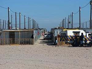
Symphony Way Temporary Relocation Area in Delft, Cape Town, better known by its nickname Blikkiesdorp, is a relocation camp made-up of corrugated iron shacks. Blikkiesdorp, which is Afrikaans for "Tin Can Village", was given its name by residents because of the row-upon-row of tin-like one room structures throughout the settlement.
Blackheath train accident
Commuter train crashed into a minibus taxi
Distance: Approx. 4363 meters
Latitude and longitude: -33.9702,18.7059
The Blackheath train accident occurred at 7:03 a.m. on 25 August 2010 when a Metrorail commuter train crashed into a minibus taxi on the Buttskop Road level crossing in Blackheath, a suburb of Cape Town, South Africa. The minibus was carrying fourteen children to school; nine died on the scene and five were hospitalised.
Khayelitsha tavern shooting
2020 shooting
Distance: Approx. 2873 meters
Latitude and longitude: -34.0239,18.6736
The Khayelitsha tavern shooting was a mass shooting which occurred on the morning of 8 March 2020. It took place at a tavern in Site B, Khayelitsha and resulted in the deaths of seven people. An additional seven people were injured in the shooting including a six-year-old girl.
Mandalay, Mitchells Plain
Suburb of Cape Town, in Western Cape, South Africa
Distance: Approx. 4762 meters
Latitude and longitude: -34.0163,18.626
Mandalay is a neighbourhood in the northeastern corner of the Mitchells Plain urban area of the City of Cape Town in the Western Cape province of South Africa.
Weather in this IP's area
clear sky
19 Celsius
19 Celsius
19 Celsius
20 Celsius
1019 hPa
62 %
1019 hPa
1015 hPa
10000 meters
8.23 m/s
180 degree

