102.244.220.47 - IP Lookup: Free IP Address Lookup, Postal Code Lookup, IP Location Lookup, IP ASN, Public IP
Country:
Region:
City:
Location:
Time Zone:
Postal Code:
IP information under different IP Channel
ip-api
Country
Region
City
ASN
Time Zone
ISP
Blacklist
Proxy
Latitude
Longitude
Postal
Route
Luminati
Country
ASN
Time Zone
Africa/Douala
ISP
ORANGE
Latitude
Longitude
Postal
IPinfo
Country
Region
City
ASN
Time Zone
ISP
Blacklist
Proxy
Latitude
Longitude
Postal
Route
IP2Location
102.244.220.47Country
Region
littoral
City
edea
Time Zone
Africa/Douala
ISP
Language
User-Agent
Latitude
Longitude
Postal
db-ip
Country
Region
City
ASN
Time Zone
ISP
Blacklist
Proxy
Latitude
Longitude
Postal
Route
ipdata
Country
Region
City
ASN
Time Zone
ISP
Blacklist
Proxy
Latitude
Longitude
Postal
Route
Popular places and events near this IP address
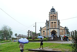
Edéa
Place in Littoral Province, Cameroon
Distance: Approx. 4 meters
Latitude and longitude: 3.8,10.13333333
Edéa is a city located along the Sanaga River in Cameroon's Littoral Region. It lies on the Douala–Yaoundé–Ngaoundéré railway line. Its population was estimated at 122,300 in 2001.

Edea Hydroelectric Power Station
Hydroelectric power plant of the Sanaga River in Edéa, Cameroon
Distance: Approx. 1552 meters
Latitude and longitude: 3.8129,10.128
The Edea Power Station is a hydroelectric power plant of the Sanaga River near Edéa in Cameroon. It has a power generating capacity of 264 megawatts (354,000 hp), enough to power over 136,600 homes. Nearly 60% of the power goes to the aluminum smelter.
Second Battle of Edea
Battle in 1915 during the First World War
Distance: Approx. 4 meters
Latitude and longitude: 3.8,10.13333333
The Second Battle of Edea was the German counter-attack against French forces stationed in the village of Edea during the Kamerun campaign of the First World War. Allied forces from Duala occupied the town following the First Battle of Edea in October 1914. The Germans, eager to retake the position attacked on 5 January 1915 but were repulsed by the French force.
First Battle of Edea
Distance: Approx. 4 meters
Latitude and longitude: 3.8,10.13333333
The First Battle of Edea involved the British and French assault on German forces stationed in the village of Edea during the Kamerun campaign of the First World War. Allied forces from Duala launched their advance on 20 October. Following stiff resistance along the southern railway line between Duala and Edea, German forces withdrew from the town to Jaunde, allowing Allied troops to finally occupy Edea on 26 October 1914.

Japoma Bridge
Distance: Approx. 1184 meters
Latitude and longitude: 3.805,10.12388889
The Japoma Bridge (also known as the Edea German Bridge or the German Bridge) is a former railway bridge over the Sanaga River near Edea, Cameroon. Note there is now another bridge across the Dibamba River called the Yapoma Bridge. It is sometimes called Japoma Bridge, which causes confusion, for example, in accounts of the fighting during WW1 - see the First Battle of Edea.
Weather in this IP's area
broken clouds
24 Celsius
25 Celsius
24 Celsius
24 Celsius
1010 hPa
98 %
1010 hPa
1007 hPa
10000 meters
0.11 m/s
0.19 m/s
324 degree
82 %
