102.223.20.7 - IP Lookup: Free IP Address Lookup, Postal Code Lookup, IP Location Lookup, IP ASN, Public IP
Country:
 Ghana
GhanaRegion:
City:
Location:
Time Zone:
Postal Code:
ISP:
ASN:
language:
User-Agent:
Proxy IP:
Blacklist:
IP information under different IP Channel
ip-api
Country
Region
City
ASN
Time Zone
ISP
Blacklist
Proxy
Latitude
Longitude
Postal
Route
db-ip
Country
Region
City
ASN
Time Zone
ISP
Blacklist
Proxy
Latitude
Longitude
Postal
Route
IPinfo
Country
Region
City
ASN
Time Zone
ISP
Blacklist
Proxy
Latitude
Longitude
Postal
Route
IP2Location
102.223.20.7Country
ghRegion
central
City
cape coast
Time Zone
Africa/Accra
ISP
Language
User-Agent
Latitude
Longitude
Postal
ipdata
Country
Region
City
ASN
Time Zone
ISP
Blacklist
Proxy
Latitude
Longitude
Postal
Route
Popular places and events near this IP address

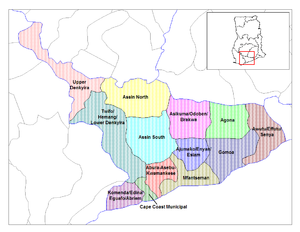
Cape Coast
City in Central Region, Ghana
Distance: Approx. 710 meters
Latitude and longitude: 5.1,-1.25
Cape Coast is a city and the capital of the Cape Coast Metropolitan District and the Central Region of Ghana. It is located about 38.4 mi (61.8 km) from Sekondi-Takoradi and approximately 80 mi (130 km) from Accra. The city is one of the most historically significant settlements in Ghana.

Cape Coast Castle
Former fortified colonial trading post in Ghana
Distance: Approx. 640 meters
Latitude and longitude: 5.10361111,-1.24111111
Cape Coast Castle (Swedish: Carolusborg) is one of about forty "slave castles", or large commercial forts, built on the Gold Coast of West Africa (now Ghana) by European traders. It was originally a Portuguese "feitoria" or trading post, established in 1555, which was named Cabo Corso. In 1653, a timber fort was constructed by the Swedish Africa Company.

Mfantsipim School
All-boys boarding secondary school in Cape Coast, Ghana
Distance: Approx. 1591 meters
Latitude and longitude: 5.119,-1.251
Mfantsipim is an all-boys boarding secondary school in Cape Coast, Ghana, established by the Methodist Church in 1876 to foster intellectual, moral, and spiritual growth on the then Gold Coast. Its founding name was Wesleyan High School and the first headmaster was James Picot, a French scholar, who was only 18 years old on his appointment. Mfantsipim is nicknamed "The School" because it gave birth to other prominent schools such as Prempeh College.

Roman Catholic Archdiocese of Cape Coast
Roman Catholic archdiocese in Ghana
Distance: Approx. 253 meters
Latitude and longitude: 5.1065,-1.2446
The Catholic Archdiocese of Cape Coast (Latin: a Litore Aureo) is the Metropolitan See for the ecclesiastical province of Cape Coast in Ghana.

Cape Coast Metropolitan Assembly
Metropolitan District in Central Region, Ghana
Distance: Approx. 589 meters
Latitude and longitude: 5.1065,-1.2414
Cape Coast Metropolitan Assembly is one of the twenty-two districts in Central Region, Ghana. Originally created as a municipal district assembly in 1988 when it was known as Cape Coast Municipal District, which was created from the Cape Coast Municipal Council; until it was later elevated to metropolitan district assembly status on 29 February 2008 to become Cape Coast Metropolitan District. The municipality is located in the southwest part of Central Region and has Cape Coast as its capital town; which is also the regional capital of the Central Region.

Cape Coast Nurses Training College
Public college in the Central Region of Ghana
Distance: Approx. 1170 meters
Latitude and longitude: 5.1027,-1.2568
The Cape Coast Nursing and Midwifery Training College is a public tertiary health institution in the Cape Coast in the Central Region of Ghana. The college is in the Cape Coast Metropolitan Assembly. The activities of the institution is supervised by the Ministry of Health.

Cape Coast Castle Museum
Ethnography and archeological museum in Cape Coast, Ghana.
Distance: Approx. 610 meters
Latitude and longitude: 5.1036,-1.2414
Cape Coast Castle Museum is an ethnography and archeological museum located in Cape Coast, Ghana. It was established in 1974.

Fort McCarthy
British Colonial Fort, located in Ghana
Distance: Approx. 377 meters
Latitude and longitude: 5.10797,-1.24438
Fort McCarthy is a fort from the colonial British Gold Coast period in present-day Ghana. The fort is a ruin in Cape Coast, of the Central Region of Ghana.

Fort Victoria, Cape Coast
Distance: Approx. 314 meters
Latitude and longitude: 5.1068,-1.24906
Fort Victoria is a structure in Cape Coast, Ghana. It was initially known as 'Phipps Tower', in honour of its initial constructor English Governor Phipps. Its name was changed later to Fort Victoria in honor of Queen Victoria.
Fosu Lagoon
Distance: Approx. 1405 meters
Latitude and longitude: 5.108,-1.259
The Fosu Lagoon is a body of water, located in the area of Cape Coast in the Central Region of Ghana, that empties into the Atlantic Ocean. A major source of livelihood for its surrounding communities over the years, the lagoon has been the subject of studies on the impact of pollution and ecological degradation. The Fosu Lagoon plays a significant part in the annual Fetu Afahye festival.
Cape Coast Municipal Council
Former Municipal Council in Central, Ghana
Distance: Approx. 589 meters
Latitude and longitude: 5.1065,-1.2414
Cape Coast Municipal Council is a former district council that was located in Central Region, Ghana. Originally created as a municipal council in 1975. However on 1988, it was split off into two new district assemblies: Cape Coast Municipal District (capital: Cape Coast) and Komenda/Edina/Eguafo/Abirem District (capital: Elmina).

Capture of Carolusborg (1658)
Colonial conflict between the Danes and Swedes
Distance: Approx. 621 meters
Latitude and longitude: 5.1036,-1.2413
The capture of Carolusborg (1658) was a capture by the newly recruited Hendrik Carloff of the Swedish fort of Carolusborg on the Gold Coast.
Weather in this IP's area
broken clouds
26 Celsius
27 Celsius
26 Celsius
26 Celsius
1009 hPa
91 %
1009 hPa
1007 hPa
10000 meters
2.76 m/s
7.22 m/s
250 degree
84 %