102.222.212.123 - IP Lookup: Free IP Address Lookup, Postal Code Lookup, IP Location Lookup, IP ASN, Public IP
Country:
Region:
City:
Location:
Time Zone:
Postal Code:
ISP:
ASN:
language:
User-Agent:
Proxy IP:
Blacklist:
IP information under different IP Channel
ip-api
Country
Region
City
ASN
Time Zone
ISP
Blacklist
Proxy
Latitude
Longitude
Postal
Route
db-ip
Country
Region
City
ASN
Time Zone
ISP
Blacklist
Proxy
Latitude
Longitude
Postal
Route
IPinfo
Country
Region
City
ASN
Time Zone
ISP
Blacklist
Proxy
Latitude
Longitude
Postal
Route
IP2Location
102.222.212.123Country
Region
beni-mellal-khenifra
City
nador
Time Zone
Africa/Casablanca
ISP
Language
User-Agent
Latitude
Longitude
Postal
ipdata
Country
Region
City
ASN
Time Zone
ISP
Blacklist
Proxy
Latitude
Longitude
Postal
Route
Popular places and events near this IP address

Nador
City in Oriental, Morocco
Distance: Approx. 919 meters
Latitude and longitude: 35.16666667,-2.93333333
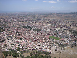
Nador (Arabic: الناظور) is a coastal city and provincial capital in the northeastern Rif region of Morocco with a population of about 158,202 (2024 census). Nador city is separated from the Mediterranean Sea by a salt lagoon named Ayrar Ameẓẓyan in Berber (Mar Chica in Spanish) and is 10 kilometres (6.2 mi) south of the Spanish enclave Melilla. Nador was founded in the 19th century by local Berber tribes and was under Spanish occupation from 1912 until Morocco's independence in 1956.

Nador Province
Province in Oriental, Morocco
Distance: Approx. 520 meters
Latitude and longitude: 35.17833333,-2.93083333
Nador (Arabic: الناظور) is a province in the Oriental Region of Morocco. Its population in 2014 was 564,943. It is situated east from Driouch Province and west from Berkane Province.

Nador railway stations
Two railway-stations in Nador, Morocco
Distance: Approx. 1104 meters
Latitude and longitude: 35.1839,-2.9279
The city of Nador in Morocco has two railway-stations: Nador Ville and Nador South. Further on the line there is also a station at Beni Anşār / Aït Nsar and the terminal Beni Anşār / Aït Nsar Port, which is generally indicated as Nador Port station. As with all railway stations in Morocco, these stations are operated by ONCF, Morocco's national railway operator.
Jaadar
Town in Oriental, Morocco
Distance: Approx. 5736 meters
Latitude and longitude: 35.15944444,-2.98916667
Jaadar is a town in Nador Province, Oriental, Morocco. According to the 2004 census, it has a population of 9,497.

Segangan
Town in Oriental, Morocco
Distance: Approx. 7017 meters
Latitude and longitude: 35.15,-3
Zeghanghane (Arabic: أزغنغان) is a town and municipality in the province of Nador, Oriental, Morocco. It is one of the major towns of the province. According to the 2014 census, its population was 34,025.
Bni Bouifrour
Commune in Oriental, Morocco
Distance: Approx. 5696 meters
Latitude and longitude: 35.153611,-2.986111
Bni Bouifrour or Ait Bouifrour (Riffian-Berber: ⴰⵢⵜ ⴱⵡⵉⴼⵔⵓⵔ) is a commune in the Nador Province of the Oriental administrative region of Morocco. At the time of the 2014 census, the commune had a total population of 17,090 people.
Bouarg
Commune in Oriental, Morocco
Distance: Approx. 5447 meters
Latitude and longitude: 35.1289,-2.9519
Bouarg (Arabic: بوعرك) is a commune in the Nador Province of the Oriental administrative region of Morocco. At the time of the 2014 census, the commune had a total population of 37,737 people.
Ihaddadene
Commune in Oriental, Morocco
Distance: Approx. 4368 meters
Latitude and longitude: 35.15,-2.96666667
Ihaddadene (Riffian-Berber: ⵉⵃⴷⴰⴷⴰⵏ, Arabic: إحدادن) is a commune in the Nador Province of the Oriental administrative region of Morocco. At the time of the 2014 census, the commune had a total population of 14,345 people.

Mount Gurugu
Mountain in Morocco
Distance: Approx. 8087 meters
Latitude and longitude: 35.22083333,-2.99666667
Mount Gurugu (Adrar 'n Gourgou) is a rural area in Morocco located almost entirely in the town of Bni Chiker near the province of Nador. The Mountain is densely populated, with no proper census having been done within the area, rather relying on the amount of houses visible. The mountain's main resources exist out of agricultural products such as animal herding or crops.

Marchica, Morocco
Distance: Approx. 7644 meters
Latitude and longitude: 35.15,-2.85
Marchica is a lake in northern Morocco, adjacent to the city of Nador. It was named by the Spanish colonization of the region. In the Spanish language, mar chica means "small sea".
Weather in this IP's area
clear sky
16 Celsius
15 Celsius
16 Celsius
17 Celsius
1020 hPa
59 %
1020 hPa
1001 hPa
10000 meters