102.221.42.171 - IP Lookup: Free IP Address Lookup, Postal Code Lookup, IP Location Lookup, IP ASN, Public IP
Country:
Region:
City:
Location:
Time Zone:
Postal Code:
IP information under different IP Channel
ip-api
Country
Region
City
ASN
Time Zone
ISP
Blacklist
Proxy
Latitude
Longitude
Postal
Route
Luminati
Country
ASN
Time Zone
Africa/Johannesburg
ISP
SAIX-NET
Latitude
Longitude
Postal
IPinfo
Country
Region
City
ASN
Time Zone
ISP
Blacklist
Proxy
Latitude
Longitude
Postal
Route
IP2Location
102.221.42.171Country
Region
western cape
City
george
Time Zone
Africa/Johannesburg
ISP
Language
User-Agent
Latitude
Longitude
Postal
db-ip
Country
Region
City
ASN
Time Zone
ISP
Blacklist
Proxy
Latitude
Longitude
Postal
Route
ipdata
Country
Region
City
ASN
Time Zone
ISP
Blacklist
Proxy
Latitude
Longitude
Postal
Route
Popular places and events near this IP address

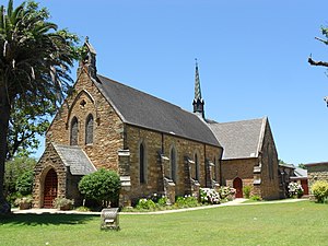
George, South Africa
City in Western Cape, South Africa
Distance: Approx. 1107 meters
Latitude and longitude: -33.96666667,22.45
George is the second largest city in the Western Cape province of South Africa. The city is a popular holiday and conference centre, as well as the administrative and commercial hub and the seat of the Garden Route District Municipality. It is named after the British Monarch George III. The city is situated roughly halfway between Cape Town and Gqeberha (Port Elizabeth) on the Garden Route.
Outeniqua Park
Distance: Approx. 1624 meters
Latitude and longitude: -33.95322222,22.44762222
Outeniqua Park is a multi-purpose stadium in George, South Africa. It is currently used mostly for rugby union matches and was the home stadium of the South African leg of the IRB Sevens World Series from 2001 through 2010, after which it moved to Nelson Mandela Bay Stadium in Port Elizabeth. The stadium is also the home of the SWD Eagles rugby team who compete in the Currie Cup.
George High School
High School in South Africa
Distance: Approx. 1518 meters
Latitude and longitude: -33.9675,22.47638889
George High School, also known as George Secondary School (Afrikaans: George Sekondêre Skool) is an Afrikaans-medium school in George, a town in the Western Cape province of South Africa. It was established in 1947 [1]. As of 2006 the school had some 1,266 students and 38 educators [2].
2003 Presidents Cup
Golf match in South Africa
Distance: Approx. 5296 meters
Latitude and longitude: -33.968,22.404
The 2003 Presidents Cup was held 20–23 November 2003 at the Links Course at Fancourt Hotel and Country Club in George, Western Cape, South Africa. The United States and International team tied the competition 17–17, and after three tied playoff holes between Tiger Woods and Ernie Els, it was decided that the Cup would be shared by agreement of the captains and players. The honorary chairman was South African President Thabo Mbeki.
York High School (George)
Public, boarding school in George, Western Cape, South Africa
Distance: Approx. 1314 meters
Latitude and longitude: -33.9711,22.451
York High School is a co-educational English Medium High School (Grade 8 to 12) for boarders and dayscholars in George, Western Cape, South Africa. For many years the Southern Cape was served by dual-medium schools in George, Mossel Bay, Oudtshoorn and Knysna. There was a growing feeling that a purely English-medium school should be built and the Department of Education eventually agreed to this.

Outeniqua Transport Museum
Distance: Approx. 1238 meters
Latitude and longitude: -33.9632,22.4744
The Outeniqua Transport Museum is a railway museum located in George, South Africa. The Outeniqua Railway Museum is one of Transnet Heritage Foundation museums. Situated in the former PX-goods shed in George, the museum opened on 24 September 1998.
Twee Rivieren
Place in Western Cape, South Africa
Distance: Approx. 2045 meters
Latitude and longitude: -33.952,22.479
Twee Rivieren is a small residential suburb in George, South Africa. It is located in the northern area of the city between Denneoord to the north and Bo-dorp to the south. "Twee Rivieren" is a Dutch name, meaning "Two Rivers".
Garden Route Botanical Garden
Botanical Garden in George, Western Cape
Distance: Approx. 1736 meters
Latitude and longitude: -33.94722222,22.46333333
The Garden Route Botanical Garden located in George, Western Cape and borders the Outeniqua Nature Reserve. The Garden focuses on plants native to the Southern Cape region. It also houses the South Cape Herbarium, an Indigenous Nursery, the Getafix Garden Cafe, and the Garden Route Environmental Education Centre.
Thembalethu
Place in Western Cape, South Africa
Distance: Approx. 4762 meters
Latitude and longitude: -34.0049511,22.4690654
Thembalethu is a township in Western Cape, South Africa. The township is on the Garden Route and falls part of the George Municipality. The name of the township "Thembalethu" is Xhosa meaning "Our Hope".

Moederkerk, George
Church in Western Cape , South Africa
Distance: Approx. 749 meters
Latitude and longitude: -33.9562,22.4631
The Moederkerk (Mother Church) is a place of worship of the Dutch Reformed Church in George, South Africa. The church was built in 1842. The cornerstone for the church was laid on 14 April 1832.
Fancourt Hotel and Country Club
Golf estate in George, Western Cape, South Africa
Distance: Approx. 5085 meters
Latitude and longitude: -33.95311,22.40716
Fancourt Hotel and Country Club is a South African golf estate in George, Western Cape (Garden Route District Municipality). It is rated among the top 10 lifestyle estates in the world. The Links Course at Fancourt is rated as the number 1 golf course in South Africa by Golf Digest.
Apartment building collapse in George
2024 building collapse in George, South Africa
Distance: Approx. 722 meters
Latitude and longitude: -33.96166667,22.45327778
On 6 May 2024, an apartment building collapsed while under construction in George, South Africa, resulting in 34 deaths.
Weather in this IP's area
scattered clouds
28 Celsius
29 Celsius
28 Celsius
28 Celsius
1011 hPa
61 %
1011 hPa
984 hPa
10000 meters
4.12 m/s
40 %