102.220.55.49 - IP Lookup: Free IP Address Lookup, Postal Code Lookup, IP Location Lookup, IP ASN, Public IP
Country:
Region:
City:
Location:
Time Zone:
Postal Code:
IP information under different IP Channel
ip-api
Country
Region
City
ASN
Time Zone
ISP
Blacklist
Proxy
Latitude
Longitude
Postal
Route
Luminati
Country
Region
wc
City
hartenbos
ASN
Time Zone
Africa/Johannesburg
ISP
VTS-CONNECT
Latitude
Longitude
Postal
IPinfo
Country
Region
City
ASN
Time Zone
ISP
Blacklist
Proxy
Latitude
Longitude
Postal
Route
IP2Location
102.220.55.49Country
Region
western cape
City
mossel bay
Time Zone
Africa/Johannesburg
ISP
Language
User-Agent
Latitude
Longitude
Postal
db-ip
Country
Region
City
ASN
Time Zone
ISP
Blacklist
Proxy
Latitude
Longitude
Postal
Route
ipdata
Country
Region
City
ASN
Time Zone
ISP
Blacklist
Proxy
Latitude
Longitude
Postal
Route
Popular places and events near this IP address

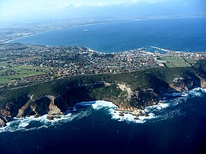
Mossel Bay
Town in Western Cape, South Africa
Distance: Approx. 1167 meters
Latitude and longitude: -34.18333333,22.13333333
Mossel Bay (Afrikaans: Mosselbaai) is a harbour town of about 170,000 people on the Garden Route of South Africa. It is an important tourism and farming region of the Western Cape Province. Mossel Bay lies 400 kilometres east of the country's seat of parliament, Cape Town (which is also the capital city of the Western Cape), and 400 km west of Gqeberha, the largest city in the Eastern Cape.
Hartenbos
Town in cape, South Africa
Distance: Approx. 7874 meters
Latitude and longitude: -34.11666667,22.11666667
Hartenbos is a town in the Western Cape province of South Africa. It is located some 45 kilometres outside George, South Africa. It belongs, together with 20 other settlements, to the Mossel Bay Local Municipality.
Pinnacle Point
Small promontory south of Mossel Bay, South Africa
Distance: Approx. 5888 meters
Latitude and longitude: -34.20777778,22.08944444
Pinnacle Point a small promontory immediately south of Mossel Bay, a town on the southern coast of South Africa. Excavations since the year 2000 of a series of caves at Pinnacle Point, first recognized and documented in 1997 by South African professional archaeologists, Jonathan Kaplan and Peter Nilssen, have revealed occupation by Middle Stone Age people between 170,000 and 40,000 years ago. The focus of excavations has been at Cave 13B (PP13B), where the earliest evidence for the systematic exploitation of marine resources (shellfish) and symbolic behaviour has been documented, and at Pinnacle Point Cave 5–6 (PP5–6), where the oldest evidence for the heat treatment of rock to make stone tools has been documented.
Danabaai
Place in Western Cape, South Africa
Distance: Approx. 9772 meters
Latitude and longitude: -34.19916667,22.04166667
Dana Bay can really be considered as a sort of village with a mini supermarket, bakery, butchery, eating establishments, fuel station and liquor outlets amongst other small businesses and it forms part of the greater Mossel Bay municipality. Dana Bay lies approximately halfway between Port Elizabeth and Cape Town and is a mere 4 kilometers off the N2 highway with the central part of Mossel Bay about 12 kilometers away. There are no hotels in Dana Bay however there are multiple Bed and Breakfast establishments and a new specialised medical centre.

Mossel Bay Yacht and Boat Club
Distance: Approx. 666 meters
Latitude and longitude: -34.17916667,22.14055556
Mossel Bay Yacht and Boat Club (abb: MBYBC)/Mosselbaai Seiljag- en Bootklub (Afrikaans) was a yacht club in South Africa. Established in 1956, it was located in the harbour city of Mossel Bay on the Garden Route in the Western Cape Province. Club activities included yachting, boating, diving, rowing, and social events.

Cape St. Blaize Lighthouse
Lighthouse in South Africa
Distance: Approx. 1008 meters
Latitude and longitude: -34.18602778,22.15636111
Cape St. Blaize Lighthouse is a lighthouse near Mossel Bay, South Africa.
Fairview, Mossel Bay
Place in Western Cape, South Africa
Distance: Approx. 1167 meters
Latitude and longitude: -34.18333333,22.13333333
Fairview is a suburb of Mossel Bay, a large town on the south coast of the Western Cape province in South Africa
Post Office Tree
Tree in Mossel Bay, South Africa
Distance: Approx. 523 meters
Latitude and longitude: -34.180363,22.141382
The Post Office Tree (Afrikaans: Poskantoorboom) is a famous milkwood tree (Sideroxylon inerme) in Mossel Bay, South Africa that was used by early Portuguese explorers as a post office. It is located in the grounds of the Bartholomeu Dias Museum Complex in Market Street.
Weather in this IP's area
clear sky
27 Celsius
29 Celsius
27 Celsius
27 Celsius
1013 hPa
75 %
1013 hPa
1008 hPa
10000 meters
7.28 m/s
7.96 m/s
110 degree
3 %

