102.220.211.73 - IP Lookup: Free IP Address Lookup, Postal Code Lookup, IP Location Lookup, IP ASN, Public IP
Country:
Region:
City:
Location:
Time Zone:
Postal Code:
IP information under different IP Channel
ip-api
Country
Region
City
ASN
Time Zone
ISP
Blacklist
Proxy
Latitude
Longitude
Postal
Route
Luminati
Country
Region
wc
City
capetown
ASN
Time Zone
Africa/Johannesburg
ISP
Vox-Telecom
Latitude
Longitude
Postal
IPinfo
Country
Region
City
ASN
Time Zone
ISP
Blacklist
Proxy
Latitude
Longitude
Postal
Route
IP2Location
102.220.211.73Country
Region
western cape
City
blouberg
Time Zone
Africa/Johannesburg
ISP
Language
User-Agent
Latitude
Longitude
Postal
db-ip
Country
Region
City
ASN
Time Zone
ISP
Blacklist
Proxy
Latitude
Longitude
Postal
Route
ipdata
Country
Region
City
ASN
Time Zone
ISP
Blacklist
Proxy
Latitude
Longitude
Postal
Route
Popular places and events near this IP address

Table View
Suburb of Cape Town, in Western Cape, South Africa
Distance: Approx. 2707 meters
Latitude and longitude: -33.81666667,18.48333333
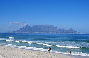
Table View, also known as Unstable View by local residents, is a West Coast suburb of Cape Town, South Africa, named after its view of Table Mountain. It has expanded rapidly since the 1970s and has extensions such as Flamingo Vlei, Sunridge, West Riding, Parklands, Sunningdale, and Killarney. Table View has various shopping malls, such as Bayside Mall and Table Bay Mall.

Killarney Motor Racing Complex
Motorsport complex in Table View, Cape Town, South Africa
Distance: Approx. 1686 meters
Latitude and longitude: -33.82333333,18.52777778
Killarney International Raceway is a motorsport complex in Table View, Cape Town, South Africa. It first saw action in 1947.

Parklands, Western Cape
Suburb of Cape Town, in Western Cape, South Africa
Distance: Approx. 1530 meters
Latitude and longitude: -33.81444444,18.5025
Parklands is a suburb of Cape Town, South Africa. It is located within the greater Blouberg area, bordered by Table View and is part of the Western Seaboard residential district. Parklands is one of the fastest-growing residential developments in the Western Cape.

Rietvlei Wetland Reserve
Nature reserve in Table View, Western Cape, South Africa.
Distance: Approx. 2303 meters
Latitude and longitude: -33.84579,18.50039
The Rietvlei Wetland Reserve is a 663-hectare (1,640-acre) nature reserve situated in Table View, Western Cape, South Africa. It is managed by the City of Cape Town's Environmental Resource Management Department. The Rietvlei Wetland Reserve forms part of the greater 880 hectares (2,200 acres) Table Bay Nature Reserve.
Milnerton Racecourse
Training course and stabling at Milnerton, Western Cape, South Africa
Distance: Approx. 3028 meters
Latitude and longitude: -33.85374,18.50641
Milnerton Racecourse is located in Milnerton, Western Cape, South Africa and is owned and managed by Gold Circle. Though the racecourse is not used for races anymore, it is still used for the training and stabling of racing horses. Much of Gold Circle's land around the race track was sold for the development of the Royal Ascot residential precinct.
Diep River Fynbos Corridor
Nature reserve in South Africa
Distance: Approx. 1857 meters
Latitude and longitude: -33.81389,18.52287
The Diep River Fynbos Corridor is a nature reserve located in the Blaauwberg region of Cape Town, South Africa. It forms part of the larger Table Bay Nature Reserve, which was established in June 2012.
Table View High School
High school in Table View, Cape Town, South Africa
Distance: Approx. 1192 meters
Latitude and longitude: -33.8312,18.4983
Table View High School was founded in 1986 in Table View, near Cape Town, and is a public dual-medium Afrikaans and English school that enrolls both boys and girls (co-educational). The school is financially assisted by the Western Cape Education Department and therefore, like most other schools in South Africa, it charges a school fee, as regulated by the South African Schools Act. The school's current principal as of 2018 is Ms.
Parklands College
Private & boarding school in Parklands, Western Cape, South Africa
Distance: Approx. 1006 meters
Latitude and longitude: -33.8177,18.509
Parklands College and Christopher Robin Pre-Primary are private schools situated in Parklands, near Cape Town, South Africa. The college is managed by a board of directors represented by the managing director.

Table Bay Nature Reserve
Nature reserve in Western Cape, South Africa
Distance: Approx. 2303 meters
Latitude and longitude: -33.84579,18.50039
The Table Bay Nature Reserve is an 880-hectare (2,200-acre) nature reserve in Milnerton, Western Cape, South Africa. It consists of several smaller constituent reserves including Rietvlei Wetland Reserve, Diep River Fynbos Corridor, Zoarvlei Wetlands, Milnerton Racecourse Nature Reserve, and Milnerton Lagoon, as well as surrounding protected areas. These adjacent reserves were amalgamated on 27 June 2012, in order to improve the biodiversity management in the built-up area.
Dunoon, Cape Town
Township in the Western Cape, South Africa
Distance: Approx. 2904 meters
Latitude and longitude: -33.819,18.54
Dunoon is a sprawling township in the Western Cape province of South Africa. The first erf for Dunoon was surveyed in 1996. As formal housing was built, shacks developed rapidly.
Killarney Gardens
Industrial area of Cape Town in Western Cape, South Africa
Distance: Approx. 2127 meters
Latitude and longitude: -33.827,18.533
Killarney Gardens is an industrial area of Cape Town with no population or households. It is located about 30 minutes away from the harbour and the airport and situated between the N1, the N7 and Plattekloof roads. Neighbouring suburbs include Milnerton Rural, Dunoon, Richwood, and Flamingo Vlei.
Blouberg, Western Cape
Place in Western Cape, South Africa
Distance: Approx. 2707 meters
Latitude and longitude: -33.81666667,18.48333333
Blouberg or Blaauwberg, is a group of suburbs situated along the Table Bay, approximately 16 kilometres (10 miles) north of Cape Town in the Western Cape, South Africa.
Weather in this IP's area
clear sky
19 Celsius
19 Celsius
18 Celsius
20 Celsius
1018 hPa
67 %
1018 hPa
1016 hPa
10000 meters
2.24 m/s
6.26 m/s
203 degree
