102.217.121.43 - IP Lookup: Free IP Address Lookup, Postal Code Lookup, IP Location Lookup, IP ASN, Public IP
Country:
Region:
City:
Location:
Time Zone:
Postal Code:
ISP:
ASN:
language:
User-Agent:
Proxy IP:
Blacklist:
IP information under different IP Channel
ip-api
Country
Region
City
ASN
Time Zone
ISP
Blacklist
Proxy
Latitude
Longitude
Postal
Route
db-ip
Country
Region
City
ASN
Time Zone
ISP
Blacklist
Proxy
Latitude
Longitude
Postal
Route
IPinfo
Country
Region
City
ASN
Time Zone
ISP
Blacklist
Proxy
Latitude
Longitude
Postal
Route
IP2Location
102.217.121.43Country
Region
laikipia
City
nanyuki
Time Zone
Africa/Nairobi
ISP
Language
User-Agent
Latitude
Longitude
Postal
ipdata
Country
Region
City
ASN
Time Zone
ISP
Blacklist
Proxy
Latitude
Longitude
Postal
Route
Popular places and events near this IP address

Nanyuki
Town in Laikipia County, Kenya
Distance: Approx. 683 meters
Latitude and longitude: 0.01666667,37.06666667
Nanyuki is a market town in Laikipia County of Kenya lying northwest of Mount Kenya along the A2 road and at the terminus of the branch railway from Nairobi. The name is derived from Enyaanyukie Maasai word for resemblance. It is situated just north of the Equator (0° 01' North).
Nanyuki Airport
Airport in Nanyuki, Kenya
Distance: Approx. 5712 meters
Latitude and longitude: 0.045,37.03
Nanyuki Airfield is an airport in Nanyuki, Kenya.

Laikipia Air Base
Distance: Approx. 5519 meters
Latitude and longitude: 0.03083333,37.02527778
Laikipia Air Base (IATA: n/a, ICAO: n/a) is a Kenya Air Force base located approximately 8 kilometres (5.0 mi) west-northwest of Nanyuki, Kenya. Laikipia AB was established in 1974 as Nanyuki Air Base and later renamed for the county in which it is located.

Ol Pejeta Conservancy
Not-for-profit wildlife conservancy in Central Kenya's Laikipia County
Distance: Approx. 0 meters
Latitude and longitude: 0,37
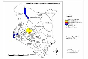
The Ol Pejeta Conservancy is a 360 km2 (140 sq mi) not-for-profit wildlife conservancy in Central Kenya's Laikipia County. It is situated on the equator west of Nanyuki, between the foothills of the Aberdares and Mount Kenya. The Ol Pejeta Conservancy works to conserve wildlife, provide a sanctuary for great apes, and generate income through wildlife tourism and complementary enterprises for re-investment in conservation and community development.

Nanyuki Cottage Hospital
Hospital in Kenya
Distance: Approx. 1655 meters
Latitude and longitude: 0.00296476,37.07848308
Nanyuki Cottage Hospital is a nonprofit hospital in Nanyuki, Laikipia County, Kenya. The hospital has 50 inpatient beds and includes an operating theatre, laboratory, X-ray department and pharmacy. The hospital also offers outpatient services such as antiretroviral therapy, family planning, HIV counselling and testing, and immunisation.
Weather in this IP's area
clear sky
24 Celsius
24 Celsius
24 Celsius
24 Celsius
1013 hPa
32 %
1013 hPa
816 hPa
10000 meters
6.06 m/s
6.3 m/s
40 degree
6 %