102.214.6.180 - IP Lookup: Free IP Address Lookup, Postal Code Lookup, IP Location Lookup, IP ASN, Public IP
Country:
Region:
City:
Location:
Time Zone:
Postal Code:
ISP:
ASN:
language:
User-Agent:
Proxy IP:
Blacklist:
IP information under different IP Channel
ip-api
Country
Region
City
ASN
Time Zone
ISP
Blacklist
Proxy
Latitude
Longitude
Postal
Route
db-ip
Country
Region
City
ASN
Time Zone
ISP
Blacklist
Proxy
Latitude
Longitude
Postal
Route
IPinfo
Country
Region
City
ASN
Time Zone
ISP
Blacklist
Proxy
Latitude
Longitude
Postal
Route
IP2Location
102.214.6.180Country
Region
niamey
City
niamey
Time Zone
Africa/Niamey
ISP
Language
User-Agent
Latitude
Longitude
Postal
ipdata
Country
Region
City
ASN
Time Zone
ISP
Blacklist
Proxy
Latitude
Longitude
Postal
Route
Popular places and events near this IP address

Niamey
Capital and the largest city of Niger
Distance: Approx. 99 meters
Latitude and longitude: 13.51361111,2.10888889
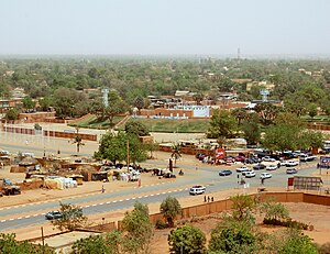
Niamey (French pronunciation: [njamɛ]) is the capital and largest city of Niger. Niamey lies on the Niger River, primarily situated on the east bank. Niamey's population was counted as 1,026,848 as of the 2012 census.
Lycée La Fontaine (Niger)
French international school in Niamey, Niger
Distance: Approx. 1258 meters
Latitude and longitude: 13.5213,2.1012
Lycée La Fontaine in Niamey, Niger, is a French-speaking international school attached to the French Embassy. It was established in 1962. In 2021 it had some 876 students (32% French, 68% local and from other countries) and 56 educators.

National Assembly (Niger)
Legislative body of Niger
Distance: Approx. 565 meters
Latitude and longitude: 13.51138889,2.11444444
The unicameral National Assembly (French: Assemblée nationale) is Niger's legislative body. The National Assembly proposed laws and was required to approve all legislation. It was suspended following the 2023 Nigerien coup d'état by the military junta.
Roman Catholic Archdiocese of Niamey
Roman Catholic archdiocese in Niger
Distance: Approx. 531 meters
Latitude and longitude: 13.5183,2.1111
The Archdiocese of Niamey (Latin: Archidioecesis Niameyensis) is a Roman Catholic Archdiocese in Niger. It is based in the capital city of Niamey and was erected on 28 April 1942. Pope Benedict XVI made it an archdiocese in June 2007.

Kennedy Bridge (Niamey)
Bridge in Niamey, Niger
Distance: Approx. 1187 meters
Latitude and longitude: 13.50472222,2.10388889
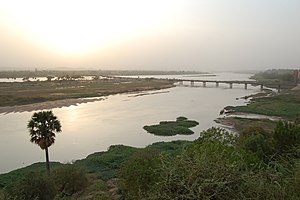
The Kennedy Bridge is the main crossing for the Niger River in Niamey, Niger. It was built in 1970, and named for United States President John F. Kennedy. Its construction enabled Niamey to expand onto the right bank of the river to the west.

Niamey Grand Market
Market in Niamey, Niger
Distance: Approx. 829 meters
Latitude and longitude: 13.51638889,2.11694444
The Niamey Grand Market (fr:Grand marché de Niamey) is the largest market and shopping center in Niamey, the capital and largest city in the West African state of Niger.

Commune II (Niamey)
Commune in Niamey, Niger
Distance: Approx. 293 meters
Latitude and longitude: 13.51194444,2.10777778
Commune II (Niamey), also known as Niamey II, is an urban commune in Niger. It is a commune of the capital city of Niamey.
2010 Nigerien coup d'état
Military overthrow of Mamadou Tandja
Distance: Approx. 818 meters
Latitude and longitude: 13.5167,2.1167
A coup d'état occurred in Niger on 18 February 2010. Soldiers attacked the presidential palace in Niamey under weapons fire at midday and captured President Mamadou Tandja, who was chairing a government meeting at the time. Later in the day, the rebels announced on television the formation of the Supreme Council for the Restoration of Democracy (CSRD), headed by chef d'escadron Salou Djibo.

National Hospital (Niamey)
Hospital in Niamey, Niger
Distance: Approx. 888 meters
Latitude and longitude: 13.5135,2.1016
The National Hospital is a government founded district general hospital in Niamey, Niger. It has 244 beds. The hospital was founded in 1922.

Our Lady of Perpetual Help Cathedral, Niamey
Church in Niamey, Niger
Distance: Approx. 465 meters
Latitude and longitude: 13.5178,2.1106
The Our Lady of Perpetual Help Cathedral (French: Cathédrale Notre-Dame du Perpétuel Secours de Niamey) or simply Cathedral of Niamey, is a religious building of the Catholic Church located in Niamey, the capital city of the African country of Niger.
WAQF Tower
Skyscraper in Niamey, Niger
Distance: Approx. 317 meters
Latitude and longitude: 13.5148,2.1071
WAQF Tower is a skyscraper in Niamey, Niger, and is the country's tallest building, standing at 58.85 m (193.1 ft). Construction finished in 2019. The foundation was ceremonially laid by Niger's president Mahamadou Issoufou.

2021 Nigerien coup attempt
2021 coup attempt in Niger
Distance: Approx. 818 meters
Latitude and longitude: 13.5167,2.1167
The 2021 Nigerien coup d'etat attempt occurred on 31 March at around 3 am WAT (2 am UTC) after gunfire erupted in the streets of Niamey, the capital of Niger, two days before the inauguration of president-elect Mohamed Bazoum. The coup attempt was staged by elements within the military, and was attributed to an Air Force unit based in the area of the Niamey Airport. The alleged leader of the plot was Captain Sani Saley Gourouza, who was in charge of security at the unit's base.
Weather in this IP's area
clear sky
23 Celsius
22 Celsius
23 Celsius
23 Celsius
1016 hPa
14 %
1016 hPa
989 hPa
10000 meters
6.66 m/s
13.64 m/s
86 degree
3 %