102.185.114.36 - IP Lookup: Free IP Address Lookup, Postal Code Lookup, IP Location Lookup, IP ASN, Public IP
Country:
Region:
City:
Location:
Time Zone:
Postal Code:
IP information under different IP Channel
ip-api
Country
Region
City
ASN
Time Zone
ISP
Blacklist
Proxy
Latitude
Longitude
Postal
Route
Luminati
Country
Region
shr
City
zagazig
ASN
Time Zone
Africa/Cairo
ISP
RAYA Telecom - Egypt
Latitude
Longitude
Postal
IPinfo
Country
Region
City
ASN
Time Zone
ISP
Blacklist
Proxy
Latitude
Longitude
Postal
Route
IP2Location
102.185.114.36Country
Region
dumyat
City
damietta
Time Zone
Africa/Cairo
ISP
Language
User-Agent
Latitude
Longitude
Postal
db-ip
Country
Region
City
ASN
Time Zone
ISP
Blacklist
Proxy
Latitude
Longitude
Postal
Route
ipdata
Country
Region
City
ASN
Time Zone
ISP
Blacklist
Proxy
Latitude
Longitude
Postal
Route
Popular places and events near this IP address

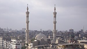
Damietta
City in Egypt
Distance: Approx. 2752 meters
Latitude and longitude: 31.41666667,31.82138889
Damietta (Arabic: دمياط Dumyāṭ [domˈjɑːtˤ]; Coptic: ⲧⲁⲙⲓⲁϯ, romanized: Tamiati) is a port city and the capital of the Damietta Governorate in Egypt. It is located at the Damietta branch, an eastern distributary of the Nile Delta, 15 kilometres (9.3 mi) from the Mediterranean Sea, and about 200 kilometres (120 mi) north of Cairo. It was a Catholic bishopric and is a multiple titular see.
Damietta Governorate
Governorate of Egypt
Distance: Approx. 7601 meters
Latitude and longitude: 31.4,31.72
Damietta Governorate (Egyptian Arabic: محافظة دمياط Muḥafazat Dumyāṭ [moˈħɑfzet domˈjɑːtˤ]) is one of the 27 governorates of Egypt. It is located in the northeastern part of the country, and has a population of over 1.3 million. The capital is the city of Damietta.
Damietta Port
Distance: Approx. 8046 meters
Latitude and longitude: 31.46694444,31.76805556
Egypt's Damietta Port is located 10 km west of the Nile river of Damietta branch westward Ras El-Bar, 70 km to the west of Port Said and 200 km from Alexandria Port. The port installations extend on an area of 11.8 km2. The port is bordered by an imaginary line connecting the eastern and western external breakwaters.

Siege of Damietta (1249)
Part of the Seventh Crusade
Distance: Approx. 2444 meters
Latitude and longitude: 31.4167,31.8167
The siege of Damietta occurred in 1249 and was part of the Seventh Crusade. Louis IX of France landed at Damietta in 1249. Egypt would, Louis thought, provide a base from which to attack Jerusalem, and its wealth and supply of grain would keep the crusaders fed and equipped.
Caphutkia
Distance: Approx. 2439 meters
Latitude and longitude: 31.41666667,31.81666667
Caphutkia (also Capotakia or Kapotakia; in Aramaic קפוטקיא, קפוטקאי, קפודקאי; later Katpatuka in Old Persian) was the name used in some medieval Jewish and Syriac writings for the town in the vicinity of the former Ptolemaic city of Pelusium and its later Arab counterpart Damietta. Caphutkia is mentioned in the Targums and the Syriac commentary on Genesis where it is identified with the locality called Caphtor in the Bible. It is mentioned by Maimonides in his commentary where he equates it with Damietta which accords with the identification of Caphtor with Damietta by Saadia Gaon, Benjamin of Tudela and Abraham Zacuto.
Shata, Egypt
City in Damietta, Egypt
Distance: Approx. 6907 meters
Latitude and longitude: 31.408889,31.871944
Shata or Sheikh Shata (Arabic: شطا, Greek: Σάτα) is an old city in Damietta Governorate, Egypt. It lies North East of the Nile Delta on Lake Manzala. City was famous in Middle Ages for its production of textiles known as "Shatawi" and for producing cover (Kiswah) for Kaaba.
Arrawda
City in Damietta, Egypt
Distance: Approx. 9294 meters
Latitude and longitude: 31.32336,31.76122
Arrawda (Arabic: الروضة) is a city in the Damietta Governorate, Egypt. Its population was estimated at 29,600 people in 2018.
Kafr El Battikh
City in Damietta, Egypt
Distance: Approx. 9294 meters
Latitude and longitude: 31.32336,31.76122
Kafr El Battikh (Arabic: كفر البطيخ) is a city in the Damietta Governorate, Egypt. Its population was estimated at 44,700 people in 2018.

Amr ibn al-As Mosque (Damietta)
2nd oldest mosque in Egypt
Distance: Approx. 3070 meters
Latitude and longitude: 31.4229,31.818
The Amr ibn al-As Mosque (Arabic: مَسْجِد عَمْرِو بْنِ الْعَاصِ, romanized: Masjid ʿAmr ibn al-ʿĀṣ), also known as the Abu'l-Ma'ati Mosque or Al-Fateh Mosque, is a historic mosque in Damietta, Egypt. According to some local sources, it is the second mosque to be built in Egypt, named for Amr ibn al-As, one of the Companions of the Prophet who led the Arab conquest of Egypt. It was temporarily the Cathedral of the Holy Virgin during the Crusader occupation of Damietta.
Weather in this IP's area
clear sky
14 Celsius
13 Celsius
14 Celsius
14 Celsius
1016 hPa
58 %
1016 hPa
1016 hPa
10000 meters
5.62 m/s
10.16 m/s
203 degree
