Country:
Region:
City:
Latitude and Longitude:
Time Zone:
Postal Code:
IP information under different IP Channel
ip-api
Country
Region
City
ASN
Time Zone
ISP
Blacklist
Proxy
Latitude
Longitude
Postal
Route
Luminati
Country
ASN
Time Zone
Africa/Gaborone
ISP
ABARI
Latitude
Longitude
Postal
IPinfo
Country
Region
City
ASN
Time Zone
ISP
Blacklist
Proxy
Latitude
Longitude
Postal
Route
db-ip
Country
Region
City
ASN
Time Zone
ISP
Blacklist
Proxy
Latitude
Longitude
Postal
Route
ipdata
Country
Region
City
ASN
Time Zone
ISP
Blacklist
Proxy
Latitude
Longitude
Postal
Route
Popular places and events near this IP address
Mogoditshane
City in Kweneng District, Botswana
Distance: Approx. 6441 meters
Latitude and longitude: -24.63333333,25.86666667
Mogoditshane is a town located in the Kweneng District of Botswana.

Sir Seretse Khama International Airport
Airport in Gaborone, Botswana
Distance: Approx. 3875 meters
Latitude and longitude: -24.55527778,25.91833333
Sir Seretse Khama International Airport (IATA: GBE, ICAO: FBSK), located 15 kilometres (9 mi) north of downtown Gaborone, is the main international airport of the capital city of Botswana. The airport is named after Sir Seretse Khama, the first president of Botswana. It was opened in 1984 to handle regional and international traffic.

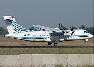
1999 Air Botswana ATR 42 crash
1999 aviation incident
Distance: Approx. 3825 meters
Latitude and longitude: -24.557,25.922
On 11 October 1999, an Air Botswana ATR 42-320 piloted by Chris Phatswe, an Air Botswana pilot, intentionally crashed the aircraft into a group of aircraft at Sir Seretse Khama International Airport in Gaborone, Botswana. He was the only casualty. His actions effectively crippled operations for Air Botswana.
Mmopane
Village in Kweneng District, Botswana
Distance: Approx. 4160 meters
Latitude and longitude: -24.56694444,25.87333333
Mmopane is a village in the Kweneng District of Botswana. The village is located around 15 km from Gaborone, the capital of Botswana. The population was 3,512 in 2001 census and 14,655 at the 2011 census.
SSKB Stadium
Distance: Approx. 5025 meters
Latitude and longitude: -24.6022,25.8596
Sir Seretse Khama Barracks Stadium, popularly known as SSKB Stadium, is a multi-use stadium in Mogoditshane, Kweneng, Botswana. It is used mostly for football matches and serves as the home stadium of Botswana Defence Force XI. The stadium holds 5,000 people. The stadium is owned by the Botswana Defence Force (BDF).
Dumadumana
Place in Gaborone, Botswana
Distance: Approx. 4402 meters
Latitude and longitude: -24.577383,25.865173
Ledumadumana is a village in Botswana, located about 10 km (6.2 mi) northwest of Gaborone, the capital of Botswana.
Three Dikgosi Monument
Monument in Gaborone, Botswana
Distance: Approx. 6280 meters
Latitude and longitude: -24.64491667,25.90733333
The Three Dikgosi Monument is a bronze sculpture located in the Central Business District of Gaborone, Botswana. The statues depict three dikgosi, or tribal chiefs: Khama III, Sebele I, and Bathoen I. The three dikgosi played important roles in Botswana's independence. In 1895, the three men traveled to Great Britain to ask Joseph Chamberlain, Secretary of State for the Colonies, and Queen Victoria to separate the Bechuanaland Protectorate from Cecil Rhodes's British South Africa Company and Southern Rhodesia.
Kgalagadi Breweries Limited
Motswana brewery
Distance: Approx. 4900 meters
Latitude and longitude: -24.63111111,25.91905556
Kgalagadi Breweries (Pty) Limited are brewers based in Gaborone, Botswana. They produce lager beers, traditional beers, bottled water and soft drinks under license. The brewery started out as Prinz Brau, with two brands, Prinz Brau and Prinz Deluxe.

Botswana Examination Council
Educational qualification provider in Botswana
Distance: Approx. 5546 meters
Latitude and longitude: -24.6366608,25.8928871
Botswana Examinations Council (or BEC) is a provider of national qualifications, offering examinations and qualifications to schools in Botswana.
Phakalane Power Station
Photovoltaic power station in Phakalane, Botswana
Distance: Approx. 6463 meters
Latitude and longitude: -24.57361111,25.96861111
Phakalane Power Station is a photovoltaic pilot power plant located in Phakalane, Botswana. The power station was funded through a Japanese grant which was part of Prime Minister Hatoyama's initiative strategy called Cool Earth Partnership aimed at supporting developing countries in their efforts to combat global warming. The Cool Earth Partnership is part of the initiatives which saw Hatoyama win the Sustainable Development Leadership Award in 2010.
Botswana University of Agriculture and Natural Resources
Agricultural university in Gaborone
Distance: Approx. 3517 meters
Latitude and longitude: -24.5914,25.9415
Botswana University of Agriculture and Natural Resources (BUAN) formally known as Botswana College of Agriculture (BCA) is an agricultural and natural resources University located in Gaborone, Botswana.
Botswana Vaccine Institute
Botswana scientific research parastatal
Distance: Approx. 4281 meters
Latitude and longitude: -24.62472222,25.92111111
The Botswana Vaccine Institute (BVI) is a veterinary research institute owned by the Botswana government that carries out research on communicable diseases in domestic animals, with emphasis on viral transmitted infections. BVI manufactures vaccines against major animal diseases for use in Botswana and for sale in 16 African and Middle Eastern countries. BVI is a "leader in the research, manufacture and supply of livestock vaccines".
Weather in this IP's area
clear sky
28 Celsius
27 Celsius
28 Celsius
28 Celsius
1014 hPa
34 %
1014 hPa
906 hPa
10000 meters
2.57 m/s
05:21:31
18:41:08