Country:
 Mauritius
Region:
City:
Latitude and Longitude:
Time Zone:
Postal Code:
IP information under different IP Channel
ip-api
Country
Region
City
ASN
Time Zone
ISP
Blacklist
Proxy
Latitude
Longitude
Postal
Route
IPinfo
Country
Region
City
ASN
Time Zone
ISP
Blacklist
Proxy
Latitude
Longitude
Postal
Route
MaxMind
Country
Region
City
ASN
Time Zone
ISP
Blacklist
Proxy
Latitude
Longitude
Postal
Route
Luminati
Country
MURegion
ro
City
rodrigues
ASN
Time Zone
Indian/Mauritius
ISP
EMTEL-AS-AP
Latitude
Longitude
Postal
db-ip
Country
Region
City
ASN
Time Zone
ISP
Blacklist
Proxy
Latitude
Longitude
Postal
Route
ipdata
Country
Region
City
ASN
Time Zone
ISP
Blacklist
Proxy
Latitude
Longitude
Postal
Route
Popular places and events near this IP address

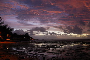
Rodrigues
Autonomous outer island in Mauritius
Distance: Approx. 1745 meters
Latitude and longitude: -19.71666667,63.41666667
Rodrigues (French: Île Rodrigues [il ʁɔdʁiɡ]; Creole: Rodrig) is a 108 km2 (42 sq mi) autonomous outer island of the Republic of Mauritius in the Indian Ocean, about 560 km (350 mi) east of Mauritius. It is part of the Mascarene Islands, which include Mauritius and Réunion. Like Agaléga, Rodrigues is a constituent island of the Republic of Mauritius, under the Constitution of Mauritius and still remains, as explicitly defined by the same Constitution, part of the Sovereignty of Mauritius, together with the following islands: "Agalega, Tromelin, Cargados Carajos (Saint Brandon), Chagos Archipelago ...
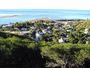
Port Mathurin
Capital of the island of Rodrigues
Distance: Approx. 1968 meters
Latitude and longitude: -19.68333333,63.41666667
The village of Port Mathurin (French pronunciation: [pɔʁ matyʁɛ̃]) serves as the capital of the island of Rodrigues, a dependency of Mauritius. Most of the population of Rodrigues is settled close to or in the city. It lies on the north coast of the Indian Ocean island and functions as the administrative, judicial and economic centre of Rodrigues.
Rodrigues College
Distance: Approx. 2179 meters
Latitude and longitude: -19.682,63.421
Rodrigues College is a secondary school for both girls and boys. It is located in Port Mathurin, Rodrigues. It is the first ecumenical educational institution on the Indian Ocean.
Anse aux Anglais
Village in Mauritius
Distance: Approx. 4232 meters
Latitude and longitude: -19.66666667,63.43333333
Anse aux Anglais or English Bay is a small coastal village located in the north of the Mauritian island of Rodrigues in the Indian Ocean. Its name, French for "English Bay," is apparently linked with the fact that English troops landed on its beach in 1809 during the Napoleonic Wars between France and Great Britain. French writer of Mauritian origin, J. M. G. Le Clézio situated the plot of his book Le Chercheur d’or in this village.
Cat Island (Rodrigues)
Island in the Indian Ocean
Distance: Approx. 7532 meters
Latitude and longitude: -19.76666667,63.43333333
Cat Island (French: Île aux Chats) is a small island lying south of Rodrigues in the Indian Ocean. It is surrounded by a coral reef and is known for diving and snorkelling sites.

Hermitage Island
Island in Mauritius
Distance: Approx. 5749 meters
Latitude and longitude: -19.75,63.43333333
Hermitage Island (French: Île Hermitage) is a small island lying south west of Port Sud-Est in Rodrigues, Mauritius. It is reputed to be the location of buried treasure and is a popular destination for tourists.
Rivière Tamarin
River in Mauritius
Distance: Approx. 3600 meters
Latitude and longitude: -19.73333333,63.41666667
Rivière Tamarin is a river in southwest Mauritius. It is the outflow of the country's largest lake, Mare aux Vacoas. From there it flows west over the cascades known as the Tamarind Falls, reaching the Indian Ocean close to the village of Tamarin.

Apostolic Vicariate of Rodrigues
Roman Catholic missionary jurisdiction in Mauritius
Distance: Approx. 3015 meters
Latitude and longitude: -19.718,63.4384
The Apostolic Vicariate of Rodrigues (Latin: Vicariatus Apostolicus Rodrigensis) is a Roman Catholic apostolic vicariate located on the island of Rodrigues in Mauritius.

Baie aux Huîtres
Place in Rodrigues, Mauritius
Distance: Approx. 6551 meters
Latitude and longitude: -19.72916667,63.36111111
Baie aux Huîtres is a coastal village located on the Mauritian island of Rodrigues in the Indian Ocean. It has approximately 2,500 inhabitants.
St. Gabriel Cathedral, Rodrigues
Church in Rodrigues, Mauritius
Distance: Approx. 3016 meters
Latitude and longitude: -19.7179,63.4385
The St. Gabriel Cathedral (French: Cathédrale Saint-Gabriel de Rodrigues) is a religious building that serves as a cathedral of the Catholic Church's Apostolic Vicariate of Rodrigues. It is located in the town of St.
Mont Limon
Mountain in Mauritius
Distance: Approx. 3247 meters
Latitude and longitude: -19.70666667,63.44638889
Mont Limon is the highest point on the Mauritian island of Rodrigues, with a height of 398 metres (1,306 ft). It is located approximately four kilometres south-east of the island's capital, Port Mathurin.
Weather in this IP's area
broken clouds
22 Celsius
22 Celsius
22 Celsius
22 Celsius
1022 hPa
75 %
1022 hPa
1003 hPa
10000 meters
7.09 m/s
8.74 m/s
94 degree
71 %
05:48:40
17:39:40