Country:
 Mauritius
Region:
City:
Latitude and Longitude:
Time Zone:
Postal Code:
IP information under different IP Channel
ip-api
Country
Region
City
ASN
Time Zone
ISP
Blacklist
Proxy
Latitude
Longitude
Postal
Route
IPinfo
Country
Region
City
ASN
Time Zone
ISP
Blacklist
Proxy
Latitude
Longitude
Postal
Route
MaxMind
Country
Region
City
ASN
Time Zone
ISP
Blacklist
Proxy
Latitude
Longitude
Postal
Route
Luminati
Country
MURegion
pw
City
curepipe
ASN
Time Zone
Indian/Mauritius
ISP
EMTEL-AS-AP
Latitude
Longitude
Postal
db-ip
Country
Region
City
ASN
Time Zone
ISP
Blacklist
Proxy
Latitude
Longitude
Postal
Route
ipdata
Country
Region
City
ASN
Time Zone
ISP
Blacklist
Proxy
Latitude
Longitude
Postal
Route
Popular places and events near this IP address

Curepipe
Town in Plaines Wilhems, Mauritius
Distance: Approx. 1444 meters
Latitude and longitude: -20.318775,57.52629444
Curepipe (Mauritian Creole pronunciation: [kiːəpip]) also known as La Ville-Lumière (The City of Light), is a town in Mauritius, located mainly in the Plaines Wilhems District. Its eastern part lies in the Moka District. The town is administered by the Municipal Council of Curepipe.

Plaines Wilhems District
District in Mauritius
Distance: Approx. 3633 meters
Latitude and longitude: -20.3,57.48333333
Plaines Wilhems (Mauritian Creole pronunciation: [plɛn wilɛmz]) is a district of Mauritius. It is the most populous district, with an estimated population of 366,506 at the end of 2018. The district is mainly urban; it consists of four towns, the village of Midlands and part of two other villages.
Royal College Curepipe
Public school in Curepipe, Mauritius
Distance: Approx. 1160 meters
Latitude and longitude: -20.31777778,57.52361111
The Royal College Curepipe (commonly known as RCC) is considered as the most prestigious secondary school with extremely high admission standards in Curepipe, Mauritius. Since 1791 it has been regarded as a school of excellence and started to build a consistent laureateship from the 1800s. In the past, it only admitted boys with the best results at the Certificate of Primary Education (CPE) exams, based on national rankings.

Stade George V
Distance: Approx. 1831 meters
Latitude and longitude: -20.32126667,57.52965
New George V Stadium is a football stadium in Curepipe, Mauritius. The stadium holds 6,500 people.

Trou aux Cerfs
Distance: Approx. 843 meters
Latitude and longitude: -20.315,57.505
Trou aux Cerfs (also known as Murr's Volcano) is a dormant volcano with a well-defined cone and crater. It is 605 m (1,985 ft) high and located in Curepipe, Mauritius. The crater has been alternately described as 300 and 350 meters in diameter, and is 80 meters deep.

Curepipe Botanic Gardens
Distance: Approx. 1768 meters
Latitude and longitude: -20.3291,57.5244
Curepipe Botanic Gardens (or SSR Botanical Garden of Curepipe) in Route des Jardins, Curepipe, is the second largest botanical garden in Mauritius. It has a relatively informal layout, and contains a river, lake and the world's rarest palm tree among other attractions.
Sir Abdool Raman Osman State College
Academy, national college in Mauritius
Distance: Approx. 4346 meters
Latitude and longitude: -20.282124,57.495596
Sir Abdool Raman Osman State College, abbreviated as SARO SC or simply SARO, is a public secondary school for boys and girls in Phoenix, Mauritius. It was found in 1996 as the Royal College of Phoenix and was renamed in late 1996 after Sir Abdool Raman Osman, the first Governor-General of Mauritius. The school became a National College in 2007.
Midlands, Mauritius
Distance: Approx. 4279 meters
Latitude and longitude: -20.33333333,57.55
Midlands (Mauritian Creole pronunciation: [midlɛndz]) is a small village (population approx 4,500 in 2006) in the Plaines Wilhems district of Mauritius. The village is situated approximately halfway between Nouvelle France and Curepipe on the M2 motorway. Midlands is on the highlands of the island at approximately 386 metres.

Municipal Council of Vacoas-Phoenix
Distance: Approx. 4431 meters
Latitude and longitude: -20.300047,57.474509
The Municipal Council of Vacoas-Phoenix (French: Conseil Municipal de Vacoas-Phoenix) also known as Municipality is the local authority responsible for the administration of the town of Vacoas-Phoenix, Plaines Wilhems District, Mauritius. The Mayor is Praveen Kumar Ramburn and the Deputy Mayor Mike Manfred Roy Mungur.

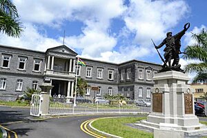
Municipal Council of Curepipe
Distance: Approx. 1444 meters
Latitude and longitude: -20.318777,57.526297
The Municipal Council of Curepipe (French: Conseil Municipal de Curepipe), also known as Municipality, is the local authority responsible for the administration of the town of Curepipe, Plaines Wilhems District, in the island nation of Mauritius. The current mayor is HanMargueritte.
Lycée La Bourdonnais
School
Distance: Approx. 1952 meters
Latitude and longitude: -20.325313,57.529393
Lycée La Bourdonnais (LLB) is a French international school in Curepipe, Mauritius. It serves primary school through lycée (senior high school/sixth form). It was founded in 1953.
1911 Curepipe riots
Distance: Approx. 1314 meters
Latitude and longitude: -20.31638889,57.525
The 1911 Curepipe riots refer to violent clashes which broke out in the historic town of Curepipe and then spread to Port Louis on the island of Mauritius on 19 January 1911. The riots also came to be known as Election Rabble Riots of 1911 by the administrators in London.
Weather in this IP's area
few clouds
19 Celsius
19 Celsius
18 Celsius
20 Celsius
1024 hPa
88 %
1024 hPa
958 hPa
10000 meters
0.45 m/s
0.89 m/s
50 degree
12 %
06:12:31
18:03:01