102.135.211.69 - IP Lookup: Free IP Address Lookup, Postal Code Lookup, IP Location Lookup, IP ASN, Public IP
Country:
Region:
City:
Location:
Time Zone:
Postal Code:
ISP:
ASN:
language:
User-Agent:
Proxy IP:
Blacklist:
IP information under different IP Channel
ip-api
Country
Region
City
ASN
Time Zone
ISP
Blacklist
Proxy
Latitude
Longitude
Postal
Route
db-ip
Country
Region
City
ASN
Time Zone
ISP
Blacklist
Proxy
Latitude
Longitude
Postal
Route
IPinfo
Country
Region
City
ASN
Time Zone
ISP
Blacklist
Proxy
Latitude
Longitude
Postal
Route
IP2Location
102.135.211.69Country
Region
kwara
City
ilorin
Time Zone
Africa/Lagos
ISP
Language
User-Agent
Latitude
Longitude
Postal
ipdata
Country
Region
City
ASN
Time Zone
ISP
Blacklist
Proxy
Latitude
Longitude
Postal
Route
Popular places and events near this IP address

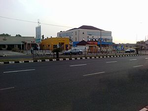
Ilorin
Capital city of Kwara State, Nigeria
Distance: Approx. 0 meters
Latitude and longitude: 8.5,4.55
Ilorin is the capital city of Kwara State located in the Western region of Nigeria. Although Ilorin is classified under the North-Central geopolitical zone, the city is considered a Yoruba city by all historical and sociological standards. As of the 2006 census, it had a population of 777,667, making it the 7th largest city by population in Nigeria.

Al-Hikmah University
Private university in Kwara, Nigeria
Distance: Approx. 5097 meters
Latitude and longitude: 8.485446,4.506111
Al-Hikmah University is an Islamic university located in Ilorin, Kwara State, Nigeria. It was founded in 2005 by AbdulRaheem Oladimeji Islamic Foundation (AROIF) based in Nigeria and World Assembly of Muslim Youths (WAMY) based in Jeddah. Muhammed Taofeek Olalekan Ibrahim is the immediate past Vice-chancellor.

Kwara State Stadium
Stadium in Ilorin, Nigeria
Distance: Approx. 2894 meters
Latitude and longitude: 8.475,4.54277778
The Kwara State Stadium is a multi-use stadium in Ilorin, Kwara, Nigeria. It is currently used mostly for football matches and is the home stadium of Kwara United F.C. and ABS FC The stadium has a capacity of 18,000 after renovation work that started in 2010. It is located on Stadium road, off Ibrahim Taiwo road.

Ilorin International Airport
Airport
Distance: Approx. 9034 meters
Latitude and longitude: 8.44027778,4.49444444
Ilorin International Airport now General Tunde Idiagbon International Airport (IATA: ILR, ICAO: DNIL) is an airport serving Ilorin, a city in Kwara State of Nigeria. Ilorin International Airport is owned and operated by Federal Airports Authority of Nigeria (FAAN) and is located about 1.8 kilometers from downtown Ilorin.
Irepodun, Kwara State
LGA in Kwara State, Nigeria
Distance: Approx. 2866 meters
Latitude and longitude: 8.4874,4.5273
Irepodun is a Local Government Area in Kwara State, Nigeria. Its headquarters is in the town of Omu-Aran. The local government is located on 8.5381º N, 5.1431º E. It has an area of 737 km2 and a population of 148,610 at the 2006 census.

A123 highway (Nigeria)
Road in Nigeria
Distance: Approx. 8599 meters
Latitude and longitude: 8.435946,4.593658
The A123 highway is a highway in Nigeria. It is one of the east-west roads linking the main south-north roads.(It is named from the two highways it links). It runs from the A1 highway at Ilorin, the capital of Kwara State to the A2 highway north of Okene, Kogi State.
Ilorin Emirate
Traditional state in Kwara State, Nigeria
Distance: Approx. 0 meters
Latitude and longitude: 8.5,4.55
The Ilorin Emirate is a traditional state based in the city of Ilorin in Kwara State, Nigeria. It is largely populated by the Yoruba-speaking people, though the kingdom is a hybrid state due to the influence of the many other tribes that make up the city.

Kwara State College of Education, Ilorin
Distance: Approx. 3695 meters
Latitude and longitude: 8.47537,4.5275
Kwara State College of Education, Ilorin was established in September 1974 by the Kwara State Government. The College is located in the ancient city of Ilorin, the capital of Kwara State.
Emmanuel Baptist College
School in Ilorin, Kwara., Nigeria
Distance: Approx. 5847 meters
Latitude and longitude: 8.4815,4.5003
Emmanuel Baptist College is a Baptist secondary school located at Tanke in Ilorin, Kwara State, Nigeria. It is a mixed private mission school. It is affiliated with the Nigerian Baptist Convention.
Weather in this IP's area
clear sky
26 Celsius
26 Celsius
26 Celsius
26 Celsius
1009 hPa
44 %
1009 hPa
975 hPa
10000 meters
3.09 m/s
270 degree