101.50.48.86 - IP Lookup: Free IP Address Lookup, Postal Code Lookup, IP Location Lookup, IP ASN, Public IP
Country:
Region:
City:
Location:
Time Zone:
Postal Code:
ISP:
ASN:
language:
User-Agent:
Proxy IP:
Blacklist:
IP information under different IP Channel
ip-api
Country
Region
City
ASN
Time Zone
ISP
Blacklist
Proxy
Latitude
Longitude
Postal
Route
db-ip
Country
Region
City
ASN
Time Zone
ISP
Blacklist
Proxy
Latitude
Longitude
Postal
Route
IPinfo
Country
Region
City
ASN
Time Zone
ISP
Blacklist
Proxy
Latitude
Longitude
Postal
Route
IP2Location
101.50.48.86Country
Region
hiroshima
City
onomichi
Time Zone
Asia/Tokyo
ISP
Language
User-Agent
Latitude
Longitude
Postal
ipdata
Country
Region
City
ASN
Time Zone
ISP
Blacklist
Proxy
Latitude
Longitude
Postal
Route
Popular places and events near this IP address
Onomichi
City in Chūgoku, Japan
Distance: Approx. 37 meters
Latitude and longitude: 34.41666667,133.2
Onomichi (尾道市, Onomichi-shi) is a city located in Hiroshima Prefecture, Japan. As of 31 January 2023, the city had an estimated population of 129,314 in 64055 households and a population density of 450 persons per km². The total area of the city is 285.11 square kilometres (110.08 sq mi).

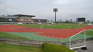
Bingo Stadium
Multi-use stadium in Onomichi, Hiroshima, Japan
Distance: Approx. 2752 meters
Latitude and longitude: 34.43333333,133.1775
Bingo Stadium (広島県立びんご運動公園陸上競技場) is a multi-use stadium in Onomichi, Hiroshima, Japan. It is used mostly for football matches and was used as a venue for the 1992 AFC Asian Cup. The stadium has a capacity of 10,000 people.

Senkō-ji (Onomichi)
Buddhist temple in Onomichi, Japan
Distance: Approx. 685 meters
Latitude and longitude: 34.410925,133.198783
Senkō-ji (千光寺) is a historic Japanese temple in Senko-ji Park in Onomichi, Hiroshima, Japan.

Senkōji Ropeway
Aerial lift line in Onomichi, Hiroshima, Japan
Distance: Approx. 712 meters
Latitude and longitude: 34.41061111,133.19955556
The Senkōji Ropeway (千光寺山ロープウェイ, Senkōjiyama Rōpuwei) is a Japanese aerial lift line in Onomichi, Hiroshima, operated by the city government. Opened in 1957, the line climbs Mount Senkōji of Senkō-ji, a famous temple. Senkōji Park around the temple is famous for its cherry blossoms in spring.

Onomichi Station
Railway station in Onomichi, Hiroshima Prefecture, Japan
Distance: Approx. 1474 meters
Latitude and longitude: 34.40483333,133.19366667
Onomichi Station (尾道駅, Onomichi-eki) is a passenger railway station located in the city of Onomichi, Hiroshima Prefecture, Japan. It is operated by the West Japan Railway Company (JR West).

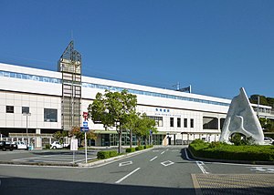
Shin-Onomichi Station
High speed rail station in Onomichi, Hiroshima prefecture, Japan
Distance: Approx. 1706 meters
Latitude and longitude: 34.43008333,133.19033333
Shin-Onomichi Station (新尾道駅, Shin-Onomichi-eki) is a railway station in the city of Onomichi, Hiroshima, Japan. It is operated by the West Japan Railway Company (JR West).

Onomichi City Museum of Art
Museum in Onomichi, Hiroshima Prefecture, Japan
Distance: Approx. 878 meters
Latitude and longitude: 34.409917,133.1958
Onomichi City Museum of Art (尾道市立美術館, Onomichi shiritsu bijutsukan) opened in Senkō-ji Park in Onomichi, Hiroshima Prefecture, Japan, in 1980. The Museum reopened to a design by Tadao Ando in 2003. The collection includes works by Kobayashi Wasaku (小林和作) and Wada Eisaku (和田英作).

Nakata Museum
Museum in Onomichi, Hiroshima Prefecture, Japan
Distance: Approx. 1486 meters
Latitude and longitude: 34.409083,133.186978
Nakata Museum (なかた美術館, Nakata bijutsukan) opened in Onomichi, Hiroshima Prefecture, Japan, in 1997. The collection includes works by Corot, Renoir, Cézanne, Kobayashi Wasaku (小林和作), and Umehara Ryūzaburō.

Jikō-ji
Distance: Approx. 1152 meters
Latitude and longitude: 34.40725,133.195806
Jikō-ji (持光寺) is a Buddhist temple in Onomichi, Hiroshima Prefecture belonging to the Seizan Zenrin-ji of Jōdo-shū Buddhism. Its principal image is a seated image of Amida Nyōrai. The temple houses a National Treasure, an 1153 Heian Period hanging scroll of Fugen Enmei (Samantabhadra).
Jōdo-ji (Onomichi)
Buddhist temple in Onomichi, Japan
Distance: Approx. 1089 meters
Latitude and longitude: 34.412167,133.210306
Jōdo-ji (浄土寺) is a temple of Shingon Buddhism in Onomichi, Hiroshima Prefecture, Japan. As a site sacred to the boddhisattva Kannon, it is the 9th temple on the Chūgoku 33 Kannon Pilgrimage. The temple, built at the end of the Kamakura period, is noted for two national treasures: the temple's main hall (hondō) and the treasure pagoda (tahōtō).

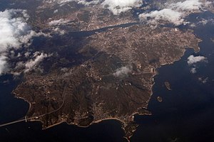
Mukaishima Island, Hiroshima
Distance: Approx. 3442 meters
Latitude and longitude: 34.386088,133.200866
Mukaishima Island (向島, Mukaishima) is the northernmost island in the Geiyo Islands chain accommodating Nishiseto Expressway connecting Honshu and Shikoku islands. Its coasts are washed by Seto Inland Sea. The island's highest peak is Takamiyama (高見山) 283.2 m (929 ft) high.
Ariekami-ike Dam
Dam in Hiroshima Prefecture, Japan
Distance: Approx. 2736 meters
Latitude and longitude: 34.43722222,133.21694444
Ariekami-ike Dam (Japanese: 有江上池) is an earthfill dam located in Hiroshima Prefecture in Japan. The dam is used for irrigation. The catchment area of the dam is 0.8 km2.
Weather in this IP's area
clear sky
7 Celsius
5 Celsius
7 Celsius
7 Celsius
1025 hPa
55 %
1025 hPa
1012 hPa
10000 meters
2.14 m/s
5.19 m/s
346 degree
4 %
