101.50.41.91 - IP Lookup: Free IP Address Lookup, Postal Code Lookup, IP Location Lookup, IP ASN, Public IP
Country:
Region:
City:
Location:
Time Zone:
Postal Code:
IP information under different IP Channel
ip-api
Country
Region
City
ASN
Time Zone
ISP
Blacklist
Proxy
Latitude
Longitude
Postal
Route
Luminati
Country
Region
34
City
hiroshima
ASN
Time Zone
Asia/Tokyo
ISP
Chupicom Inc.
Latitude
Longitude
Postal
IPinfo
Country
Region
City
ASN
Time Zone
ISP
Blacklist
Proxy
Latitude
Longitude
Postal
Route
IP2Location
101.50.41.91Country
Region
hiroshima
City
hiroshima
Time Zone
Asia/Tokyo
ISP
Language
User-Agent
Latitude
Longitude
Postal
db-ip
Country
Region
City
ASN
Time Zone
ISP
Blacklist
Proxy
Latitude
Longitude
Postal
Route
ipdata
Country
Region
City
ASN
Time Zone
ISP
Blacklist
Proxy
Latitude
Longitude
Postal
Route
Popular places and events near this IP address

Hiroshima
City in Chūgoku, Japan
Distance: Approx. 689 meters
Latitude and longitude: 34.39138889,132.45194444
Hiroshima (広島市, Hiroshima-shi, , also UK: , US: , [çiɾoɕima] ) is the capital of Hiroshima Prefecture in Japan. As of June 1, 2019, the city had an estimated population of 1,199,391. The gross domestic product (GDP) in Greater Hiroshima, Hiroshima Urban Employment Area, was US$61.3 billion as of 2010.
Hiroshima University
National university in Hiroshima Prefecture, Japan
Distance: Approx. 477 meters
Latitude and longitude: 34.38222222,132.45805556
Hiroshima University (広島大学, Hiroshima Daigaku) is a Japanese national research university located in Higashihiroshima and Hiroshima, Japan. Established in 1929, it was chartered as a university in 1949 following the merge of a number of national educational institutions.

Naka-ku, Hiroshima
Ward of Hiroshima, Japan
Distance: Approx. 26 meters
Latitude and longitude: 34.38611111,132.45527778
Naka-ku (中区, lit. "middle ward") is the heart of Hiroshima, Hiroshima Prefecture, Japan. Naka-ku is home to Hiroshima's central business district and Peace Memorial Park.

Hiroshima Peace Memorial Museum
Peace museum in Hiroshima, Japan
Distance: Approx. 716 meters
Latitude and longitude: 34.39166667,132.45194444
The Hiroshima Peace Memorial Museum is a museum located in Hiroshima Peace Memorial Park, in central Hiroshima, Japan, dedicated to documenting the atomic bombing of Hiroshima in World War II. The museum was established in August 1955 with the Hiroshima Peace Memorial Hall (now the International Conference Center Hiroshima). It is the most popular of Hiroshima's destinations for school field-trips from all over Japan and for international visitors. 53 million people had visited the museum from its opening in 1955 through 2005, averaging over one million visitors per year.
Fukuro-machi Station
Tram stop in Hiroshima, Japan
Distance: Approx. 605 meters
Latitude and longitude: 34.3913,132.4561
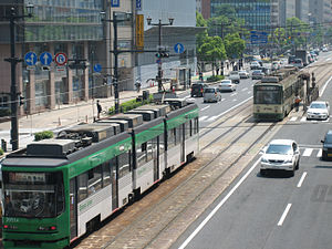
Fukuro-machi is a Hiroden station (tram stop) on the Hiroden Ujina Line located in Ote-machi 2-chome, Naka-ku, Hiroshima.

Chuden-mae Station
Tram stop in Hiroshima, Japan
Distance: Approx. 302 meters
Latitude and longitude: 34.38861111,132.45527778
Chuden-mae is a Hiroden station (tram stop) on Hiroden Ujina Line located in Ote-machi 3-chome, Naka-ku, Hiroshima.

Shiyakusho-mae Station (Hiroshima)
Tram station in Hiroshima, Hiroshima prefecture, Japan
Distance: Approx. 88 meters
Latitude and longitude: 34.38583333,132.45444444
Shiyakusho-mae is a Hiroden station (tram stop) on Hiroden Ujina Line located in front of Hiroshima City Hall, Ote-machi 4-chome, Naka-ku, Hiroshima.

Takanobashi Station
Tram stop in Hiroshima, Japan
Distance: Approx. 336 meters
Latitude and longitude: 34.38305556,132.45416667
Takanobashi is a Hiroden station (tram stop) on Hiroden Ujina Line located in Senda-machi 1-chome, Naka-ku, Hiroshima.
Nisseki-byoin-mae Station
Tram stop in Hiroshima, Japan
Distance: Approx. 559 meters
Latitude and longitude: 34.3809,132.456
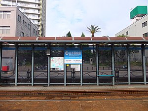
Nisseki-byoin-mae is a Hiroden station (tram stop) on Hiroden Ujina Line located in front of Hiroshima Red Cross Hospital & Atomic-bomb Survivors Hospital, in Senda-machi 1-chome, Naka-ku, Hiroshima.
Fukuromachi Elementary School Peace Museum
Museum in Hiroshima, Japan
Distance: Approx. 720 meters
Latitude and longitude: 34.39176,132.458706
The Fukuromachi Elementary School Peace Museum (袋町小学校平和資料館, Fukuromachi Shogakkou Heiwa Shiryokan) is a peace museum in Fukuromachi, Naka-ku, Hiroshima, Japan. The school was one of the closest schools to ground zero when the atomic bomb fell on August 6, 1945. They lost about 160 students and teachers and the building was heavily damaged.

Roman Catholic Diocese of Hiroshima
Roman Catholic diocese in Japan
Distance: Approx. 572 meters
Latitude and longitude: 34.38333333,132.45
The Diocese of Hiroshima (Latin: Dioecesis Hiroshimaensis, Japanese: カトリック広島教区) is a Latin Church diocese of the Catholic Church located in the city of Hiroshima in the ecclesiastical province of Osaka 大阪 in Japan.

Human Shadow Etched in Stone
Exhibition at the Hiroshima Peace Memorial Museum
Distance: Approx. 725 meters
Latitude and longitude: 34.39180556,132.45208333
Human Shadow Etched in Stone (人影の石, hitokage no ishi) is an exhibition at the Hiroshima Peace Memorial Museum. It is thought to be the shadow of a person who was sitting at the entrance of Hiroshima Branch of Sumitomo Bank when the atomic bomb was dropped over Hiroshima. It is also known as Human Shadow of Death or simply the Blast Shadow.
Weather in this IP's area
clear sky
5 Celsius
3 Celsius
5 Celsius
5 Celsius
1022 hPa
68 %
1022 hPa
1021 hPa
10000 meters
2.09 m/s
1.99 m/s
4 degree


