101.235.193.68 - IP Lookup: Free IP Address Lookup, Postal Code Lookup, IP Location Lookup, IP ASN, Public IP
Country:
Region:
City:
Location:
Time Zone:
Postal Code:
IP information under different IP Channel
ip-api
Country
Region
City
ASN
Time Zone
ISP
Blacklist
Proxy
Latitude
Longitude
Postal
Route
Luminati
Country
ASN
Time Zone
Asia/Seoul
ISP
DLIVE
Latitude
Longitude
Postal
IPinfo
Country
Region
City
ASN
Time Zone
ISP
Blacklist
Proxy
Latitude
Longitude
Postal
Route
IP2Location
101.235.193.68Country
Region
gyeonggi-do
City
mansan
Time Zone
Asia/Seoul
ISP
Language
User-Agent
Latitude
Longitude
Postal
db-ip
Country
Region
City
ASN
Time Zone
ISP
Blacklist
Proxy
Latitude
Longitude
Postal
Route
ipdata
Country
Region
City
ASN
Time Zone
ISP
Blacklist
Proxy
Latitude
Longitude
Postal
Route
Popular places and events near this IP address

Sanggye station
Train station in Seoul, South Korea
Distance: Approx. 3886 meters
Latitude and longitude: 37.66095,127.07344
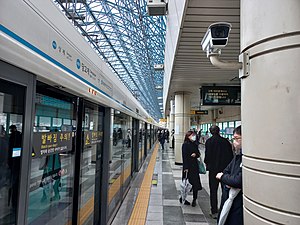
Sanggye Station is a station on Line 4 of the Seoul Metropolitan Subway network in Nowon-gu, Seoul. It is named after the upper valley of the Suraksan mountain nearby. The station has 4 exits and is also connected with Daeho Department Store.
Camp Stanley
Former U.S. Army military camp in South Korea
Distance: Approx. 4762 meters
Latitude and longitude: 37.7208,127.0967
Camp Stanley is a former U.S. Army military camp located just east of the city of Uijeongbu, South Korea. The camp is part of the Red Cloud Garrison which is composed of Army installations near the Korean Demilitarized Zone (DMZ). Camp Stanley began as a tent city in 1954.

Nowon station
Subway station in Seoul, South Korea
Distance: Approx. 4903 meters
Latitude and longitude: 37.65637,127.06345
Nowon station is a station on the Seoul Subway Line 4 and Line 7. The station on Line 4 is elevated whereas the station on Line 7 is underground, owing to the elevated tracks of Line 4 between Danggogae station and Chang-dong station. In addition, the two stations are far apart, making passengers walk a considerable distance for transfers.

Buramsan station
Metro station in Seoul, South Korea
Distance: Approx. 2981 meters
Latitude and longitude: 37.66958333,127.07936667
Buramsan Station (Korean: 불암산역) is a station on Line 4 of the Seoul Metropolitan Subway network. It was the northern terminus of Line 4, until 19 March 2022, when the line was extended to Jinjeop. It is an elevated station.

Madeul station
Metro station in Seoul, South Korea
Distance: Approx. 4953 meters
Latitude and longitude: 37.66472222,127.05777778
Madeul Station is a station on the Seoul Subway Line 7. Its name is pure Korean, hence there is no Hanja equivalent. The name presumably comes from a nearby place where horses were kept.

Suraksan station
Station of the Seoul Metropolitan Subway
Distance: Approx. 4895 meters
Latitude and longitude: 37.67777778,127.05527778
Suraksan Station is a station on the Seoul Subway Line 7 in Nowon-gu, Seoul. Its name comes from the nearby Suraksan mountain.
Sahmyook University
University in Seoul, South Korea
Distance: Approx. 4043 meters
Latitude and longitude: 37.6434,127.1058
Sahmyook University (Korean: 삼육대학교, Hanja: 三育大學校) is a private, Christian, coeducational university located in Nowon-gu, Seoul, South Korea. Sahmyook University is part of a worldwide network of Seventh-day Adventist institutions of higher education. The school was founded in 1906 as Euimyung College in Sunahn, Pyeongan-namdo in what would become today's North Korea.
Korea National Training Center
Athletic training center in South Korea
Distance: Approx. 4956 meters
Latitude and longitude: 37.63525,127.104565
Korea National Training Center, also known as the Taereung Training Center, located in Gongneung-dong, Nowon-gu, in the northeast part of Seoul, is the first national athletic training center established in South Korea. Since its establishment on 30 June 1966 by the Korea Sports Council (대한체육회 大韓體育會), Taereung Training Center has been the home of elite Korean sports activities. It consists of 24 buildings, including training facilities, gymnasiums and dormitories in an area of 100,000 square metres (25 acres).

Byeollae station
Station of the Seoul Metropolitan Subway
Distance: Approx. 4395 meters
Latitude and longitude: 37.64222,127.127208
Byeollae station (Korean: 별내역) is a railway station of the Gyeongchun Line that opened in December 2012. It is located at Byeollae-dong, Namyangju, Gyeonggi Province, South Korea. In August 2024, the station have a transfer with line 8.

Toegyewon Station
Train station in South Korea
Distance: Approx. 4550 meters
Latitude and longitude: 37.64822,127.14403
Toegyewon Station (Korean: 퇴계원역; Hanja: 退溪院驛) is a railway station of the Gyeongchun Line in Toegyewon-myeon, Namyangju-si, Gyeonggi-do, South Korea.

Taereung International Skating Rink
Speed skating rink in South Korea
Distance: Approx. 4619 meters
Latitude and longitude: 37.638456,127.103084
Taereung International Skating Rink is a speed skating oval in South Korea, used for training and competitions, operated by the Korean Olympic Committee. It is one of only two indoor long-track (400m) skating facilities in the country, and the most actively used, with Gangneung Oval completed in 2017 for the 2018 Winter Olympics but planned for conversion to a multi-sports and convention center.

ByeollaeByeolgaram station
Station of the Seoul Metropolitan Subway
Distance: Approx. 1390 meters
Latitude and longitude: 37.6678,127.1163
ByeollaeByeolgaram station (Korean: 별내별가람) is an underground station of the Seoul Subway Line 4 in Namyangju, Gyeonggi Province, South Korea.
Weather in this IP's area
overcast clouds
-1 Celsius
-1 Celsius
-1 Celsius
-1 Celsius
1026 hPa
26 %
1026 hPa
1006 hPa
10000 meters
0.79 m/s
1.14 m/s
202 degree
100 %