Country:
Region:
City:
Latitude and Longitude:
Time Zone:
Postal Code:
IP information under different IP Channel
ip-api
Country
Region
City
ASN
Time Zone
ISP
Blacklist
Proxy
Latitude
Longitude
Postal
Route
Luminati
Country
Region
11
City
jungnanggu
ASN
Time Zone
Asia/Seoul
ISP
DLIVE
Latitude
Longitude
Postal
IPinfo
Country
Region
City
ASN
Time Zone
ISP
Blacklist
Proxy
Latitude
Longitude
Postal
Route
db-ip
Country
Region
City
ASN
Time Zone
ISP
Blacklist
Proxy
Latitude
Longitude
Postal
Route
ipdata
Country
Region
City
ASN
Time Zone
ISP
Blacklist
Proxy
Latitude
Longitude
Postal
Route
Popular places and events near this IP address

Sagajeong station
Distance: Approx. 2646 meters
Latitude and longitude: 37.58083333,127.08833333
Sagajeong Station is a station on the Seoul Subway Line 7.

Myeonmok station
Metro station in Jungnang-gu, Seoul, South Korea
Distance: Approx. 2319 meters
Latitude and longitude: 37.58861111,127.0875
Myeonmok Station is a station on the Seoul Subway Line 7.

Junghwa station
Distance: Approx. 3071 meters
Latitude and longitude: 37.6025,127.07916667
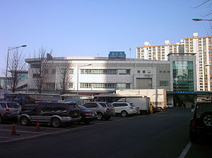
Junghwa Station (Korean: 중화역) is a station on the Seoul Subway Line 7. The station is located in Junghwa-dong, Jungnang-gu, on a main arterial road running broadly north to south past the western flank of Bonghwasan (a mountain). Joong Rang (sometimes written Jungnang) Middle School and Junghwa High School are situated nearby.
Sangbong Station
Train station in Seoul, South Korea
Distance: Approx. 2369 meters
Latitude and longitude: 37.59557,127.08576
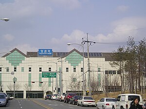
Sangbong Station is a station on Seoul Subway Line 7, the Gyeongchun Line and the Gyeongui–Jungang Line. It is located in Sangbong-dong, Jungnang-gu, Seoul.

Jungnang District
Autonomous district in Seoul, South Korea
Distance: Approx. 2186 meters
Latitude and longitude: 37.6064,127.0926
Jungnang District (Korean: 중랑구; RR: Jungnang-gu) is one of the 25 gu, or districts, of Seoul, South Korea. It is located on the north side of the Han River. It is characterized by a typical residential area with many natural green areas such as Yongma, Mangwoo, and Bonghwasan Mountain.

Mangu Station
Train station in Jungnang-gu, Seoul, South Korea
Distance: Approx. 1852 meters
Latitude and longitude: 37.5992,127.09235
Mangu Station is a station on the Gyeongui–Jungang Line, and the Gyeongchun Line since 21 December 2010. The station was Seoul's main distribution center of charcoal briquettes in the 1950s and 1960s, extracted and manufactured in southern Gangwon province. These briquettes were widely used by people to weather harsh winters when Korea was a developing country and recovering from the Korean War.

Yangwon Station
Station of the Seoul Metropolitan Subway
Distance: Approx. 1371 meters
Latitude and longitude: 37.60654,127.10789
Yangwon Station is a station on the Gyeongui–Jungang Line. Geographically, it is the easternmost train/metro station in Seoul north of the Han River.

Guri station
Train station in Guri, South Korea
Distance: Approx. 2832 meters
Latitude and longitude: 37.60277778,127.14308889
Guri station is a train station on the Gyeongui–Jungang Line. It is located in Inchang-dong, Guri, behind GS Square, a large department store in the central city area. Guri station is in Gyeonggi-do, whereas the previous western station, Yangwon station, is in Seoul.
Yongmabong
Mountain in Seoul, South Korea
Distance: Approx. 2995 meters
Latitude and longitude: 37.57128,127.09611
Yongmabong (Korean: 용마봉) is a mountain in Seoul, South Korea. It extends across Guui-dong and Junggok-dong in the district of Gwangjin-gu. It has an elevation of 348 m (1,142 ft).
GS Champions Park
Football training center in Guri, South Korea
Distance: Approx. 3097 meters
Latitude and longitude: 37.56748,127.11923
The GS Champions Park is the training center of FC Seoul. It is located in Guri, east of nearby Seoul. In 1983, it was built by GS Sports, then known as Lucky-Goldstar Sports.

Bonghwasan station
Station of the Seoul Metropolitan Subway
Distance: Approx. 3144 meters
Latitude and longitude: 37.6175,127.09138889
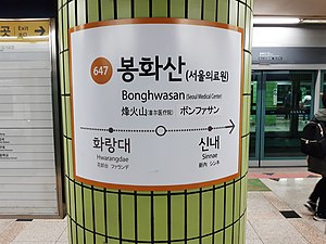
Bonghwasan Station is a railway station in Jungnang District, Seoul, South Korea. It was the eastern terminus of Seoul Subway Line 6 until December 21, 2019, though many eastbound trains still terminate here, as Sinnae station is only allowed to accommodate 1 train at a time as the Line 6 station only has one track and one platform, but it will be expanded to 2 tracks and 2 platforms in the future.
Sinnae Station
Station of the Seoul Metropolitan Subway
Distance: Approx. 2179 meters
Latitude and longitude: 37.6129,127.1032
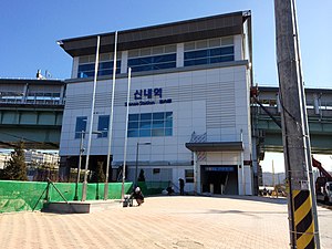
Sinnae station (Korean: 신내역; Hanja: 新內驛) is a railway station on the Gyeongchun Line and Seoul Subway Line 6. The station is located near the Sinnae train depot, which is the depot of Line 6. Line 6 currently only has 1 track and 1 platform, however, in the future, the Line 6 station will be expanded to 2 tracks and 2 platforms.
Weather in this IP's area
light rain
16 Celsius
16 Celsius
16 Celsius
16 Celsius
1019 hPa
82 %
1019 hPa
1000 hPa
10000 meters
3.45 m/s
8.8 m/s
236 degree
72 %
06:59:37
17:30:36


