101.128.120.68 - IP Lookup: Free IP Address Lookup, Postal Code Lookup, IP Location Lookup, IP ASN, Public IP
Country:
Region:
City:
Location:
Time Zone:
Postal Code:
ISP:
ASN:
language:
User-Agent:
Proxy IP:
Blacklist:
IP information under different IP Channel
ip-api
Country
Region
City
ASN
Time Zone
ISP
Blacklist
Proxy
Latitude
Longitude
Postal
Route
db-ip
Country
Region
City
ASN
Time Zone
ISP
Blacklist
Proxy
Latitude
Longitude
Postal
Route
IPinfo
Country
Region
City
ASN
Time Zone
ISP
Blacklist
Proxy
Latitude
Longitude
Postal
Route
IP2Location
101.128.120.68Country
Region
kalimantan selatan
City
banjarmasin
Time Zone
Asia/Makassar
ISP
Language
User-Agent
Latitude
Longitude
Postal
ipdata
Country
Region
City
ASN
Time Zone
ISP
Blacklist
Proxy
Latitude
Longitude
Postal
Route
Popular places and events near this IP address

Banjarmasin
City in Kalimantan, Indonesia
Distance: Approx. 517 meters
Latitude and longitude: -3.32,114.5925
Banjarmasin is the largest city in South Kalimantan, Indonesia. It was the capital of the province until 15 February 2022. The city is located on a delta island near the junction of the Barito and Martapura rivers.

Lambung Mangkurat University
Distance: Approx. 3035 meters
Latitude and longitude: -3.2976,114.586
Lambung Mangkurat University (Indonesian: Universitas Lambung Mangkurat) is a public university in Banjarmasin and Banjarbaru, South Kalimantan, Indonesia. It is established on September 1, 1958. Its current rector is Prof.

Sultan Suriansyah Mosque
Mosque in Banjarmasin, South Kalimantan, Indonesia
Distance: Approx. 3733 meters
Latitude and longitude: -3.2943,114.5762
The Sultan Suriansyah Mosque (Indonesian: Masjid Sultan Suriansyah) is the oldest mosque in South Kalimantan. Built in 1526 during the reign of Sultan Suriansyah, the first Banjar King to convert to Islam. The mosque is located in the village of Kuin Utara, in Banjarmasin.
Roman Catholic Diocese of Banjarmasin
Roman Catholic diocese in South Kalimantan, Indonesia
Distance: Approx. 111 meters
Latitude and longitude: -3.3244,114.59
The Roman Catholic Diocese of Banjarmasin (Latin: Bangiarmasin(a)) is a diocese located in the city of Banjarmasin in the ecclesiastical province of Samarinda in Indonesia.

Martapura River
River in Kalimantan (Indonesian Borneo)
Distance: Approx. 3781 meters
Latitude and longitude: -3.2919,114.5811
The Martapura River (Indonesian: Sungai Martapura) is a river in southeast Borneo, Indonesia. It is a tributary of the Barito River. Other names for the river are Banjar Kecil River or Kayutangi River and due to many activities of Chinese merchants in the past in the downstream area also called China River.

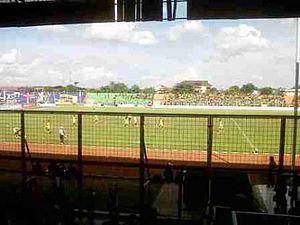
17th May Stadium
Multi-purpose stadium in Banjarmasin, Indonesia
Distance: Approx. 1477 meters
Latitude and longitude: -3.31675,114.58013889
17th May Stadium is a multi-purpose stadium located in Banjarmasin, Indonesia. It is currently used mostly for football matches. The stadium holds 30,000 people.

Holy Family Cathedral, Banjarmasin
Church in Banjarmasin, Indonesia
Distance: Approx. 22 meters
Latitude and longitude: -3.3246,114.591
The Holy Family Cathedral (Indonesian: Gereja Katedral Keluarga Kudus) is a religious building of the Catholic Church in Banjarmasin in the province of South Kalimantan, Indonesia. It was designed by architect Roestenhurg in a neo-Gothic style. The cathedral was consecrated June 28, 1931, and follows the Roman or Latin rite.

Kelayan Muhammadiyah Mosque
Mosque in Banjarmasin, South Kalimantan, Indonesia
Distance: Approx. 810 meters
Latitude and longitude: -3.32969444,114.596
Kelayan Muhammadiyah Mosque (Indonesian: Masjid Muhammadiyah Kelayan) is a mosque located in Kelayan B st., West Kelayan, South Banjarmasin, Banjarmasin, South Kalimantan, Indonesia, and it was built in 1938. The mosque is right next to the tip of Kelayan River. Front side faces Kelayan B street, and back side faces the river.

Port of Trisakti
Port in Indonesia
Distance: Approx. 3745 meters
Latitude and longitude: -3.33119444,114.558
Port of Trisakti (Indonesian: Pelabuhan Trisakti) is a seaport in Banjarmasin in South Kalimantan, Indonesia. It is one of the major ports in Borneo. The port is located on the Southwest of the Tatas Island, which is between the intersection of Barito River and Martapura River, with which it is connected to the Java Sea.

Mausoleum of Surgi Mufti
Tomb in South Kalimantan
Distance: Approx. 1628 meters
Latitude and longitude: -3.3124145,114.5993968
The Mausoleum of Surgi Mufti (Indonesian: Kubah Surgi Mufti) is a mausoleum located at Banjarmasin in South Kalimantan, Indonesia. The mausoleum entombs the remains of Jamaluddin al-Banjari, a local Muslim cleric and scholar who died in 1929. The mausoleum, topped by a conical dome, is a modern structure and has three graves inside it, including that of Jamaluddin al-Banjari.

Banjarmasin metropolitan area
Place in South Kalimantan, Indonesia
Distance: Approx. 517 meters
Latitude and longitude: -3.32,114.5925
Banjarmasin metropolitan area officially Banjarbakula; (acronym of "Banjarmasin-Banjarbaru-Banjar") or native name Wilayah metropolitan Banjarmasin is a metropolitan area located in Indonesia. This area includes Banjarmasin city and its surrounding areas such as Banjarbaru city, and Banjar Regency. This region of South Kalimantan province, officially the biggest city in Southern Kalimantan island on Barito River to Java Sea.

Sei Alalak Bridge
Bridge in Barito Kuala Regency, South Kalimantan
Distance: Approx. 5256 meters
Latitude and longitude: -3.2772,114.5897
Sei Alalak Bridge is a curved cable-stayed bridge in South Kalimantan province of Indonesia. The bridge, which has length of 850 meters, crossing the Alalak river in Alalak District, Barito Kuala Regency, and connecting the regency through the main Trans-Kalimantan Road towards Banjarmasin city.
Weather in this IP's area
overcast clouds
26 Celsius
26 Celsius
26 Celsius
26 Celsius
1008 hPa
95 %
1008 hPa
1007 hPa
10000 meters
0.86 m/s
1.26 m/s
320 degree
100 %