Country:
 Australia
Region:
City:
Latitude and Longitude:
Time Zone:
Postal Code:
IP information under different IP Channel
ip-api
Country
Region
City
ASN
Time Zone
ISP
Blacklist
Proxy
Latitude
Longitude
Postal
Route
IPinfo
Country
Region
City
ASN
Time Zone
ISP
Blacklist
Proxy
Latitude
Longitude
Postal
Route
MaxMind
Country
Region
City
ASN
Time Zone
ISP
Blacklist
Proxy
Latitude
Longitude
Postal
Route
Luminati
Country
AURegion
nsw
City
sydney
ASN
Time Zone
Australia/Sydney
ISP
Vodafone Australia Pty Ltd
Latitude
Longitude
Postal
db-ip
Country
Region
City
ASN
Time Zone
ISP
Blacklist
Proxy
Latitude
Longitude
Postal
Route
ipdata
Country
Region
City
ASN
Time Zone
ISP
Blacklist
Proxy
Latitude
Longitude
Postal
Route
Popular places and events near this IP address

Lilyfield, New South Wales
Suburb of Sydney, New South Wales, Australia
Distance: Approx. 639 meters
Latitude and longitude: -33.87305556,151.16611111
Lilyfield is a suburb in the Inner West of Sydney, in the state of New South Wales, Australia. Lilyfield is located 6 kilometres west of the Sydney central business district, in the local government area of the Inner West Council. Lilyfield is nestled in between the suburbs of Annandale, Rozelle and Leichhardt and is bounded to the west by Iron Cove.
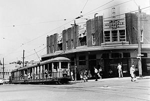
Annandale, New South Wales
Suburb of Sydney, New South Wales, Australia
Distance: Approx. 398 meters
Latitude and longitude: -33.88138889,151.17083333
Annandale is a suburb in the Inner West of Sydney, in the state of New South Wales, Australia. Annandale is located within 5 kilometres west of the Sydney central business district and is part of the local government area of the Inner West Council. Annandale's northern end lies on Rozelle Bay, which is on Sydney Harbour.

Hunter Baillie Memorial Presbyterian Church
Church in New South Wales, Australia
Distance: Approx. 544 meters
Latitude and longitude: -33.8833,151.1694
The Hunter Baillie Memorial Presbyterian Church is a heritage–listed Presbyterian church, located in the inner western Sydney suburb of Annandale, New South Wales, Australia. The church is an example of Gothic Revival architecture. It was designed by Cyril and Arthur Blacket and built from 1886 to 1889.
Linear Recording
Distance: Approx. 669 meters
Latitude and longitude: -33.878275,151.16106389
Linear Recording is a recording studio complex located in Sydney, Australia, which was established by recording engineer Christopher Vallejo and Emren Kara in 2005. Linear Recording is one of Australia's only dedicated all-analogue recording studios. Notable producers who have recorded at Linear Recording include Tony Cohen, Paul McKercher, Wayne Connelly, Nick Littlemore, Tim Whitten, Andrew Klippel, Donnie Sloan, Owen Penglis and Melvin Tree.

Whites Creek (Annandale)
River in New South Wales, Australia
Distance: Approx. 515 meters
Latitude and longitude: -33.87397222,151.16944444
Whites Creek, formerly known as White's Creek, was once a natural waterway that was concreted to improve sanitation. The creek is now a heritage–listed artificial waterway located in the inner–west region of Sydney, New South Wales, Australia.

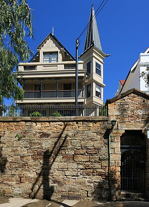
The Abbey, Annandale
Distance: Approx. 663 meters
Latitude and longitude: -33.8744,151.1735
The Abbey is an historic house located at 272 Johnston Street in the Sydney suburb of Annandale, New South Wales, Australia. The house is listed on the (now defunct) Register of the National Estate, the local government register in the New South Wales Heritage Database, and on the non-statutory register of the National Trust of Australia.
Highroyd, Annandale
House in New South Wales, Australia
Distance: Approx. 576 meters
Latitude and longitude: -33.8753,151.1732
Highroyd is a house in the Sydney suburb of Annandale, New South Wales, Australia. The house is listed on the Inner West Council local government heritage list.

Sydney Secondary College Leichhardt Campus
School in Australia
Distance: Approx. 847 meters
Latitude and longitude: -33.87916667,151.15916667
The Leichhardt Campus of the Sydney Secondary College is a government-funded, co-educational, dual modality, partially academically selective and comprehensive junior secondary day school, located in the inner-western Sydney suburb of Leichhardt, New South Wales, Australia. Together with the senior school at the Blackwattle Bay Campus and the other junior school at Balmain Campus, the school is a part of the Sydney Secondary College. Established in 2002, the campus caters for approximately 1000 students from Year 7 to Year 10.
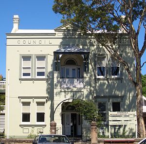
Annandale Council Chambers
Government town hall in New South Wales, Australia
Distance: Approx. 517 meters
Latitude and longitude: -33.8828,151.1704
The former Annandale Council Chambers is a landmark civic building in Annandale, a suburb of Sydney, Australia. It stands at 79 Johnston Street and was built in 1899 in the Victorian style by architect J. W. Richards. The council chambers was the seat of Annandale Municipal Council from 1899 to 1948 when it became a Leichhardt Council depot and since 1980 has been the Annandale Community Centre run by the Inner West Council.
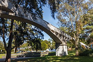
White's Creek Aqueduct
Heritage-listed sewage aqueduct in Sydney, Australia
Distance: Approx. 104 meters
Latitude and longitude: -33.8776,151.168
White's Creek Aqueduct is a heritage-listed sewage aqueduct at Piper Street, Lilyfield, Inner West Council, Sydney, New South Wales, Australia. It was designed by engineer William Julius Baltzer of the New South Wales Public Works Department and built by the Department from 1897 to 1898. The property is owned by Sydney Water.

Johnston's Creek Sewer Aqueduct
Located in Sydney, Australia
Distance: Approx. 708 meters
Latitude and longitude: -33.8798,151.1758
Johnston's Creek Sewer Aqueduct is a heritage-listed sewage aqueduct located in Hogan Park, off Taylor Street, Annandale, Inner West Council, Sydney, New South Wales, Australia. It was designed by William Julius Baltzer, an engineer in the NSW Public Works Department, and built by the Department in 1897. The property is owned by Sydney Water.
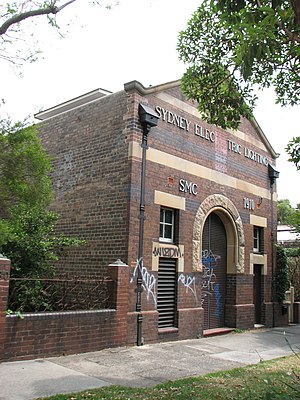
Substation No. 15
Historical electrical substation in Sydney, Australia
Distance: Approx. 308 meters
Latitude and longitude: -33.8789,151.1716
Substation No. 15 is a heritage-listed electrical substation at 182 Johnston Street, Annandale, Inner West Council, Sydney, New South Wales, Australia. It was built in 1910.
Weather in this IP's area
light rain
13 Celsius
13 Celsius
12 Celsius
14 Celsius
1023 hPa
85 %
1023 hPa
1021 hPa
10000 meters
4.63 m/s
330 degree
75 %
06:20:12
19:04:11