1.38.107.224 - IP Lookup: Free IP Address Lookup, Postal Code Lookup, IP Location Lookup, IP ASN, Public IP
Country:
 India
IndiaRegion:
City:
Location:
Time Zone:
Postal Code:
ISP:
ASN:
language:
User-Agent:
Proxy IP:
Blacklist:
IP information under different IP Channel
ip-api
Country
Region
City
ASN
Time Zone
ISP
Blacklist
Proxy
Latitude
Longitude
Postal
Route
db-ip
Country
Region
City
ASN
Time Zone
ISP
Blacklist
Proxy
Latitude
Longitude
Postal
Route
IPinfo
Country
Region
City
ASN
Time Zone
ISP
Blacklist
Proxy
Latitude
Longitude
Postal
Route
IP2Location
1.38.107.224Country
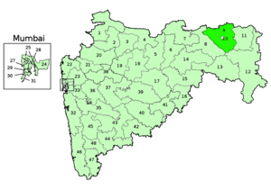
inRegion
maharashtra
City
ramtek
Time Zone
Asia/Kolkata
ISP
Language
User-Agent
Latitude
Longitude
Postal
ipdata
Country
Region
City
ASN
Time Zone
ISP
Blacklist
Proxy
Latitude
Longitude
Postal
Route
Popular places and events near this IP address

Mahadula
Census town in Maharashtra, India
Distance: Approx. 9471 meters
Latitude and longitude: 21.4035,79.4246
Mahadula is a census town in Nagpur district in the Indian state of Maharashtra.

Khindsi Lake
Reservoir in Nagpur district
Distance: Approx. 4040 meters
Latitude and longitude: 21.3965,79.3721
Khindsi Lake is a lake near the city of Ramtek in the Nagpur district of India. The lake offers boating activities, watersports, restaurants, and resorts, which are operated by Rajkamal Tourism and Olive Resorts at Khindsi Lake. It is Central India's largest boating center and amusement park with many tourists visiting every year.
Kachurwahi
Village in Maharashtra
Distance: Approx. 9055 meters
Latitude and longitude: 21.3333,79.3833
Kachurwahi is a Gram Panchayat village in Ramtek Tehsil of Nagpur district, India. It is situated in the South East of Ramtek at the distance of 10 km from Ramtek. The village has a post office and a branch of State Bank of India.
Mansar, India
Census town in Maharashtra, India
Distance: Approx. 8634 meters
Latitude and longitude: 21.4,79.25
Mansar is a census town in Ramtek tehsil of Nagpur district in the Indian state of Maharashtra. This town is located 5 km west of Ramtek and 45 km northeast of Nagpur city.
Ramtek Lok Sabha constituency
Lok Sabha constituency in Maharashtra
Distance: Approx. 3451 meters
Latitude and longitude: 21.4,79.3
Ramtek is one of the 48 Lok Sabha (parliamentary) constituencies in the state of Maharashtra in western India. The constituency did not exist during the Indian general elections of 1951-52 for the 1st Lok Sabha. It was created for 1957 Indian general election for the 2nd Lok Sabha, with abolition of the Amravati West constituency in the neighbouring Amravati district.

Ramtek Assembly constituency
Constituency of the Maharashtra legislative assembly in India
Distance: Approx. 1165 meters
Latitude and longitude: 21.39,79.33
Ramtek is one of twelve constituencies of the Maharashtra Vidhan Sabha located in the Nagpur district. It is a part of the Ramtek Lok Sabha constituency (SC) from Nagpur district along with five other assembly constituencies, viz Katol, Hingna, Umred (SC), Kamthi and Savner Assembly constituency.

Ramtek Dam
Dam in Ramtek
Distance: Approx. 5110 meters
Latitude and longitude: 21.3811003,79.3782323
Ramtek Dam, is an earthfill dam on Sur River near Ramtek, Nagpur district in the state of Maharashtra in India.
Kavikulguru Institute of Technology and Science
Distance: Approx. 3045 meters
Latitude and longitude: 21.402126,79.304008
Kavikulguru Institute of Technology and Science (K.I.T.S) is an engineering college affiliated to the Rashtrasant Tukadoji Maharaj Nagpur University and situated in the city of Ramtek, Nagpur district in the Indian state of Maharashtra.

Shantinatha temple, Ramtek
Jain temple in the state of Maharashtra
Distance: Approx. 715 meters
Latitude and longitude: 21.40555556,79.32983333
Shantinatha temple, Ramtek is a major Jain tirth (pilgrimage site) in the Indian state of Maharashtra, located between the villages of Ramtek in Nagpur district.
Weather in this IP's area
few clouds
23 Celsius
22 Celsius
23 Celsius
23 Celsius
1014 hPa
38 %
1014 hPa
975 hPa
10000 meters
0.7 m/s
0.64 m/s
88 degree
23 %