Country:
 Netherlands
Region:
City:
Latitude and Longitude:
Time Zone:
Postal Code:
IP information under different IP Channel
ip-api
Country
IPinfo
Country
MaxMind
Country
Luminati
Country
NLASN
Time Zone
Europe/Amsterdam
ISP
Stichting Internet Domeinregistratie Nederland
Latitude
Longitude
Postal
db-ip
Country
ipdata
Country
Popular places and events near this IP address

Netherlands
Country in northwestern Europe
Distance: Approx. 1893 meters
Latitude and longitude: 52,6
The Netherlands, informally Holland, is a country located in Northwestern Europe with overseas territories in the Caribbean. It is the largest of the four constituent countries of the Kingdom of the Netherlands. The Netherlands consists of twelve provinces; it borders Germany to the east and Belgium to the south, with a North Sea coastline to the north and west.

Rozendaal
Municipality in Gelderland, Netherlands
Distance: Approx. 732 meters
Latitude and longitude: 52,5.96666667
Rozendaal (Dutch pronunciation: [ˈroːzə(n)ˌdaːl] ) is a municipality and a town in the eastern Netherlands, in the province of Gelderland. The town, next to Arnhem and Velp, is known for the Rozendaal Castle (Kasteel Rosendael) and its water fountain follies (bedriegertjes). The municipality is the least densely populated on the mainland of the Netherlands, i.e., in effect, not on one of the West Frisian Islands.

Westervoort
Municipality in Gelderland, Netherlands
Distance: Approx. 3190 meters
Latitude and longitude: 51.96666667,5.96666667
Westervoort (Dutch pronunciation: [ˌʋɛstərˈvoːrt] ) is a municipality and a town in the eastern Netherlands. The town has two rivers inside its borders, the Rhine and the IJssel. It is a commuter town closely linked to Arnhem, the capital of Gelderland, which is situated on the west bank of the IJssel river, the east bank being occupied by Westervoort.
Monnikenhuize
Building in the Netherlands
Distance: Approx. 2914 meters
Latitude and longitude: 51.994167,5.931111
Monnikenhuize was a multi-use stadium in Arnhem, Netherlands. It was used mostly for football matches and hosted the home matches of SBV Vitesse. The stadium was able to hold 7,500 people.
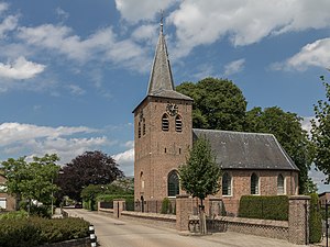
Velp, Gelderland
Town in Gelderland, Netherlands
Distance: Approx. 156 meters
Latitude and longitude: 51.99472222,5.97583333
Velp is a Dutch village located east of Arnhem within the municipality of Rheden, between Arnhem, Rozendaal, and the town of Rheden. Velp was a separate municipality from 1812 to 1818, when it was merged with Rheden. The municipality also included the village of Rozendaal.

Arnhem Presikhaaf railway station
Distance: Approx. 2254 meters
Latitude and longitude: 51.9875,5.94305556
Arnhem Presikhaaf is a railway station located in the neighborhood Presikhaaf of Arnhem, Netherlands. The station was opened on 28 September 1969 and is located on the Arnhem–Leeuwarden railway. The train services at this station are operated by Nederlandse Spoorwegen.

HAN International School of Business
Distance: Approx. 1808 meters
Latitude and longitude: 51.98888889,5.94916667
The HAN International School of Business is the business school of the HAN University of Applied Sciences in Arnhem, the Netherlands. It offers Bachelor's degrees in international business, communications, logistics and management. All programmes are taught in English.

Bronbeek
Distance: Approx. 1618 meters
Latitude and longitude: 51.99472222,5.95
Bronbeek is a former royal palace in Arnhem, Netherlands. It is now a museum and a home for elderly soldiers. Bronbeek was built early in the 19th century.

Velp railway station
Distance: Approx. 440 meters
Latitude and longitude: 51.99472222,5.98
Velp is a railway station located in Velp, Netherlands. The station was opened in 1865 and is located on the Arnhem–Leeuwarden railway. The train services are operated by Nederlandse Spoorwegen.

Westervoort railway station
Railway station located in Westervoort, Netherlands
Distance: Approx. 3656 meters
Latitude and longitude: 51.96222222,5.97027778
Westervoort is a railway station in the eastern Netherlands, in the town of Westervoort. The station is situated on the Oberhausen–Arnhem railway. Train services are operated by Arriva and Breng.

Siege of IJsseloord
1585 siege
Distance: Approx. 2885 meters
Latitude and longitude: 51.972219,5.953522
The siege of IJsseloord or the capture of Arnhem was a siege that took place between the 6 and 15 October 1585 at Arnhem (Gelderland in the Netherlands) during the Eighty Years' War and the Anglo-Spanish War (1585–1604). The Dutch and English were victorious when the sconce of IJsseloord after seven days capitulated and Arnhem fell into their hands. The English under Queen Elizabeth I had just signed the treaty of Nonsuch in August and as such the English contingent was enlarged and put under temporary command of John Norreys.
Lathum
Village in Gelderland, Netherlands
Distance: Approx. 3245 meters
Latitude and longitude: 51.98703,6.01913
Lathum is a village in the municipality of Zevenaar in the province of Gelderland, the Netherlands. The village was first mentioned between 1294 and 1295 as Latheym, and means "settlement of Laeta (lit: serf)". Lathum developed near the Castle Bahr en Lathum.
Weather in this IP's area
light rain
24 Celsius
24 Celsius
22 Celsius
24 Celsius
1014 hPa
69 %
1014 hPa
1012 hPa
10000 meters
5.66 m/s
250 degree
75 %
05:28:37
21:54:00