Country:
Region:
City:
Latitude and Longitude:
Time Zone:
Postal Code:
IP information under different IP Channel
ip-api
Country
IPinfo
Country
MaxMind
Country
Luminati
Country
ASN
Time Zone
Europe/Bucharest
ISP
Orange Romania S.A.
Latitude
Longitude
Postal
db-ip
Country
ipdata
Country
Popular places and events near this IP address

Cocorăștii Colț
Commune in Prahova, Romania
Distance: Approx. 6159 meters
Latitude and longitude: 44.83333333,25.9
Cocorăștii Colț is a commune in Prahova County, Muntenia, Romania. It is composed of eight villages: Cheșnoiu, Cocorăștii Colț, Cocorăștii Grind, Colțu de Jos, Ghioldum, Perșunari, Piatra, and Satu de Sus. Until 2004, these belonged to Mănești Commune, when they were split off to form a separate commune.
Cricovul Dulce
River in Prahova, Romania
Distance: Approx. 7874 meters
Latitude and longitude: 44.7482,25.9532
The Cricovul Dulce or Cricov is a left tributary of the river Ialomița in Romania. It discharges into the Ialomița near Podu Văleni. It flows through the towns and villages Valea Lungă-Cricov, Iedera de Jos, Moreni, Ion Luca Caragiale, Vlădeni, Băltița, Hăbud, and Crivățu.
Pâscov
River in Dâmbovița County, Romania
Distance: Approx. 8292 meters
Latitude and longitude: 44.7948,25.763
The Pâscov is a left tributary of the river Ialomița in Romania. It discharges into Ialomița in Gheboaia. Its length is 38 km (24 mi) and its basin size is 74 km2 (29 sq mi).
Crivăț (river)
River in Dâmbovița, Romania
Distance: Approx. 6271 meters
Latitude and longitude: 44.7454,25.9254
The Crivăț is a left tributary of the river Ialomița in Romania. It discharges into the Ialomița in Crivățu. Its length is 29 km (18 mi) and its basin size is 102 km2 (39 sq mi).
Iazul Morilor Prahova
Distance: Approx. 5447 meters
Latitude and longitude: 44.8322,25.8692
The Iazul Morilor Prahova is an old artificial canal in Prahova County, Romania, built for a succession of water mills. The 35 km (22 mi) long canal originates in the river Prahova near the locality of Florești and flows into the Cricovul Dulce near Ghioldum. The original water mills for which the canal was built have been dismantled and do not exist any more.

Bilciurești
Commune in Dâmbovița, Romania
Distance: Approx. 7664 meters
Latitude and longitude: 44.73333333,25.8
Bilciurești is a commune in Dâmbovița County, Muntenia, Romania. It is composed of two villages, Bilciurești and Suseni-Socetu.

Cojasca
Commune in Dâmbovița, Romania
Distance: Approx. 7534 meters
Latitude and longitude: 44.71666667,25.85
Cojasca is a commune in Dâmbovița County, Muntenia, Romania. It is composed of three villages: Cojasca, Fântânele and Iazu. At the 2011 census, 77.8% of inhabitants were Roma and 22.2% Romanians.

Cornești, Dâmbovița
Commune in Dâmbovița, Romania
Distance: Approx. 5 meters
Latitude and longitude: 44.78333333,25.86666667
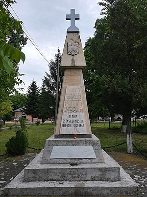
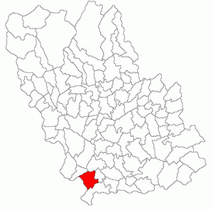
Cornești is a commune in Dâmbovița County, Muntenia, Romania with a population of 7,551 people. It is composed of ten villages: Bujoreanca, Cătunu, Cornești, Cristeasca, Crivățu, Frasinu, Hodărăști, Ibrianu, Postârnacu and Ungureni.

Finta, Dâmbovița
Commune in Dâmbovița, Romania
Distance: Approx. 5588 meters
Latitude and longitude: 44.8,25.8
Finta is a commune in Dâmbovița County, Muntenia, Romania with a population of 4,574 people. It is composed of four villages: Bechinești, Finta Mare (the commune center), Finta Veche and Gheboaia.

Mănești, Prahova
Commune in Prahova, Romania
Distance: Approx. 9374 meters
Latitude and longitude: 44.86666667,25.85
Mănești is a commune in Prahova County, Muntenia, Romania. It is composed of five villages: Băltița, Coada Izvorului, Gura Crivățului, Mănești and Zalhanaua. It also included eight other villages until 2004, when they were split off to form Cocorăștii Colț Commune.

Șirna
Commune in Prahova, Romania
Distance: Approx. 6838 meters
Latitude and longitude: 44.8,25.95
Șirna is a commune in Prahova County, Muntenia, Romania. It is composed of six villages: Brătești, Coceana, Hăbud, Șirna, Tăriceni and Varnița.
Weather in this IP's area
overcast clouds
24 Celsius
24 Celsius
22 Celsius
26 Celsius
1016 hPa
57 %
1016 hPa
1000 hPa
10000 meters
2.49 m/s
3.72 m/s
39 degree
92 %
05:41:28
21:02:14