Country:
 Romania
Region:
City:
Latitude and Longitude:
Time Zone:
Postal Code:
IP information under different IP Channel
ip-api
Country
IPinfo
Country
MaxMind
Country
Luminati
Country
RORegion
nt
City
roznov
ASN
Time Zone
Europe/Bucharest
ISP
Orange Romania S.A.
Latitude
Longitude
Postal
db-ip
Country
ipdata
Country
Popular places and events near this IP address

Voroneț Monastery
Distance: Approx. 9237 meters
Latitude and longitude: 47.5171,25.86425
The Voroneț Monastery is a medieval monastery in the Romanian village of Voroneț, now a part of the town Gura Humorului. It is one of the famous painted monasteries from southern Bukovina, in Suceava County. The monastery was constructed by Stephen the Great in 1488 over a period of 3 months and 3 weeks to commemorate the victory at Battle of Vaslui.
Gemenea
River in Suceava County, Romania
Distance: Approx. 1358 meters
Latitude and longitude: 47.4545,25.7666
The Gemenea is a left tributary of the river Suha in Romania. It flows into the Suha in Stulpicani. Its length is 15 km (9.3 mi) and its basin size is 76 km2 (29 sq mi).
Suha (river)
River in Suceava County, Romania
Distance: Approx. 9047 meters
Latitude and longitude: 47.5442,25.8029
The Suha is a right tributary of the river Moldova in Romania. It discharges into the Moldova in Frasin. It flows through the villages Ostra, Tărnicioara, Stulpicani, Plutonița, Doroteia and the town Frasin.
Negrileasa
River in Suceava County, Romania
Distance: Approx. 587 meters
Latitude and longitude: 47.4629,25.7721
The Negrileasa is a right tributary of the river Suha in Romania. It flows into the Suha near Stulpicani. Its length is 21 km (13 mi) and its basin size is 79 km2 (31 sq mi).
Ostra, Suceava
Commune in Suceava, Romania
Distance: Approx. 7425 meters
Latitude and longitude: 47.4,25.76666667
Ostra (German: Ostra) is a commune located in Suceava County, in the historical region of Bukovina, northeastern Romania. It is composed of two villages, namely Ostra and Tărnicioara.

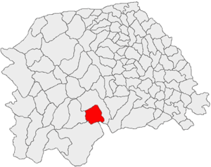
Stulpicani
Commune in Suceava, Romania
Distance: Approx. 4 meters
Latitude and longitude: 47.46666667,25.76666667
Stulpicani (German: Stulpikany or Sztulpikany) is a commune located in Suceava County, in the historical region of Bukovina, northeastern Romania. It is composed of five villages, namely: Gemenea, Negrileasa, Slătioara, Stulpicani, and Vadu Negrilesei. In the past, from the modern period during the mid 20th century, the commune was inhabited by a sizeable German population, more specifically by Zipser Germans (part of the larger local community of Bukovina Germans).

Vama, Suceava
Commune in Suceava, Romania
Distance: Approx. 10007 meters
Latitude and longitude: 47.55,25.71666667
Vama (German: Wama) is a commune located in Suceava County, Bukovina, northeastern Romania. It is composed of four villages: namely Molid, Prisaca Dornei (German: Eisenau), Strâmtura, and Vama. The locality was a town until 1950 when it lost its urban status.

Frasin
Town in Suceava, Romania
Distance: Approx. 5861 meters
Latitude and longitude: 47.51833333,25.78194444
Frasin (German: Frassin or Fraßin) is a town in Suceava County, mountainous northeastern Romania. It is situated in the historical region of Bukovina. Frasin is the thirteenth-largest urban settlement in the county, with a population of 5,817 according to the 2021 census.
Weather in this IP's area
scattered clouds
16 Celsius
16 Celsius
16 Celsius
19 Celsius
1020 hPa
93 %
1020 hPa
954 hPa
10000 meters
1.64 m/s
1.46 m/s
248 degree
38 %
05:31:28
21:13:02