Country:
 Switzerland
Region:
City:
Latitude and Longitude:
Time Zone:
Postal Code:
IP information under different IP Channel
ip-api
Country
Region
City
ASN
Time Zone
ISP
Blacklist
Proxy
Latitude
Longitude
Postal
Route
IPinfo
Country
Region
City
ASN
Time Zone
ISP
Blacklist
Proxy
Latitude
Longitude
Postal
Route
MaxMind
Country
Region
City
ASN
Time Zone
ISP
Blacklist
Proxy
Latitude
Longitude
Postal
Route
Luminati
Country
CHRegion
zg
ASN
Time Zone
Europe/Zurich
ISP
Datacamp Limited
Latitude
Longitude
Postal
db-ip
Country
Region
City
ASN
Time Zone
ISP
Blacklist
Proxy
Latitude
Longitude
Postal
Route
ipdata
Country
Region
City
ASN
Time Zone
ISP
Blacklist
Proxy
Latitude
Longitude
Postal
Route
Popular places and events near this IP address

Cham, Switzerland
Municipality in Zug, Switzerland
Distance: Approx. 2088 meters
Latitude and longitude: 47.18333333,8.45
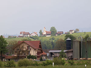
Cham is a municipality in the canton of Zug in Switzerland.
Oberrüti
Municipality in Aargau, Switzerland
Distance: Approx. 2127 meters
Latitude and longitude: 47.16666667,8.4
Oberrüti is a municipality in the district of Muri in the canton of Aargau in Switzerland.
Hünenberg
Municipality in Zug, Switzerland
Distance: Approx. 1085 meters
Latitude and longitude: 47.18333333,8.43333333
Hünenberg is a municipality in the canton of Zug in Switzerland.

St. Andreas Castle
Distance: Approx. 3143 meters
Latitude and longitude: 47.17875,8.46625
St. Andreas Castle (German: Schloss St. Andreas) is a privately owned castle located in Cham, in the Canton of Zug, Switzerland.
International School of Central Switzerland
Private international school in Cham, Canton of Zug, Switzerland
Distance: Approx. 2827 meters
Latitude and longitude: 47.1913892,8.4540218
The International School of Central Switzerland (ISCS) is a private international school in Cham, Canton of Zug, Switzerland. It serves students aged 3 to 18 in Kindergarten through Year 13 and is a Cambridge International School.

Rotkreuz railway station
Swiss railway station
Distance: Approx. 3767 meters
Latitude and longitude: 47.14176389,8.430495
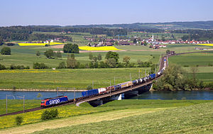
Rotkreuz railway station (German: Bahnhof Rotkreuz) is a railway station in the municipality of Risch-Rotkreuz, in the Swiss canton of Zug. It is located at the junction of the standard gauge Rupperswil–Immensee and Zug–Lucerne lines of Swiss Federal Railways.

Hünenberg Chämleten railway station
Swiss railway station
Distance: Approx. 2009 meters
Latitude and longitude: 47.16915889,8.44990806
Hünenberg Chämleten railway station (German: Bahnhof Hünenberg Chämleten) is a railway station in the municipality of Hünenberg, in the Swiss canton of Zug. It is an intermediate stop on the standard gauge Zug–Lucerne line of Swiss Federal Railways.

Hünenberg Zythus railway station
Swiss railway station
Distance: Approx. 1909 meters
Latitude and longitude: 47.17360806,8.450095
Hünenberg Zythus railway station (German: Bahnhof Hünenberg Zythus) is a railway station in the municipality of Hünenberg, in the Swiss canton of Zug. It is an intermediate stop on the standard gauge Zug–Lucerne line of Swiss Federal Railways.

Cham railway station (Switzerland)
Swiss railway station
Distance: Approx. 2480 meters
Latitude and longitude: 47.17824389,8.457505
Cham railway station (German: Bahnhof Cham) is a railway station in the municipality of Cham, in the Swiss canton of Zug. It is an intermediate stop on the standard gauge Zug–Lucerne line of Swiss Federal Railways.

Cham Alpenblick railway station
Swiss railway station
Distance: Approx. 3598 meters
Latitude and longitude: 47.18228194,8.47146306
Cham Alpenblick railway station (German: Bahnhof Cham Alpenblick) is a railway station in the municipality of Cham, in the Swiss canton of Zug. It is an intermediate stop on the standard gauge Zug–Lucerne line of Swiss Federal Railways.
Sins railway station
Distance: Approx. 2878 meters
Latitude and longitude: 47.19,8.39361111
Sins railway station (German: Bahnhof Sins) is a railway station in the municipality of Sins, in the Swiss canton of Aargau. It is an intermediate stop on the standard gauge Rupperswil–Immensee line of Swiss Federal Railways.
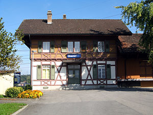
Oberrüti railway station
Distance: Approx. 1736 meters
Latitude and longitude: 47.17027778,8.40333333
Oberrüti railway station (German: Bahnhof Oberrüti) is a railway station in the municipality of Oberrüti, in the Swiss canton of Aargau. It is an intermediate stop on the standard gauge Rupperswil–Immensee line of Swiss Federal Railways.
Weather in this IP's area
overcast clouds
17 Celsius
17 Celsius
14 Celsius
19 Celsius
1023 hPa
84 %
1023 hPa
971 hPa
10000 meters
1.03 m/s
80 degree
100 %
06:01:40
21:03:39