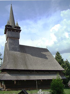
Country:
Region:
City:
Latitude and Longitude:
Time Zone:
Postal Code:
IP information under different IP Channel
ip-api
Country
Region
City
ASN
Time Zone
ISP
Blacklist
Proxy
Latitude
Longitude
Postal
Route
IPinfo
Country
Region
City
ASN
Time Zone
ISP
Blacklist
Proxy
Latitude
Longitude
Postal
Route
MaxMind
Country
Region
City
ASN
Time Zone
ISP
Blacklist
Proxy
Latitude
Longitude
Postal
Route
Luminati
Country
Region
cj
City
campiaturzii
ASN
Time Zone
Europe/Bucharest
ISP
Orange Romania S.A.
Latitude
Longitude
Postal
db-ip
Country
Region
City
ASN
Time Zone
ISP
Blacklist
Proxy
Latitude
Longitude
Postal
Route
ipdata
Country
Region
City
ASN
Time Zone
ISP
Blacklist
Proxy
Latitude
Longitude
Postal
Route
Popular places and events near this IP address

Cavnic
Town in Maramureș, Romania
Distance: Approx. 1057 meters
Latitude and longitude: 47.66083333,23.87777778
Cavnic (Hungarian: Kapnikbánya; German: Kapnik) is a former mining town located in the valley of the river Cavnic, 26 km (16 mi) east of Baia Mare, in Maramureș County, northern Romania. Part of the Baia Mare metropolitan area, the town covers 47.17 km2 (18 sq mi), at altitudes ranging from 500 to 1,050 m (1,640 to 3,440 ft) above sea level.
Budești, Maramureș
Commune in Maramureș, Romania
Distance: Approx. 9190 meters
Latitude and longitude: 47.73055556,23.94444444
Budești (Hungarian: Budfalva or Budfalu, Yiddish: בודשט, romanized: Budesht or Budest) is a commune in Maramureș County, Maramureș, Romania. It is composed of two villages, Budești and Sârbi (Hungarian: Szerfalva or Szerfalu, Yiddish: סערב, romanized: Sarb or Serb).

Gutin Mountains
Distance: Approx. 3858 meters
Latitude and longitude: 47.69666667,23.84083333
The Gutin Mountains (Romanian: Munții Gutâi; Hungarian: Gutin-hegység; Ukrainian: Гутинський масив) are a mountain range within the Vihorlat-Gutin Area of the Inner Eastern Carpathians. They are centered in Maramureș County in Romania, bordering Satu Mare County, and also stretching further towards northwest as the Oaș Mountains, and reaching the border with Zakarpattia Oblast in Ukraine. Its highest mountain is Gutâi Peak, with an altitude of 1,443 m (4,734 ft).

Cavnic mine
Mine in Cavnic, Maramureș County, Romania
Distance: Approx. 2746 meters
Latitude and longitude: 47.6425,23.8738
The Cavnic mine is a large mine located in the northwest of Romania in Maramureș County, 26 km southwest of Baia Mare and 576 km north of the capital, Bucharest. Cavnic represents one of the largest polymetallic reserves in Romania having significant reserves of gold, silver, copper, lead and zinc amounting to 20 million tonnes of ore grading 1g/t gold, 30g/t silver, 2% lead, 3% zinc and 1% copper. The resources amount to 640,000 oz of gold, 19.2 million oz of silver, 400,000 tonnes of lead metal, 600,000 tonnes of zinc metal, and 200,000 tonnes of copper metal.
Weather in this IP's area
clear sky
15 Celsius
14 Celsius
14 Celsius
15 Celsius
1020 hPa
68 %
1020 hPa
922 hPa
10000 meters
1.45 m/s
1.82 m/s
124 degree
05:56:58
21:04:51
