Country:
 Denmark
Region:
City:
Latitude and Longitude:
Time Zone:
Postal Code:
IP information under different IP Channel
ip-api
Country
Region
City
ASN
Time Zone
ISP
Blacklist
Proxy
Latitude
Longitude
Postal
Route
IPinfo
Country
Region
City
ASN
Time Zone
ISP
Blacklist
Proxy
Latitude
Longitude
Postal
Route
MaxMind
Country
Region
City
ASN
Time Zone
ISP
Blacklist
Proxy
Latitude
Longitude
Postal
Route
Luminati
Country
DKRegion
84
City
albertslund
ASN
Time Zone
Europe/Copenhagen
ISP
Dansk Kabel Tv A/s
Latitude
Longitude
Postal
db-ip
Country
Region
City
ASN
Time Zone
ISP
Blacklist
Proxy
Latitude
Longitude
Postal
Route
ipdata
Country
Region
City
ASN
Time Zone
ISP
Blacklist
Proxy
Latitude
Longitude
Postal
Route
Popular places and events near this IP address
Albertslund Municipality
Municipality in Hovedstaden, Denmark
Distance: Approx. 1158 meters
Latitude and longitude: 55.65,12.35
Albertslund Municipality (Danish: Albertslund Kommune) is a municipality in Region Hovedstaden on the island of Zealand in eastern Denmark. The municipality covers an area of 23,04 km2, and has a population of 27,677 (1. January 2024).

Glostrup Municipality
Municipality in Hovedstaden, Denmark
Distance: Approx. 2520 meters
Latitude and longitude: 55.66666667,12.4
Glostrup Municipality (Danish: Glostrup Kommune) is a suburban municipality (Danish kommune) and town in Region Hovedstaden on the island of Zealand (Sjælland) approx. 10 km west of Copenhagen in eastern Denmark. The municipality covers an area of 13.31 km2, and has a total population of 23,655 (2024).
The Capital Region (Denmark)
Distance: Approx. 2299 meters
Latitude and longitude: 55.66,12.4
The Capital Region (Danish: Hovedstadsregionen, pronounced [ˈhoːð̩stæðsʁekiˌoˀnn̩]) was the administrative name of the municipalities of Copenhagen and Frederiksberg and the counties of Frederiksborg, Copenhagen, and Roskilde. It was replaced by the Capital Region of Denmark (Danish: Region Hovedstaden) as an administrative region on January 1, 2007 as part of the 2007 Danish Municipal Reform. The new region includes the island of Bornholm (in the Baltic Sea 100 nautical miles from Copenhagen), and excludes the southwestern parts of Greater Copenhagen that were covered by Roskilde County.

Coop amba
Danish retail cooperative
Distance: Approx. 327 meters
Latitude and longitude: 55.6579,12.3687
Coop amba, formerly FDB, is a cooperative based in Denmark. The coop has 1.9 million members and three subsidiaries. The Coop Danmark subsidiary operates the retail store chains of Kvickly, Brugsen, SuperBrugsen, Dagli'Brugsen and 365discount as well as the furniture company FDB Møbler.

Glostrup railway station
Railway station in Greater Copenhagen, Denmark
Distance: Approx. 2203 meters
Latitude and longitude: 55.66291667,12.39722222
Glostrup station is a commuter rail railway station serving the railway town/suburb of Glostrup west of Copenhagen, Denmark. It is located close to the historical, administrative and commercial centre of Glostrup Municipality, but also serves Brøndbyvester in Brøndby Municipality, the boundary of which comes within a few hundred metres from the station. The station is connected to the nearby Glostrup Shopping Center via an underground walkway, the same walkway which is used to access the platforms.

Albertslund railway station
Suburban railway station in Greater Copenhagen, Denmark
Distance: Approx. 689 meters
Latitude and longitude: 55.658,12.353
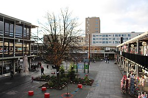
Albertslund station is an S-train railway station serving the suburb of Albertslund west of the Danish capital Copenhagen. The station is situated in the central part of the suburb and is integrated in the adjacent open-air shopping centre, Albertslund Centrum. Albertslund station is located on the Taastrup radial of Copenhagen's S-train network, a hybrid commuter rail and rapid transit system serving Greater Copenhagen.

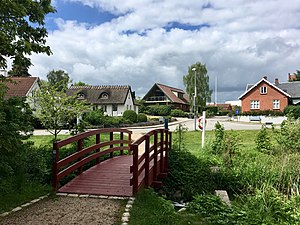
Albertslund
Suburb of Copenhagen, Denmark
Distance: Approx. 342 meters
Latitude and longitude: 55.65972222,12.36166667
Albertslund is a Copenhagen suburb in Albertslund Municipality, Denmark. It is located 15 km (9.3 mi) west of central Copenhagen, with a population of around 30,000. Albertslund is a planned community or new town mainly built in the 1960s and 1970s.

Rigshospitalet Glostrup
Hospital in Capital Region, Denmark
Distance: Approx. 2160 meters
Latitude and longitude: 55.67,12.38916667
Rigshospitalet Glostrup is hospital located in the township of Glostrup, 8 km from the center of Copenhagen in Denmark. It is owned and managed by the regional health authority of the Greater Copenhagen region, Region Hovedstaden. The hospital was formerly known as Glostrup Hospital, but after the merger with Rigshospitalet 1/1/2015, it is now known as Rigshospitalet Glostrup.

Vridsløselille Prison
Former state prison in Copenhagen, Denmark
Distance: Approx. 1067 meters
Latitude and longitude: 55.65975,12.34758333
Vridsløselille Prison (Danish: Vridsløselille Fængsel) is a former state prison located in Albertslund in the western suburbs of Copenhagen in Denmark. It was operated as a state prison from its opening in 1859 to January 2016 and then served as a special departure center for rejected asylum seekers with prison sentences until February 2018. The prison was used for the enforcement of imprisonment and execution of arrests and had a total of 241 inmates.
Herstedvester Prison
Prison in Denmark
Distance: Approx. 1074 meters
Latitude and longitude: 55.6603,12.3478
Herstedvester Prison (Danish: Herstedvester Fængsel) is a prison in Herstedvester, Greater Copenhagen, Denmark, for treatment by the Danish Prison and Probation Service. It houses convicted felons and occasionally people with custody rulings in need of psychiatric assistance and observation. Herstedvester was built in 1935 for the detention and imprisonment of psychopaths.
Danish Headache Center
Distance: Approx. 2539 meters
Latitude and longitude: 55.672523,12.393272
The Danish Headache Center (DHC) is an academic medical center at Rigshospitalet in Copenhagen, Denmark. It was founded in 2001 and currently employs more than 100 health care professionals, scientists and administrative staff. The DHC focuses on health care services, education, and research related to headache disorders and facial pains.
Vallensbæk Landsby
Village in Capital Region, Denmark
Distance: Approx. 2314 meters
Latitude and longitude: 55.63611111,12.36416667
Vallensbæk Landsby is a village on Zealand, located in Vallensbæk Municipality in the Capital Region of Denmark.
Weather in this IP's area
broken clouds
15 Celsius
14 Celsius
14 Celsius
16 Celsius
1016 hPa
91 %
1016 hPa
1014 hPa
10000 meters
2.57 m/s
300 degree
75 %
05:09:27
21:24:23