Country:
 Romania
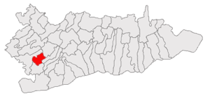
Region:
City:
Latitude and Longitude:
Time Zone:
Postal Code:
IP information under different IP Channel
ip-api
Country
IPinfo
Country
MaxMind
Country
Luminati
Country
RORegion
bt
City
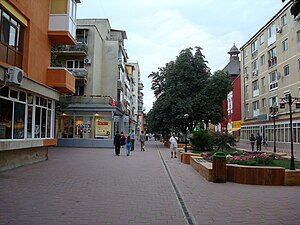
botosani
ASN
Time Zone
Europe/Bucharest
ISP
Orange Romania S.A.
Latitude
Longitude
Postal
db-ip
Country
ipdata
Country
Popular places and events near this IP address
Oltenița
Municipality in Călărași, Romania
Distance: Approx. 9379 meters
Latitude and longitude: 44.08666667,26.63666667
Oltenița (Romanian pronunciation: [olˈtenitsa] ) is a city in Călărași County, Muntenia, Romania, on the left bank of the river Argeș, where its waters flow into the Danube.

Ulmeni, Călărași
Commune in Călărași, Romania
Distance: Approx. 9501 meters
Latitude and longitude: 44.15,26.71666667
Ulmeni is a commune in Călărași County, Muntenia, Romania. It is composed of a single village, Ulmeni.
Șoldanu
Commune in Călărași, Romania
Distance: Approx. 8671 meters
Latitude and longitude: 44.21666667,26.51666667
Șoldanu is a commune in Călărași County, Muntenia, Romania, 44 km (27 mi) away from Bucharest. It is composed of two villages: Negoești and Șoldanu.

Chirnogi
Commune in Călărași, Romania
Distance: Approx. 5727 meters
Latitude and longitude: 44.11666667,26.58333333
Chirnogi is a commune in Călărași County, Muntenia, Romania. It is composed of a single village, Chirnogi.

Curcani
Commune in Călărași, Romania
Distance: Approx. 3938 meters
Latitude and longitude: 44.2,26.58333333
Curcani is a commune in Călărași County, Muntenia, Romania. It is composed of two villages, Curcani and Sălcioara. At the 2002 census, there were 5233 inhabitants.

Luica
Commune in Romania
Distance: Approx. 7536 meters
Latitude and longitude: 44.23333333,26.58333333
Luica is a commune in Călărași County, Muntenia, Romania. It is composed of two villages, Luica and Valea Stânii. As of 2007, the population of Luica is 2,118.

Mitreni
Commune in Călărași, Romania
Distance: Approx. 4 meters
Latitude and longitude: 44.16666667,26.6
Mitreni is a commune in Călărași County, Muntenia, Romania. It is composed of three villages: Clătești, Mitreni and Valea Roșie.

Radovanu
Commune in Călărași, Romania
Distance: Approx. 7615 meters
Latitude and longitude: 44.2,26.51666667
Radovanu is a commune in Călărași County, Muntenia, Romania. It is composed of two villages, Radovanu and Valea Popii. As of 2007 the population of Radovanu is 4,695.
Rasa (Argeș)
River in Călărași County, Romania
Distance: Approx. 9496 meters
Latitude and longitude: 44.2229,26.5105
The Rasa is a left tributary of the river Argeș in Romania. It discharges into the Argeș in Șoldanu. Its length is 22 km (14 mi) and its basin size is 94 km2 (36 sq mi).
Luica (river)
River in Călărași County, Romania
Distance: Approx. 4105 meters
Latitude and longitude: 44.1967,26.5701
The Luica is a left tributary of the river Argeș in Romania. It discharges into the Argeș in Curcani. Its length is 17 km (11 mi) and its basin size is 150 km2 (58 sq mi).

Battle of Oltenița
1853 battle of the Crimean War
Distance: Approx. 9379 meters
Latitude and longitude: 44.08666667,26.63666667
The Battle of Oltenița (or Oltenitza) was fought on 4 November 1853 and was the first engagement of the Crimean War. In this battle an Ottoman army under the command of Omar Pasha was defending its fortified positions from the Russian forces led by General Peter Dannenberg, until the Russians were ordered to withdraw. The Russian attack was called off just when they reached the Ottoman fortifications, and they retreated in good order, but suffered heavy losses.

Oltenița Water Tower
Water tower in Oltenița, Romania
Distance: Approx. 8770 meters
Latitude and longitude: 44.093,26.6388
The Oltenița Water Tower is a water tower located at 2B Argeșului Street in Oltenița, Romania. The 34.5-meter high octagonal tower was the town’s first structure made of reinforced concrete. Bidding for the building contract took place in 1913, and it was completed in 1916.
Weather in this IP's area
scattered clouds
32 Celsius
31 Celsius
32 Celsius
32 Celsius
1013 hPa
37 %
1013 hPa
1011 hPa
10000 meters
7.08 m/s
11.84 m/s
90 degree
48 %
05:39:58
20:57:37