Country:
 Romania
Region:
City:
Latitude and Longitude:
Time Zone:
Postal Code:
IP information under different IP Channel
ip-api
Country
Region
City
ASN
Time Zone
ISP
Blacklist
Proxy
Latitude
Longitude
Postal
Route
IPinfo
Country
Region
City
ASN
Time Zone
ISP
Blacklist
Proxy
Latitude
Longitude
Postal
Route
MaxMind
Country
Region
City
ASN
Time Zone
ISP
Blacklist
Proxy
Latitude
Longitude
Postal
Route
Luminati
Country
RORegion
tl
City
macin
ASN
Time Zone
Europe/Bucharest
ISP
Orange Romania S.A.
Latitude
Longitude
Postal
db-ip
Country
Region
City
ASN
Time Zone
ISP
Blacklist
Proxy
Latitude
Longitude
Postal
Route
ipdata
Country
Region
City
ASN
Time Zone
ISP
Blacklist
Proxy
Latitude
Longitude
Postal
Route
Popular places and events near this IP address
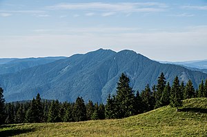
Suceava County
County of Romania
Distance: Approx. 8314 meters
Latitude and longitude: 47.58,25.76
Suceava County (Romanian pronunciation: [suˈtʃe̯ava]) is a county (Romanian: județ) of Romania. Most of its territory lies in the southern part of the historical region of Bukovina (Romanian: Bucovina), while the remainder forms part of Western Moldavia proper. The county seat is the historical town of Suceava (German: Suczawa, also Sotschen or Sutschawa; historically known in Old High German as Sedschopff as well) which was the capital of the Principality of Moldavia during the late Middle Ages and then a pivotal, predominantly German-speaking commercial town of the Habsburgs, Austrian Empire, and Austria-Hungary at the border with the Romanian Old Kingdom (Romanian: Vechiul Regat, German: Altreich) throughout the late modern period up until 1918, when, after the end of World War I, the town became part of the enlarged Kingdom of Romania.

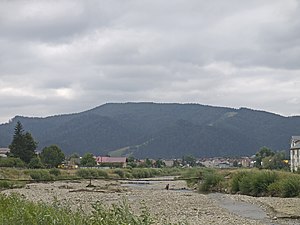
Gura Humorului
Town in Suceava, Romania
Distance: Approx. 5403 meters
Latitude and longitude: 47.55388889,25.88916667
Gura Humorului (Romanian pronunciation: [ˌɡura huˈmoruluj]; Hebrew and Yiddish: גורה חומורולוי - Gure Humuruluei or גורא הומאָרא - Gura Humora; German and Polish: Gura Humora) is a town in Suceava County, northeastern Romania. It is situated in the historical region of Bukovina. Gura Humorului is the seventh largest urban settlement in the county, with a population of 13,278 inhabitants, according to the 2021 census.

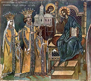
Voroneț Monastery
Distance: Approx. 9230 meters
Latitude and longitude: 47.5171,25.86425
The Voroneț Monastery is a medieval monastery in the Romanian village of Voroneț, now a part of the town Gura Humorului. It is one of the famous painted monasteries from southern Bukovina, in Suceava County. The monastery was constructed by Stephen the Great in 1488 over a period of 3 months and 3 weeks to commemorate the victory at Battle of Vaslui.
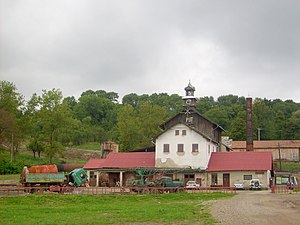
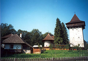
Humor Monastery
Distance: Approx. 1064 meters
Latitude and longitude: 47.5931,25.8569
Humor Monastery located in Mănăstirea Humorului, about 5 km north of the town of Gura Humorului, Romania. It is a monastery for nuns dedicated to the Dormition of Virgin Mary, or Theotokos. It was constructed in 1530 by Voievod Petru Rareş and his chancellor Teodor Bubuiog.
Suha (river)
River in Suceava County, Romania
Distance: Approx. 7845 meters
Latitude and longitude: 47.5442,25.8029
The Suha is a right tributary of the river Moldova in Romania. It discharges into the Moldova in Frasin. It flows through the villages Ostra, Tărnicioara, Stulpicani, Plutonița, Doroteia and the town Frasin.
Humor (Moldova)
River in Suceava County, Romania
Distance: Approx. 6193 meters
Latitude and longitude: 47.5476,25.8944
The Humor is a left tributary of the river Moldova in Romania. It discharges into the Moldova in Gura Humorului. Its length is 26 km (16 mi) and its basin size is 106 km2 (41 sq mi).
Cacica
Commune in Suceava, Romania
Distance: Approx. 4474 meters
Latitude and longitude: 47.63333333,25.9
Cacica (Polish: Kaczyka, German: Kaczika) is a commune in Suceava County, in the historical region of Bukovina, northeastern Romania. The commune is located in the central part of the county, 17 km (11 mi) from the town of Gura Humorului, 34 km (21 mi) from the city of Rădăuți, and 28 km (17 mi) from the county seat, Suceava. At the 2011 census, 74.8% of inhabitants were Romanians, 20.2% Poles, and 4.4% Ukrainians.

Poieni-Solca
Commune in Suceava, Romania
Distance: Approx. 9607 meters
Latitude and longitude: 47.68333333,25.9
Poieni-Solca (German: Pojeni) is a commune located in Suceava County, Romania. Composed of a single village, Poieni-Solca, it was established in 2007 when it was split from Solca town.
Mănăstirea Humorului
Commune in Suceava, Romania
Distance: Approx. 3 meters
Latitude and longitude: 47.6,25.86666667
Mănăstirea Humorului (German: Humora Kloster or Kloster Humora) is a commune located in Suceava County, in the historical region of Bukovina, northeastern Romania. It is composed of three villages, namely: Mănăstirea Humorului, Pleșa, and Poiana Micului. The 16th century Humor Monastery is located in the commune.

Păltinoasa
Commune in Suceava, Romania
Distance: Approx. 8373 meters
Latitude and longitude: 47.55,25.95
Păltinoasa (German: Paltinossa) is a commune located in Suceava County, in the historical region of Bukovina, northeastern Romania. It is composed of two villages, namely Capu Codrului (German: Kapukodrolui) and Păltinoasa.

Pârteștii de Jos
Commune in Suceava, Romania
Distance: Approx. 8369 meters
Latitude and longitude: 47.63333333,25.96666667
Pârteștii de Jos (German: Unter Pertestie) is a commune located in Suceava County, Romania. It is composed of four villages: Deleni, Pârteștii de Jos, Varvata, and Vârfu Dealului.
Weather in this IP's area
few clouds
20 Celsius
20 Celsius
19 Celsius
21 Celsius
1020 hPa
73 %
1020 hPa
950 hPa
10000 meters
0.84 m/s
0.94 m/s
253 degree
19 %
05:47:57
20:57:53