Country:
 Greece
Region:
City:
Latitude and Longitude:
Time Zone:
Postal Code:
IP information under different IP Channel
ip-api
Country
Region
City
ASN
Time Zone
ISP
Blacklist
Proxy
Latitude
Longitude
Postal
Route
IPinfo
Country
Region
City
ASN
Time Zone
ISP
Blacklist
Proxy
Latitude
Longitude
Postal
Route
MaxMind
Country
Region
City
ASN
Time Zone
ISP
Blacklist
Proxy
Latitude
Longitude
Postal
Route
Luminati
Country
GRASN
Time Zone
Europe/Athens
ISP
Connecticore Telecommunications Information Technology S.A
Latitude
Longitude
Postal
db-ip
Country
Region
City
ASN
Time Zone
ISP
Blacklist
Proxy
Latitude
Longitude
Postal
Route
ipdata
Country
Region
City
ASN
Time Zone
ISP
Blacklist
Proxy
Latitude
Longitude
Postal
Route
Popular places and events near this IP address

Lykovrysi
Municipal unit in Greece
Distance: Approx. 1458 meters
Latitude and longitude: 38.06666667,23.78333333
Lykovrysi (Greek: Λυκόβρυση; formerly Γλυκόβρυση Glykovrysi) is a town in the North Athens regional unit, Attica, Greece. Since the 2011 local government reform it is part of the municipality Lykovrysi-Pefki, of which it is a municipal unit/community.

Metamorfosi
Municipality in Greece
Distance: Approx. 2357 meters
Latitude and longitude: 38.05,23.75
Metamorfosi (Greek: Μεταμόρφωση, romanized: Metamórfosi, lit. 'transfiguration'; before 1957: Koukouvaounes (Greek: Κουκουβάουνες, romanized: Koukouváounes) is a suburb in the northern part of the Athens agglomeration, Greece, and a municipality of the Attica region.
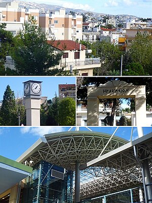
Irakleio, Attica
Municipality in Greece
Distance: Approx. 1848 meters
Latitude and longitude: 38.05,23.76666667
Irakleio, Attica (Greek: Ηράκλειο Αττικής) is a suburb in the northeastern part of the Athens agglomeration, Greece, and a municipality of the Attica region.

Pefki
Municipal unit in Greece
Distance: Approx. 2918 meters
Latitude and longitude: 38.06666667,23.8
Pefki (Greek: Πεύκη, pronounced [ˈpefci], meaning "pine", before 1959: Μαγκουφάνα Magkoufana [maɡuˈfana]) is a town and a suburb in the northeastern part of the Athens agglomeration, Greece. Since the 2011 local government reform it is part of the municipality Lykovrysi-Pefki, of which it is the seat and a municipal unit., it is part of North Athens regional unit. According to the 2021 population census, Pefki has 21,293 residents.

Acharnes Railway Center
Distance: Approx. 2632 meters
Latitude and longitude: 38.06638889,23.73666667
The Acharnes Railway Center (Greek: Σιδηροδρομικό Κέντρο Αχαρνών) or SKA is a two-level railway station in the northern parts of the Athens agglomeration, in the suburb of Acharnes, where several important railway lines converge. It is an important passenger interchange station linking The main Piraeus–Platy railway line from Athens Central to Thessaloniki and the Athens Airport–Patras railway. The station opened in April 2011.
Irakleio metro station
Athens Metro station
Distance: Approx. 2272 meters
Latitude and longitude: 38.0462,23.766
Irakleio (Greek: Ηράκλειο, lit. 'Heraklion'), also known as Iraklio on signage, is an Athens metro station in the municipality of Irakleio in the regional unit of North Athens, Attica, Greece. It is marked at the 19.246 km from the starting point in Piraeus station of Line 1. Initially, the station served the Athens–Lavrion Railway and Lavrion Square-Strofyli railway, ran by the Attica Railways.
Iphistiadae
Distance: Approx. 2364 meters
Latitude and longitude: 38.052218,23.786551
Iphistiadae (Ancient Greek: Ἰφιστιάδαι, romanized: Iphistiadai) or Hephaestiadae (Ancient Greek: Ἡφαιστιάδαι, romanized: Hephaistiadai) was one of the demes, or townships of Acamantis, one of the ten phylae of Attica established by Cleisthenes at the end of the sixth century BC. It seems to have been named for Iphistius, an obscure hero, with the alternative form, Hephaestiadae, arising from the mistaken assumption that it was named after the god Hephaestus, a much more familiar figure. The two names misled the geographer William Martin Leake to identify Iphistiadae and Hephaestiadae as two separate demes. Iphistiadae is mentioned in the Ethnica of Stephanus of Byzantium, and the lexicon of Hesychius of Alexandria.
Cholargos (deme)
Distance: Approx. 2672 meters
Latitude and longitude: 38.0564,23.7391
Cholargos (Ancient Greek: Χολαργός, romanized: Cholargós) was a deme of ancient Athens located west or north-west of Athens main city.
Sypalettus
Ancient Attic deme
Distance: Approx. 838 meters
Latitude and longitude: 38.0718195,23.759814
Sypalettus or Sypalettos (Ancient Greek: Συπαληττός) was a deme in ancient Attica of the phyle of Cecropis, sending two delegates to the Athenian Boule. Probably Sypalettus was a divided deme, even if this hypothesis is not confirmed by all scholars. The inscription that suggests the placement of the deme is a sacred calendar of 470-460 BCE; this document it is very important because it is the first Attican written text that prohibits changes to the law.
Acharnes railway station
Distance: Approx. 2514 meters
Latitude and longitude: 38.0803,23.7439
Acharnes railway station (Greek: Σιδηροδρομικός σταθμός Αχαρνών, romanized: Sidirodromikós stathmós Acharnón) is a station on the Piraeus–Platy railway line in the northern part of the Athens urban area, in the municipality of Acharnes, Greece. It was inaugurated on 8 March 1904. It is owned by OSE, however, services are provided by Hellenic Train through the Athens Suburban Railway from Athens to Chalcis.
Irakleio railway station
Railway station in Athens, Greece
Distance: Approx. 1118 meters
Latitude and longitude: 38.057227,23.771267
Irakleio railway station (Greek: Σιδηροδρομικός Σταθμός Ηρακλείου, romanized: Sidirodromikós Stathmós Iraklíou) is a station on the Piraeus–Platy railway line, located in the municipality of Irakleio, Attica close to the municipalities of Vrilissia, Maroussi, and Chalandri Greece. It was first opened on 30 July 2004 and is located in the median strip of Motorway 6, at the interchange of Pentelis Avenue, at the intersection of which with the railway line SKA - Athens International Airport has been built. Prior to its construction, it was referred to as "Ano Iraklio" station.
Metamorfosi railway station
Rail station near Athens, Greece
Distance: Approx. 1166 meters
Latitude and longitude: 38.060079,23.756287
Metamorfosi railway station (Greek: Σιδηροδρομικός Σταθμός Μεταμόρφωσης, romanized: Sidirodromikós Stathmós Metamórfosis) is a station on the Piraeus–Platy railway line, located on Kifisias Avenue in Marousi, a municipality in the regional unit of North Athens, Attica, Greece, located in the median strip of the Attiki Odos motorway. The station opened on 8 August 2010. The station consists of an island platform and a train storage line.
Weather in this IP's area
clear sky
26 Celsius
26 Celsius
24 Celsius
28 Celsius
1013 hPa
52 %
1013 hPa
991 hPa
10000 meters
3.09 m/s
340 degree
06:25:19
20:37:16