Country:
 Germany
Region:
City:
Latitude and Longitude:
Time Zone:
Postal Code:
IP information under different IP Channel
ip-api
Country
Region
City
ASN
Time Zone
ISP
Blacklist
Proxy
Latitude
Longitude
Postal
Route
IPinfo
Country
Region
City
ASN
Time Zone
ISP
Blacklist
Proxy
Latitude
Longitude
Postal
Route
MaxMind
Country
Region
City
ASN
Time Zone
ISP
Blacklist
Proxy
Latitude
Longitude
Postal
Route
Luminati
Country
DEASN
Time Zone
Europe/Berlin
ISP
FNH media KG
Latitude
Longitude
Postal
db-ip
Country
Region
City
ASN
Time Zone
ISP
Blacklist
Proxy
Latitude
Longitude
Postal
Route
ipdata
Country
Region
City
ASN
Time Zone
ISP
Blacklist
Proxy
Latitude
Longitude
Postal
Route
Popular places and events near this IP address

Heiligensee
Quarter of Berlin in Germany
Distance: Approx. 2917 meters
Latitude and longitude: 52.61666667,13.23333333
Heiligensee (German pronunciation: [ˈhaɪlɪɡn̩ˌzeː] ) is a locality within Reinickendorf, a borough of the German capital, Berlin.
Hennigsdorf
Town in Brandenburg, Germany
Distance: Approx. 202 meters
Latitude and longitude: 52.63777778,13.20361111
Hennigsdorf (German pronunciation: [ˈhɛnɪçsˌdɔʁf] ) is a town in the district of Oberhavel, in Brandenburg, in eastern Germany. It is situated north-west of Berlin, just across the city border, which is formed mainly by the Havel river.
Velten
Town in Brandenburg, Germany
Distance: Approx. 5454 meters
Latitude and longitude: 52.68333333,13.18333333
Velten is a town in the Oberhavel district of Brandenburg, Germany. It is situated 10 km southwest of Oranienburg, and 24 km northwest of Berlin.

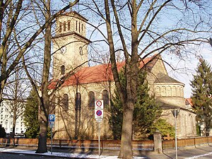
Schulzendorf station
Railway station in Heiligensee, Berlin, Germany
Distance: Approx. 3837 meters
Latitude and longitude: 52.6128,13.2462
Schulzendorf is a railway station in Heiligensee (a locality of the Reinickendorf borough) in Berlin. It is served by the S-Bahn line S25.

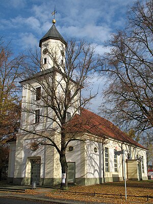
Heiligensee station
Distance: Approx. 2142 meters
Latitude and longitude: 52.6244,13.2295
Heiligensee is a railway station in Heiligensee, a locality in the Reinickendorf borough of Berlin. It is served by the S-Bahn line S25.

Hennigsdorf station
Distance: Approx. 245 meters
Latitude and longitude: 52.638,13.2057
Hennigsdorf is a railway station in the Oberhavel district of Brandenburg, located in the town of Hennigsdorf. It is the northern terminus of the S-Bahn line S25 as well as a station for regional passenger trains and freight services.
Mathiasberg
Distance: Approx. 4966 meters
Latitude and longitude: 52.66805556,13.15305556
Mathiasberg is a hill of Brandenburg, Germany.

LEW Hennigsdorf
Former German rail vehicle manufacturer
Distance: Approx. 1237 meters
Latitude and longitude: 52.62622,13.2129
The rail vehicle factory in Hennigsdorf, Germany, was founded in 1910 by AEG. Locomotive production began in 1913, and in the 1930s absorbed the work of the August Borsig locomotive factory, being renamed the Borsig Lokomotiv Werke GmbH until 1944. After the Second World War the factory was nationalised in the German Democratic Republic and produced electric locomotives for home use and for export, mainly to Communist Bloc countries under the name Lokomotivbau-Elektrotechnische Werke (LEW). After German reunification in 1990, the plant returned to AEG ownership, becoming AEG Schienenfahrzeuge GmbH, and then passed through mergers of its parent companies to Adtranz (1996), Bombardier Transportation (2001) and then Alstom (2021).

Muhre
River in Germany
Distance: Approx. 5454 meters
Latitude and longitude: 52.68333333,13.18333333
Muhre is a river of Brandenburg, Germany.

Gollanczstraße
Street in Frohnau, Berlin
Distance: Approx. 5675 meters
Latitude and longitude: 52.637059,13.288193
Gollanczstraße is a street in the Frohnau area in the northwestern part of Berlin. It is characterized by several large patrician villas from the 1920s, and several of the villas on the street are listed as cultural heritage sites by the state authorities. During the Cold War, the street was located within West Berlin, a few hundred meters from the Berlin Wall.

Ludwig Lesser Park
Distance: Approx. 5755 meters
Latitude and longitude: 52.63972222,13.28916667
The Ludwig Lesser Park (German: Ludwig-Lesser-Park) is a park in the Frohnau area in the northwestern part of Berlin. It is located between Schönfließer Straße to the north, Gollanczstraße to the west, Senheimer Straße to the east and Markgrafenstraße to the south. It is named for the landscape architect Ludwig Lesser, and was constructed around 1908.

Velten (Mark) station
Distance: Approx. 5805 meters
Latitude and longitude: 52.6845,13.1726
Velten (Mark) is a railway station in the town of Velten which is located in the Oberhavel district of Brandenburg, Germany.
Weather in this IP's area
clear sky
19 Celsius
18 Celsius
18 Celsius
21 Celsius
1023 hPa
73 %
1023 hPa
1019 hPa
10000 meters
2.02 m/s
2.72 m/s
23 degree
8 %
05:22:06
21:04:59