Country:
 Germany
Region:
City:
Latitude and Longitude:
Time Zone:
Postal Code:
IP information under different IP Channel
ip-api
Country
Region
City
ASN
Time Zone
ISP
Blacklist
Proxy
Latitude
Longitude
Postal
Route
IPinfo
Country
Region
City
ASN
Time Zone
ISP
Blacklist
Proxy
Latitude
Longitude
Postal
Route
MaxMind
Country
Region
City
ASN
Time Zone
ISP
Blacklist
Proxy
Latitude
Longitude
Postal
Route
Luminati
Country
DEASN
Time Zone
Europe/Berlin
ISP
euNetworks GmbH
Latitude
Longitude
Postal
db-ip
Country
Region
City
ASN
Time Zone
ISP
Blacklist
Proxy
Latitude
Longitude
Postal
Route
ipdata
Country
Region
City
ASN
Time Zone
ISP
Blacklist
Proxy
Latitude
Longitude
Postal
Route
Popular places and events near this IP address

International Student Week in Ilmenau
Biennial student conference in Ilmenau, Germany
Distance: Approx. 1033 meters
Latitude and longitude: 50.68138889,10.93305556
International Student Week in Ilmenau is a student conference, held biennially in the town of Ilmenau, located in the district of Ilm-Kreis, Thuringia, Germany. The conference welcomes participants from all parts of the world. The first ISWI was held in 1993.

Ilmenau
Town in Thuringia, Germany
Distance: Approx. 125 meters
Latitude and longitude: 50.68388889,10.91944444
Ilmenau (German pronunciation: [ˈɪlmənaʊ̯] ) is a town in Thuringia, central Germany. It is the largest town within the Ilm district with a population of 38,600, while the district capital is Arnstadt. Ilmenau is located approximately 33 km (21 miles) south of Erfurt and 135 km (84 miles) north of Nuremberg within the Ilm valley at the northern edge of the Thuringian Forest at an elevation of 500 metres (1,640 feet).

Technische Universität Ilmenau
German public research university
Distance: Approx. 1438 meters
Latitude and longitude: 50.68166667,10.93888889
The Technische Universität Ilmenau (Ilmenau University of Technology, TU Ilmenau) is a German public research university located in Ilmenau, Thuringia, central Germany. Founded in 1894, it has five academic departments (faculties) with about 4,900 students. Teaching and research are focused on the fields of technology (including computer science), mathematics and natural sciences, business and media.

Ehrenberg (Ilmenau)
Distance: Approx. 2003 meters
Latitude and longitude: 50.683,10.947
The Ehrenberg is a hill to the east of Ilmenau, rising to a height of 528 metres and standing opposite the Tragberg. The border between Ilmenau and Langewiesen runs over its summit, which is marked by a large wooden cross. It is home to part of the campus of the Technische Universität Ilmenau (Technical University of Ilmenau) and the Bundesanstalt für Wasserbau (Federal Institute for Hydraulic Engineering).

Burgstein (Thuringia)
Distance: Approx. 2595 meters
Latitude and longitude: 50.67694444,10.95416667
The Burgstein is a rock formation, about 10 metres (33 ft) high, in the valley of the Ilm in Langewiesen in the central German state of Thuringia. It is made from quartz porphyry and has been a geological natural monument since 1939. It was formed when the Ilm carved out its valley and washed away the surrounding rock.

Gabelbach (Ilm)
River in Thuringia, Germany
Distance: Approx. 622 meters
Latitude and longitude: 50.68166667,10.91
Gabelbach is a small river of Thuringia, Germany. It joins the Ilm in Ilmenau.
Rottenbach (Ilm)
River in Thuringia, Germany
Distance: Approx. 633 meters
Latitude and longitude: 50.6815,10.9273
Rottenbach is a small river of Thuringia, Germany. It joins the Ilm in Ilmenau.

Schorte
River in Thuringia, Germany
Distance: Approx. 1721 meters
Latitude and longitude: 50.6781,10.9418
Schorte is a river of Thuringia, Germany. It flows into the Ilm in Ilmenau.
Gehrener Formation
Distance: Approx. 2312 meters
Latitude and longitude: 50.7,10.9
The Gehrener Schichten (German for Gehren Formation) is a geologic formation in Germany. The fluvial to lacustrine shales preserve fossils dating back to the Late Carboniferous period (Stephanian C in European stratigraphy or Gzhelian in international stratigraphy).
Kickelhahn
Mountain in Germany
Distance: Approx. 3259 meters
Latitude and longitude: 50.665556,10.881389
Kickelhahn is a mountain in the northern edge of the Central Thuringian Forest in the municipal area of Ilmenau, Germany. Its summit has an altitude of 861.1 metres (2,825 ft) a.s.l.
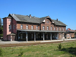
Ilmenau station
Distance: Approx. 292 meters
Latitude and longitude: 50.684167,10.922222
Ilmenau station is one of four stations in the Ilmenau municipality in the German state of Thuringia. The station is referred to locally as Ilmenau Hauptbahnhof (main station), but this has never been its official name.

St.-Jakobus-Kirche, Ilmenau
Church in Thuringia, Germany
Distance: Approx. 377 meters
Latitude and longitude: 50.68555556,10.91527778
The St.-Jakobus-Kirche (pronounced [zaŋkt jaˈkoːbʊsˌkɪʁçə], "St James Church") in the historical centre of Ilmenau, Thuringia, Germany, is a Lutheran parish church. The Ilmenau parish belongs to the Arnstadt-Ilmenau district of the Protestant Church in Central Germany. Colloquially, the St.-Jakobus-Kirche is called the Stadtkirche ("Town Church") for short.
Weather in this IP's area
clear sky
14 Celsius
13 Celsius
13 Celsius
16 Celsius
1023 hPa
79 %
1023 hPa
967 hPa
10000 meters
1.18 m/s
1.51 m/s
139 degree
3 %
05:39:13
21:06:09