Country:
 Switzerland
Region:
City:
Latitude and Longitude:
Time Zone:
Postal Code:
IP information under different IP Channel
ip-api
Country
Region
City
ASN
Time Zone
ISP
Blacklist
Proxy
Latitude
Longitude
Postal
Route
IPinfo
Country
Region
City
ASN
Time Zone
ISP
Blacklist
Proxy
Latitude
Longitude
Postal
Route
MaxMind
Country
Region
City
ASN
Time Zone
ISP
Blacklist
Proxy
Latitude
Longitude
Postal
Route
Luminati
Country
CHRegion
zh
City
dietikon
ASN
Time Zone
Europe/Zurich
ISP
green.ch AG
Latitude
Longitude
Postal
db-ip
Country
Region
City
ASN
Time Zone
ISP
Blacklist
Proxy
Latitude
Longitude
Postal
Route
ipdata
Country
Region
City
ASN
Time Zone
ISP
Blacklist
Proxy
Latitude
Longitude
Postal
Route
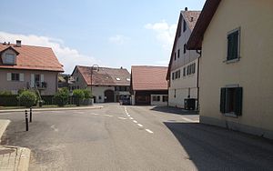
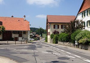
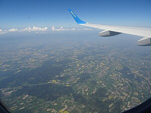
Popular places and events near this IP address
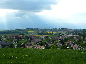
Cugy, Vaud
Municipality in Vaud, Switzerland
Distance: Approx. 4348 meters
Latitude and longitude: 46.58333333,6.63333333
Cugy is a municipality in the district of Gros-de-Vaud in the canton of Vaud in Switzerland.

Villars-Tiercelin
Former municipality in Vaud, Switzerland
Distance: Approx. 3872 meters
Latitude and longitude: 46.63333333,6.7
Villars-Tiercelin was a municipality in the district of Gros-de-Vaud in the canton of Vaud in Switzerland. The municipalities of Villars-Tiercelin, Montaubion-Chardonney, Sottens, Villars-Mendraz and Peney-le-Jorat merged on 1 July 2011 into the new municipality of Jorat-Menthue.

Bottens
Municipality in Vaud, Switzerland
Distance: Approx. 2289 meters
Latitude and longitude: 46.61666667,6.66666667
Bottens is a municipality in the district of Gros-de-Vaud in the canton of Vaud in Switzerland.

Bretigny-sur-Morrens
Municipality in Vaud, Switzerland
Distance: Approx. 3921 meters
Latitude and longitude: 46.6,6.63333333
Bretigny-sur-Morrens (French pronunciation: [bʁətiɲi syʁ mɔʁɑ̃] , literally Bretigny on Morrens) is a municipality in the district of Gros-de-Vaud in the canton of Vaud in Switzerland.
Froideville, Switzerland
Municipality in Vaud, Switzerland
Distance: Approx. 99 meters
Latitude and longitude: 46.6,6.68333333
Froideville is a municipality in the district of Gros-de-Vaud in the canton of Vaud in Switzerland.

Morrens
Municipality in Vaud, Switzerland
Distance: Approx. 4348 meters
Latitude and longitude: 46.58333333,6.63333333
Morrens (French pronunciation: [mɔʁɑ̃] ) is a municipality in the district of Gros-de-Vaud in the canton of Vaud in Switzerland.

Poliez-le-Grand
Former municipality in Vaud, Switzerland
Distance: Approx. 3935 meters
Latitude and longitude: 46.63333333,6.66666667
Poliez-le-Grand is a former municipality in the district of Gros-de-Vaud in the canton of Vaud in Switzerland. The municipalities of Dommartin, Naz, Poliez-le-Grand and Sugnens merged on 1 July 2011 into the new municipality of Montilliez.

Poliez-Pittet
Municipality in Switzerland
Distance: Approx. 3690 meters
Latitude and longitude: 46.63333333,6.68333333
Poliez-Pittet is a municipality in the district of Gros-de-Vaud in the canton of Vaud in Switzerland.

Montpreveyres
Municipality in Vaud, Switzerland
Distance: Approx. 4174 meters
Latitude and longitude: 46.58333333,6.73333333
Montpreveyres is a municipality in the district of Lavaux-Oron in the canton of Vaud in Switzerland.
Peney-le-Jorat
Former municipality in Vaud, Switzerland
Distance: Approx. 3062 meters
Latitude and longitude: 46.61666667,6.71666667
Peney-le-Jorat is a former municipality in the district of Gros-de-Vaud in the canton of Vaud in Switzerland. It is in the south-west of Switzerland, in close proximity to both France and Italy. The villages of Villars-Tiercelin, Montaubion-Chardonney, Sottens, Villars-Mendraz and Peney-le-Jorat merged on 1 July 2011 into the new municipality of Jorat-Menthue.
Jorat (Switzerland)
Distance: Approx. 2062 meters
Latitude and longitude: 46.58222222,6.69111111
The Jorat (German: "der Jurten") is the area of the Canton of Vaud (Switzerland) located between the Gros-de-Vaud, West and the Broye, East.
Montagne du Château
Mountain in Switzerland
Distance: Approx. 3218 meters
Latitude and longitude: 46.58083333,6.71583333
Montagne du Château (929 metres (3,048 ft)) is the highest hill of the Jorat. It lies west of Montpreveyres in the canton of Vaud, above the city of Lausanne. The hill is entirely wooded, except for its summit, where there is a clearing.
Weather in this IP's area
clear sky
18 Celsius
18 Celsius
17 Celsius
20 Celsius
1019 hPa
77 %
1019 hPa
928 hPa
10000 meters
0.8 m/s
1.62 m/s
83 degree
7 %
06:11:42
21:07:29