Country:
 Switzerland
Region:
City:
Latitude and Longitude:
Time Zone:
Postal Code:
IP information under different IP Channel
ip-api
Country
Region
City
ASN
Time Zone
ISP
Blacklist
Proxy
Latitude
Longitude
Postal
Route
IPinfo
Country
Region
City
ASN
Time Zone
ISP
Blacklist
Proxy
Latitude
Longitude
Postal
Route
MaxMind
Country
Region
City
ASN
Time Zone
ISP
Blacklist
Proxy
Latitude
Longitude
Postal
Route
Luminati
Country
CHRegion
zh
City
dietikon
ASN
Time Zone
Europe/Zurich
ISP
green.ch AG
Latitude
Longitude
Postal
db-ip
Country
Region
City
ASN
Time Zone
ISP
Blacklist
Proxy
Latitude
Longitude
Postal
Route
ipdata
Country
Region
City
ASN
Time Zone
ISP
Blacklist
Proxy
Latitude
Longitude
Postal
Route
Popular places and events near this IP address

Canton of Neuchâtel
Canton of Switzerland
Distance: Approx. 4169 meters
Latitude and longitude: 46.98333333,6.78333333
The Republic and Canton of Neuchâtel (French: République et Canton de Neuchâtel, German: Kanton Neuenburg; Romansh: Chantun Neuchâtel; Italian: Cantone di Neuchâtel) is a mostly French-speaking canton in western Switzerland. In 2007, its population was 169,782, of whom 39,654 (or 23.4%) were foreigners. The capital is Neuchâtel.
Brot-Dessous
Former municipality in Neuchâtel, Switzerland
Distance: Approx. 5617 meters
Latitude and longitude: 46.95,6.75
Brot-Dessous is a former municipality in the district of Boudry in the canton of Neuchâtel in Switzerland. On 1 January 2016 it was absorbed into Rochefort.
Brot-Plamboz
Municipality in Neuchâtel, Switzerland
Distance: Approx. 3622 meters
Latitude and longitude: 46.96666667,6.73333333
Brot-Plamboz is a municipality in the canton of Neuchâtel in Switzerland.
Le Cerneux-Péquignot
Municipality in Neuchâtel, Switzerland
Distance: Approx. 5440 meters
Latitude and longitude: 47.01666667,6.66666667
Le Cerneux-Péquignot is a municipality in the canton of Neuchâtel in Switzerland.

La Chaux-du-Milieu
Municipality in Neuchâtel, Switzerland
Distance: Approx. 3207 meters
Latitude and longitude: 47.01666667,6.7
La Chaux-du-Milieu (French pronunciation: [la ʃo dy miljø]) is a municipality in the canton of Neuchâtel in Switzerland.

Les Ponts-de-Martel
Municipality in Neuchâtel, Switzerland
Distance: Approx. 91 meters
Latitude and longitude: 47,6.73333333
Les Ponts-de-Martel is a municipality in the canton of Neuchâtel in Switzerland.

Noiraigue
Former municipality in Neuchâtel, Switzerland
Distance: Approx. 5626 meters
Latitude and longitude: 46.95,6.71666667
Noiraigue or Noiraigue-Les Œillons was a municipality in the district of Val-de-Travers in the canton of Neuchâtel in Switzerland. On 1 January 2009, the former municipalities of Boveresse, Buttes, Couvet, Fleurier, Les Bayards, Môtiers, Noiraigue, Saint-Sulpice and Travers merged to form Val-de-Travers.

La Tourne
Mountain pass in Switzerland
Distance: Approx. 4619 meters
Latitude and longitude: 46.98806389,6.79220556
La Tourne (el. 1170 m.) is a high mountain pass in the Jura Mountains in the canton of Neuchâtel in Switzerland. It connects Les Ponts-de-Martel and Montmollin.

Rocher des Tablettes
Mountain in Switzerland
Distance: Approx. 4815 meters
Latitude and longitude: 46.97611111,6.78722222
The Rocher des Tablettes (1,288 m) is a mountain of the Jura, located west of Rochefort in the canton of Neuchâtel. Its south side consists of steep limestone cliffs overlooking the valley of the Areuse.
Grand Som Martel
Mountain in Switzerland
Distance: Approx. 2960 meters
Latitude and longitude: 47.02305556,6.75083333
The Grand Som Martel (1,337 m) is a mountain of the Jura, located between Le Locle and Les Ponts-de-Martel in the canton of Neuchâtel.

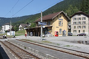
Champ-du-Moulin railway station
Distance: Approx. 5386 meters
Latitude and longitude: 46.95991194,6.77498889
Champ-du-Moulin railway station (French: Gare de Champ-du-Moulin) is a railway station in the municipality of Rochefort, in the Swiss canton of Neuchâtel. It is an intermediate stop on the standard gauge Neuchâtel–Pontarlier line of Swiss Federal Railways.
Noiraigue railway station
Distance: Approx. 5010 meters
Latitude and longitude: 46.95492,6.72179889
Noiraigue railway station (French: Gare de Noiraigue) is a railway station in the municipality of Val-de-Travers, in the Swiss canton of Neuchâtel. It is an intermediate stop on the standard gauge Neuchâtel–Pontarlier line of Swiss Federal Railways.
Weather in this IP's area
clear sky
15 Celsius
15 Celsius
15 Celsius
17 Celsius
1019 hPa
88 %
1019 hPa
904 hPa
10000 meters
06:10:14
21:08:33