Country:
 Iceland
Region:
City:
Latitude and Longitude:
Time Zone:
Postal Code:
IP information under different IP Channel
ip-api
Country
Region
City
ASN
Time Zone
ISP
Blacklist
Proxy
Latitude
Longitude
Postal
Route
IPinfo
Country
Region
City
ASN
Time Zone
ISP
Blacklist
Proxy
Latitude
Longitude
Postal
Route
MaxMind
Country
Region
City
ASN
Time Zone
ISP
Blacklist
Proxy
Latitude
Longitude
Postal
Route
Luminati
Country
ISRegion
1
City
hafnarfjordur
ASN
Time Zone
Atlantic/Reykjavik
ISP
Ljosleidarinn ehf
Latitude
Longitude
Postal
db-ip
Country
Region
City
ASN
Time Zone
ISP
Blacklist
Proxy
Latitude
Longitude
Postal
Route
ipdata
Country
Region
City
ASN
Time Zone
ISP
Blacklist
Proxy
Latitude
Longitude
Postal
Route
Popular places and events near this IP address
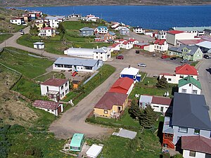
Hólmavík
Village in Iceland
Distance: Approx. 1154 meters
Latitude and longitude: 65.71666667,-21.68333333
Hólmavík (Icelandic pronunciation: [ˈhoulmaˌviːk]) is a village in the western part of Iceland, by Steingrímsfjörður. It is the largest settlement in Strandir and serves as a centre of commerce for the county. Hólmavík is part of the Strandabyggð municipality and has 375 inhabitants (2011 census).

Strandabyggð
Municipality in Westfjords, Iceland
Distance: Approx. 270 meters
Latitude and longitude: 65.7067,-21.66532
Strandabyggð (Icelandic pronunciation: [ˈstrantaˌpɪɣθ] ) is a municipality located in northwestern Iceland.

Hólmavík Airport
Airport
Distance: Approx. 1333 meters
Latitude and longitude: 65.70277778,-21.69722222
Hólmavík Airport (IATA: HVK, ICAO: BIHK) is an airport serving Hólmavík, Iceland. The Holmavik non-directional beacon (Ident: HK) is located 12 kilometres (7.5 mi) southeast of the airport.

Strandagaldur
Distance: Approx. 275 meters
Latitude and longitude: 65.7064,-21.6656
Strandagaldur (Icelandic pronunciation: [ˈstrantaˌkaltʏr̥]), also known as The Museum of Icelandic Sorcery and Witchcraft, is a privately operated and publicly accessible museum dedicated to the folklore and history of sorcery and witchcraft in Iceland. First opened in 2000, and curated by Sigurður Atlason (d. 2018), the museum is located in the coastal town Hólmavík.
Weather in this IP's area
overcast clouds
11 Celsius
11 Celsius
11 Celsius
11 Celsius
998 hPa
87 %
998 hPa
993 hPa
10000 meters
3.04 m/s
7.55 m/s
184 degree
100 %
03:58:50
23:07:17