Country:
 Germany
Region:
City:
Latitude and Longitude:
Time Zone:
Postal Code:
IP information under different IP Channel
ip-api
Country
Region
City
ASN
Time Zone
ISP
Blacklist
Proxy
Latitude
Longitude
Postal
Route
IPinfo
Country
Region
City
ASN
Time Zone
ISP
Blacklist
Proxy
Latitude
Longitude
Postal
Route
MaxMind
Country
Region
City
ASN
Time Zone
ISP
Blacklist
Proxy
Latitude
Longitude
Postal
Route
Luminati
Country
DEASN
Time Zone
Europe/Berlin
ISP
euNetworks GmbH
Latitude
Longitude
Postal
db-ip
Country
Region
City
ASN
Time Zone
ISP
Blacklist
Proxy
Latitude
Longitude
Postal
Route
ipdata
Country
Region
City
ASN
Time Zone
ISP
Blacklist
Proxy
Latitude
Longitude
Postal
Route
Popular places and events near this IP address
County of Castell
Distance: Approx. 5025 meters
Latitude and longitude: 49.75,10.33333333
Castell was a county of northern Bavaria, Germany, ruling a string of territories in the historical region of Franconia, both east and west of Würzburg. Little is known about the noble Counts of Castell, although they were the counts of Kreis Gerolzhofen, Regierungsbezirk, and Unterfranken of Bavaria. They were a member of the Fränkische Grafenkolleg ("Franconian Counts College").
Castell-Rüdenhausen
Distance: Approx. 3143 meters
Latitude and longitude: 49.7665,10.3395
Castell-Rüdenhausen was a County in the region of Franconia in northern Bavaria of the Holy Roman Empire, ruled by a branch of the Counts of Castell. It was created as a partition of Castell and in 1806, it was mediatised to Bavaria. A branch of the Princely House is the famous noble Faber-Castell family.

Castell-Castell
County in the Holy Roman Empire
Distance: Approx. 5899 meters
Latitude and longitude: 49.7416,10.3499
Castell-Castell was a county in the Holy Roman Empire, ruled by a branch of the Counts of Castell. It was established as a partition of Castell-Remlingen in 1668, and it was partitioned between itself and Castell in 1709. It annexed the County of Castell in 1772, and was mediatised to Bavaria in 1806.

Brünnau
Distance: Approx. 6188 meters
Latitude and longitude: 49.85,10.35
Brünnau is a village in the district of Kitzingen, Lower Franconia, Bavaria, Germany. It's a district of Prichsenstadt. Located about 20 miles south of Schweinfurt on route 286 and east of Würzburg 20 miles.

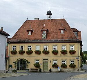
Prichsenstadt
Town in Bavaria, Germany
Distance: Approx. 2608 meters
Latitude and longitude: 49.81666667,10.33333333
Prichsenstadt (German: [ˈpʁɪksn̩ˌʃtat] ) is a town in the district of Kitzingen, Lower Franconia, Bavaria, Germany.
Abtswind
Municipality in Bavaria, Germany
Distance: Approx. 3465 meters
Latitude and longitude: 49.76666667,10.36666667
Abtswind is a municipality in the district of Kitzingen in Bavaria in Germany.

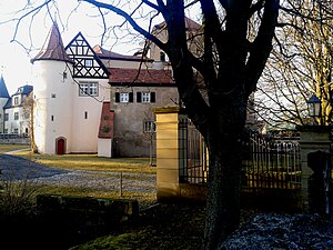
Castell, Bavaria
Municipality in Bavaria, Germany
Distance: Approx. 5025 meters
Latitude and longitude: 49.75,10.33333333
Castell is a municipality in the district of Kitzingen in Bavaria in Germany. It was the seat of the Counts of Castell. Today it is part of the municipal association Wiesentheid.

Kleinlangheim
Municipality in Bavaria, Germany
Distance: Approx. 6433 meters
Latitude and longitude: 49.76666667,10.26666667
Kleinlangheim is a municipality in the district of Kitzingen in Lower Franconia, Bavaria in Germany.
Rüdenhausen
Municipality in Bavaria, Germany
Distance: Approx. 3118 meters
Latitude and longitude: 49.76666667,10.35
Rüdenhausen is a market town and municipality in the district of Kitzingen in Bavaria in Germany.
Wiesenbronn
Municipality in Bavaria, Germany
Distance: Approx. 5921 meters
Latitude and longitude: 49.75,10.3
Wiesenbronn is a municipality in the district of Kitzingen in Bavaria in Germany.

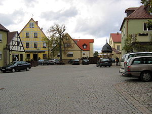
Wiesentheid
Municipality in Bavaria, Germany
Distance: Approx. 706 meters
Latitude and longitude: 49.8,10.35
Wiesentheid is a municipality in the district of Kitzingen in Bavaria in Germany.
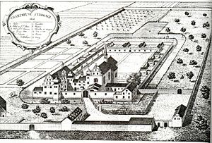
Ilmbach Charterhouse
Distance: Approx. 4698 meters
Latitude and longitude: 49.804,10.4088
Ilmbach Charterhouse, also Mariengarten Charterhouse (German: Kloster or Kartause Ilmbach; Kartause Mariengarten), is a former Carthusian monastery, or charterhouse, in Prichsenstadt in Bavaria, Germany.
Weather in this IP's area
clear sky
18 Celsius
18 Celsius
18 Celsius
18 Celsius
1021 hPa
65 %
1021 hPa
992 hPa
10000 meters
2.11 m/s
2.12 m/s
85 degree
05:44:52
21:05:05