Country:
Region:
City:
Latitude and Longitude:
Time Zone:
Postal Code:
IP information under different IP Channel
ip-api
Country
Region
City
ASN
Time Zone
ISP
Blacklist
Proxy
Latitude
Longitude
Postal
Route
IPinfo
Country
Region
City
ASN
Time Zone
ISP
Blacklist
Proxy
Latitude
Longitude
Postal
Route
MaxMind
Country
Region
City
ASN
Time Zone
ISP
Blacklist
Proxy
Latitude
Longitude
Postal
Route
Luminati
Country
ASN
Time Zone
Europe/Berlin
ISP
euNetworks GmbH
Latitude
Longitude
Postal
db-ip
Country
Region
City
ASN
Time Zone
ISP
Blacklist
Proxy
Latitude
Longitude
Postal
Route
ipdata
Country
Region
City
ASN
Time Zone
ISP
Blacklist
Proxy
Latitude
Longitude
Postal
Route
Popular places and events near this IP address

Arenrath
Municipality in Rhineland-Palatinate, Germany
Distance: Approx. 2996 meters
Latitude and longitude: 49.95472222,6.74138889
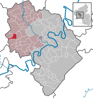
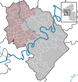
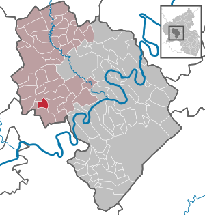
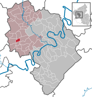
Arenrath is an Ortsgemeinde – a municipality belonging to a Verbandsgemeinde, a kind of collective municipality – in the Bernkastel-Wittlich district in Rhineland-Palatinate, Germany.

Dierscheid
Municipality in Rhineland-Palatinate, Germany
Distance: Approx. 3707 meters
Latitude and longitude: 49.9,6.76666667
Dierscheid is an Ortsgemeinde – a municipality belonging to a Verbandsgemeinde, a kind of collective municipality – in the Bernkastel-Wittlich district in Rhineland-Palatinate, Germany.

Dodenburg
Municipality in Rhineland-Palatinate, Germany
Distance: Approx. 2323 meters
Latitude and longitude: 49.91414167,6.77956389
Dodenburg is an Ortsgemeinde – a municipality belonging to a Verbandsgemeinde, a kind of collective municipality – in the Bernkastel-Wittlich district in Rhineland-Palatinate, Germany.

Dreis
Municipality in Rhineland-Palatinate, Germany
Distance: Approx. 3724 meters
Latitude and longitude: 49.94100833,6.81727778
Dreis is an Ortsgemeinde – a municipality belonging to a Verbandsgemeinde, a kind of collective municipality – in the Bernkastel-Wittlich district in Rhineland-Palatinate, Germany.

Heckenmünster
Municipality in Rhineland-Palatinate, Germany
Distance: Approx. 3082 meters
Latitude and longitude: 49.90916667,6.78777778
Heckenmünster is an Ortsgemeinde – a municipality belonging to a Verbandsgemeinde, a kind of collective municipality – in the Bernkastel-Wittlich district in Rhineland-Palatinate, Germany.

Heidweiler
Municipality in Rhineland-Palatinate, Germany
Distance: Approx. 2867 meters
Latitude and longitude: 49.91111111,6.74638889
Heidweiler is an Ortsgemeinde – a municipality belonging to a Verbandsgemeinde, a kind of collective municipality – in the Bernkastel-Wittlich district in Rhineland-Palatinate, Germany.

Niersbach
Municipality in Rhineland-Palatinate, Germany
Distance: Approx. 1900 meters
Latitude and longitude: 49.94027778,6.7425
Niersbach is an Ortsgemeinde – a municipality belonging to a Verbandsgemeinde, a kind of collective municipality – in the Bernkastel-Wittlich district in Rhineland-Palatinate, Germany.

Binsfeld
Municipality in Rhineland-Palatinate, Germany
Distance: Approx. 5526 meters
Latitude and longitude: 49.96555556,6.70805556
Binsfeld near Wittlich in the Eifel is an Ortsgemeinde – a municipality belonging to a Verbandsgemeinde, a kind of collective municipality – in the Bernkastel-Wittlich district in Rhineland-Palatinate, Germany. Nearby is the American Spangdahlem Air Base.

Bruch, Rhineland-Palatinate
Municipality in Rhineland-Palatinate, Germany
Distance: Approx. 2932 meters
Latitude and longitude: 49.95694444,6.78472222
Bruch is an Ortsgemeinde – a municipality belonging to a Verbandsgemeinde, a kind of collective municipality – in the Bernkastel-Wittlich district in Rhineland-Palatinate, Germany.

Gladbach, Rhineland-Palatinate
Municipality in Rhineland-Palatinate, Germany
Distance: Approx. 209 meters
Latitude and longitude: 49.93472222,6.76861111
Gladbach is an Ortsgemeinde – a municipality belonging to a Verbandsgemeinde, a kind of collective municipality – in the Bernkastel-Wittlich district in Rhineland-Palatinate, Germany.

Herforst
Municipality in Rhineland-Palatinate, Germany
Distance: Approx. 5145 meters
Latitude and longitude: 49.945,6.69722222
Herforst is a municipality in the district of Bitburg-Prüm, in Rhineland-Palatinate, western Germany.
Kellerberg (Meulenwald)
Distance: Approx. 4339 meters
Latitude and longitude: 49.8945,6.760889
The Kellerberg is a hill, 448.8 m above sea level (NHN), and the highest point of the Eifel part of the Meulenwald and of the collective municipality of Wittlich-Land. It rises near Dierscheid in the county of Bernkastel-Wittlich in the German state of Rhineland-Palatinate. At the top is the Kellerberg Observation Tower.
Weather in this IP's area
clear sky
25 Celsius
25 Celsius
23 Celsius
26 Celsius
1022 hPa
43 %
1022 hPa
992 hPa
10000 meters
5.66 m/s
110 degree
05:58:41
21:19:54