Country:
Region:
City:
Latitude and Longitude:
Time Zone:
Postal Code:
IP information under different IP Channel
ip-api
Country
Region
City
ASN
Time Zone
ISP
Blacklist
Proxy
Latitude
Longitude
Postal
Route
IPinfo
Country
Region
City
ASN
Time Zone
ISP
Blacklist
Proxy
Latitude
Longitude
Postal
Route
MaxMind
Country
Region
City
ASN
Time Zone
ISP
Blacklist
Proxy
Latitude
Longitude
Postal
Route
Luminati
Country
ASN
Time Zone
Europe/Berlin
ISP
euNetworks GmbH
Latitude
Longitude
Postal
db-ip
Country
Region
City
ASN
Time Zone
ISP
Blacklist
Proxy
Latitude
Longitude
Postal
Route
ipdata
Country
Region
City
ASN
Time Zone
ISP
Blacklist
Proxy
Latitude
Longitude
Postal
Route
Popular places and events near this IP address

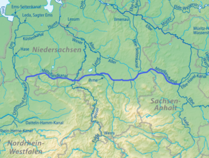
Mittelland Canal
Distance: Approx. 6704 meters
Latitude and longitude: 52.42111111,9.70111111
The Mittelland Canal, also known as the Midland Canal, (German: Mittellandkanal, German: [ˈmɪtl̩.lant.kaˌnaːl] ) is a major canal in central Germany. It forms an important link in the waterway network of the country, providing the principal east-west inland waterway connection. Its significance goes beyond Germany as it links France, Switzerland and the Benelux countries with Poland, the Czech Republic and the Baltic Sea.

Hannover Airport
International airport in Germany
Distance: Approx. 5544 meters
Latitude and longitude: 52.460214,9.683522
Hannover Airport (IATA: HAJ, ICAO: EDDV) is the international airport of Hanover, capital of the German state of Lower Saxony. The ninth largest airport in Germany, it is situated on 570 hectares (1,400 acres) in Langenhagen, 11 kilometres (6.8 mi) north of the centre of Hanover. The airport has flights to European metropolitan and leisure destinations, and serves as a base for Eurowings, Corendon Airlines Europe and TUI fly Deutschland.
Garbsen
Town in Lower Saxony, Germany
Distance: Approx. 2633 meters
Latitude and longitude: 52.41833333,9.59805556
Garbsen (German pronunciation: [ˈɡaʁpsn̩] ) is a town in the district of Hanover, in Lower Saxony, Germany. It is situated on the river Leine, approx. 11 km northwest of Hanover.

Seelze
Town in Lower Saxony, Germany
Distance: Approx. 5064 meters
Latitude and longitude: 52.39611111,9.59805556
Seelze is a town in the district of Hanover, in Lower Saxony, Germany. It is situated on the river Leine, approximately 10 kilometres (6.2 mi) west of Hanover. Today Seelze mainly plays the role of a bedroom town for commuters working in Hanover.

Baitus Sami Mosque (Hanover)
Mosque in Hanover, Germany
Distance: Approx. 3637 meters
Latitude and longitude: 52.429634,9.658125
The Baitus Sami mosque (literally, 'house of the hearer') is located in the German city of Hanover. It has both a dome and minaret, although the minaret is too slender to be climbed. Built by an Ahmadiyya community, the mosque comprises approximately 2,800 square metres (30,000 sq ft), with space for 300 worshippers.

Seelze station
Distance: Approx. 5566 meters
Latitude and longitude: 52.39194444,9.59388889
Seelze is a railway station located in Seelze, Germany. The station is located on the Hanover–Minden railway and the Bremen–Hanover railway. The train services are operated by Deutsche Bahn as part of the Hanover S-Bahn.

Letter station
Distance: Approx. 5683 meters
Latitude and longitude: 52.39416667,9.64055556
Letter is a railway station located in Letter, Germany. The station is located on the Hanover–Minden railway and the Bremen–Hanover railway. The train services are operated by Deutsche Bahn as part of the Hanover S-Bahn.
Lohnder Bach
River in Germany
Distance: Approx. 5132 meters
Latitude and longitude: 52.405,9.5612
Lohnder Bach is a small river of Lower Saxony, Germany. It flows into the Leine in Lohnde.

Institut für Integrierte Produktion Hannover
Distance: Approx. 3376 meters
Latitude and longitude: 52.415,9.63305556
Institut für Integrierte Produktion Hannover (IPH), which literally translates as "Hanover institute of integrated production", is a non-profit limited company providing research and development, consulting, and training in industrial engineering.
Engelbostel
Place in Hanover region, Germany
Distance: Approx. 3587 meters
Latitude and longitude: 52.446751,9.660072
Engelbostel is a district of the city of Langenhagen in the Hanover region. It was independent until 1974 when the village was incorporated into Langenhagen. The town is located southwest of the Hannover-Langenhagen airport.
Hanover Airport station
Railway station in Langenhagen, Germany
Distance: Approx. 6454 meters
Latitude and longitude: 52.4585,9.6988
Hanover Airport (German: Bahnhof Hannover Flughafen) is a railway station located under the terminal of Hanover Airport, Germany. The station is located on a branch of the Heath Railway. The train services are operated by Deutsche Bahn as part of the Hanover S-Bahn.

Wilhelm-Langrehr-Stadion
Football stadium in Garbsen, Germany
Distance: Approx. 3680 meters
Latitude and longitude: 52.40833333,9.60222222
Wilhelm-Langrehr-Stadion is a football stadium in the Havelse district of the Lower Saxon town of Garbsen. It is home to Regionalliga side TSV Havelse. The stadium has a capacity of 3,500.
Weather in this IP's area
clear sky
15 Celsius
15 Celsius
13 Celsius
17 Celsius
1026 hPa
91 %
1026 hPa
1020 hPa
10000 meters
1.03 m/s
190 degree
05:37:20
21:18:31


