Country:
 Luxembourg
Region:
City:
Latitude and Longitude:
Time Zone:
Postal Code:
IP information under different IP Channel
ip-api
Country
IPinfo
Country
MaxMind
Country
Luminati
Country
 US
USASN
Time Zone
America/Chicago
ISP
Ses Astra S.A.
Latitude
Longitude
Postal
db-ip
Country
ipdata
Country
Popular places and events near this IP address

Luxembourg City
Capital and largest city of Luxembourg
Distance: Approx. 141 meters
Latitude and longitude: 49.61166667,6.13194444
Luxembourg (Luxembourgish: Lëtzebuerg; French: Luxembourg; German: Luxemburg), also known as Luxembourg City (Luxembourgish: Stad Lëtzebuerg or d'Stad; French: Ville de Luxembourg; German: Stadt Luxemburg or Luxemburg-Stadt), is the capital city of Luxembourg and the country's most populous commune. Standing at the confluence of the Alzette and Pétrusse rivers in southern Luxembourg, the city lies at the heart of Western Europe, situated 213 km (132 mi) by road from Brussels and 209 km (130 mi) from Cologne. The city contains Luxembourg Castle, established by the Franks in the Early Middle Ages, around which a settlement developed.

Fortress of Luxembourg
Fortifications in and around Luxembourg City, Luxembourg, largely dismantled in 1867
Distance: Approx. 167 meters
Latitude and longitude: 49.61,6.13
The Fortress of Luxembourg (Luxembourgish: Festung Lëtzebuerg; French: Forteresse de Luxembourg; German: Festung Luxemburg) is the former fortifications of Luxembourg City, the capital of the Grand Duchy of Luxembourg, which were mostly dismantled beginning in 1867. The fortress was of great strategic importance for the control of the Left Bank of the Rhine, the Low Countries, and the border area between France and Germany. The fortifications were built gradually over nine centuries, from soon after the city's foundation in the tenth century until 1867.
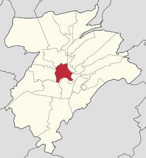
Ville Haute
Quarter in Luxembourg City, Luxembourg
Distance: Approx. 91 meters
Latitude and longitude: 49.612,6.129
Ville Haute (Luxembourgish: Uewerstad, pronounced [ˈuəvɐʃtaːt] ; German: Oberstadt; lit. 'High City') is a quarter in central Luxembourg City, in southern Luxembourg. It is the historic center of Luxembourg City and is involved in its UNESCO World Heritage Site status. As of 31 December 2022, Ville Haute has a population of 3,544 inhabitants.

Place Guillaume II
Square in Luxembourg, Luxembourg
Distance: Approx. 77 meters
Latitude and longitude: 49.61083333,6.13027778
Place Guillaume II is a town square in Luxembourg City, in southern Luxembourg. The square is in the heart of Luxembourg's historic Ville Haute quarter. It is colloquially known as Knuedler, from the Luxembourgish language's word for "knot", referring to the knot in the belt worn by Franciscan friars.

Luxembourg City Hall
Distance: Approx. 148 meters
Latitude and longitude: 49.61020556,6.13045556
Luxembourg City Hall (Luxembourgish: Stadhaus Stad Lëtzebuerg; French: Hôtel de ville de Luxembourg) is the city hall of Luxembourg City, in southern Luxembourg. The city hall is the centre of local government, including being used as the private office of the Mayor of Luxembourg City. Because of its position in Luxembourg's capital, it regularly hosts foreign dignitaries.

Cercle Municipal
Distance: Approx. 24 meters
Latitude and longitude: 49.61138889,6.12972222
The Cercle Municipal or Cercle Cité is a building in Luxembourg City, in southern Luxembourg, It is located at the eastern end of the Place d'Armes, in the historic central Ville Haute quarter of the city.
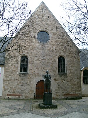
Théâtre des Capucins
Distance: Approx. 149 meters
Latitude and longitude: 49.6128,6.1305
Théâtre des Capucins (Luxembourgish: Kapuzinertheater) is a theatre in Luxembourg City, Luxembourg. It is part of the Théâtres de la Ville de Luxembourg. Directed by Frank Feitler, the Capucin Theater is located in the heart of the Old Town.

Place d'Armes (Luxembourg)
Square in Luxembourg
Distance: Approx. 91 meters
Latitude and longitude: 49.61111111,6.12888889
The Place d'Armes (Luxembourgish: Plëss d'Arem, or simply Plëss) is a square in Luxembourg City in the south of the Grand Duchy of Luxembourg. Centrally placed in the old town, it attracts large numbers of locals and visitors, especially in the summer months. It originally served as a parade ground for the troops defending the city.
Timeline of Luxembourg City
Distance: Approx. 19 meters
Latitude and longitude: 49.611667,6.13
The following is a timeline of the history of Luxembourg City, Luxembourg.

ARBED building
Former headquarters of ArcelorMittal
Distance: Approx. 164 meters
Latitude and longitude: 49.6125,6.13166667
The ARBED building is the generally used name for the headquarters of ArcelorMittal and one of its predecessors, the ARBED steel manufacturing company, which was completed in 1922 on the Avenue de la Liberté, opposite the Rose Garden in Luxembourg City. The architect was the Frenchman René Théry, and construction was overseen by Sosthène Weis.
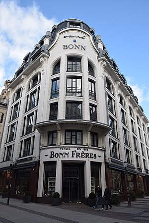
Palais du Mobilier Bonn Frères
Distance: Approx. 127 meters
Latitude and longitude: 49.61131,6.12827
The Palais du Mobilier Bonn Frères (in English: Bonn Frères Furniture Showroom) is an Art Deco-style building in Luxembourg City, Luxembourg, designed by the architect Léon Bouvart (1883–1933) and built in 1925–26 by the contractor Achille Giorgetti for the Bonn family.

Old City of Luxembourg
UNESCO World Heritage Site
Distance: Approx. 56 meters
Latitude and longitude: 49.611,6.13
The Old City of Luxembourg (officially City of Luxembourg: its Old Quarters and Fortifications) is located mainly in Ville Haute (Uewerstad) in Luxembourg City, Grand Duchy of Luxembourg. The site was added to the UNESCO World Heritage list in 1994. The origin of the city was a fort built in the 10th century and had to be demolished in most parts in the 19th century (the casemates, the bastion and some walls still exist partly).
Weather in this IP's area
broken clouds
22 Celsius
23 Celsius
22 Celsius
23 Celsius
1017 hPa
76 %
1017 hPa
981 hPa
10000 meters
3.62 m/s
6.24 m/s
254 degree
76 %
05:39:46
21:41:35