Country:
 USA
USARegion:
City:
Latitude and Longitude:
Time Zone:
Postal Code:
IP information under different IP Channel
ip-api
Country
Region
City
ASN
Time Zone
ISP
Blacklist
Proxy
Latitude
Longitude
Postal
Route
IPinfo
Country
Region
City
ASN
Time Zone
ISP
Blacklist
Proxy
Latitude
Longitude
Postal
Route
MaxMind
Country
Region
City
ASN
Time Zone
ISP
Blacklist
Proxy
Latitude
Longitude
Postal
Route
Luminati
Country
 PH
PHASN
Time Zone
Asia/Manila
ISP
Ses Astra S.A.
Latitude
Longitude
Postal
db-ip
Country
Region
City
ASN
Time Zone
ISP
Blacklist
Proxy
Latitude
Longitude
Postal
Route
ipdata
Country
Region
City
ASN
Time Zone
ISP
Blacklist
Proxy
Latitude
Longitude
Postal
Route
Popular places and events near this IP address

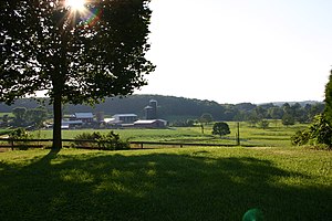
Mount Airy, Maryland
Town in Maryland
Distance: Approx. 1832 meters
Latitude and longitude: 39.37472222,-77.15555556
Mount Airy is a town in Carroll and Frederick counties in the U.S. state of Maryland. It is part of both the Washington Metropolitan Area and Baltimore Metropolitan Area. As of the 2010 census the population was 9,288.
Lisbon, Maryland
Census-designated place in Maryland
Distance: Approx. 8777 meters
Latitude and longitude: 39.33694444,-77.07361111
Lisbon is a census-designated place located in western Howard County in the state of Maryland, United States, located roughly between Baltimore and Frederick and north of Washington, D.C. It is contained in an area of roughly one square mile. Lisbon is located along Interstate 70 and Maryland Route 144 and is home to the first roundabout in Maryland (opened in 1993). It first appeared as a CDP in the 2020 Census with a population of 282.
Woodbine, Maryland
Unincorporated community in Maryland, United States
Distance: Approx. 8154 meters
Latitude and longitude: 39.36083333,-77.06194444
Woodbine is an unincorporated rural community in Howard and Carroll counties, Maryland, United States. It is part of the Baltimore metropolitan area. It is located southeast of Frederick, west of Baltimore, north of Washington, D.C., and east of Mount Airy.
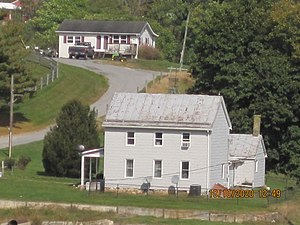
Drummine Farm
Historic house in Maryland, United States
Distance: Approx. 9282 meters
Latitude and longitude: 39.4275,-77.24527778
The Drummine Farm is a historic home and farm complex located at New Market, Frederick County, Maryland, United States. The main house was constructed about 1790 and is a 2+1⁄2-story structure of uncoursed fieldstone. The house retains Georgian stylistic influences in exterior and interior decorative detailing.
Mount Airy Historic District (Mount Airy, Maryland)
Historic district in Maryland, United States
Distance: Approx. 1781 meters
Latitude and longitude: 39.37527778,-77.15583333
The Mount Airy Historic District is a national historic district in Mount Airy, located in Carroll and Frederick County, Maryland. The district comprises a cohesive group of commercial, residential, and ecclesiastical buildings dating from the late 19th through early 20th centuries. The brick Baltimore and Ohio Railroad station, designed by E. Francis Baldwin and constructed in 1882, represents the town's origin as an early transportation center for the region, which dates back as early as 1838.
Sherwood Forest, Frederick County, Maryland
Unincorporated community in Maryland, U.S.
Distance: Approx. 7503 meters
Latitude and longitude: 39.3875,-77.23583333
Sherwood Forest is an unincorporated community in Frederick County, Maryland, United States.
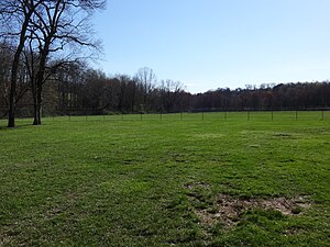
Parr's Ridge
Ridge which forms the summit of the Piedmont Plateau region in the U.S. state of Maryland
Distance: Approx. 1707 meters
Latitude and longitude: 39.4,-77.13333333
Parr's Ridge is a ridge which forms the summit of the Piedmont Plateau region in the U.S. state of Maryland. The ridge, a gentle summit in contrast to Maryland's Appalachian ridges to the west, extends from southwest to northeast through Montgomery, Howard and Carroll counties. The highest point in Maryland east of the Appalachian Mountains, Dug Hill in northern Carroll County, at an elevation of just over 1100 feet (335 m), is a mile or two to the west of the ridge.
Roxbury Mill
Historic site
Distance: Approx. 6343 meters
Latitude and longitude: 39.41666667,-77.08333333
Roxbury Mill is a historic flour and grist mill located in Glenwood, Howard County, Maryland, now part of the Howard County Farm Museum. The Roxbury Mill is located next to the Catt Tale (Cat Tail) river and with construction starting in 1753 by Capt. Philemon Dorsey Richard and John Dorsey settled plantations near the site in 1776.
Poplar Springs, Maryland
Place in Maryland
Distance: Approx. 6899 meters
Latitude and longitude: 39.34333333,-77.09638889
Poplar Springs is a town located in western Howard County in the state of Maryland, United States. The town is named for the "Poplar Spring Branch", where Levin Lawrance settled in 1741 and Captain Philimon Dorsey settled in 1750 on a land patent named "Dorseys Grove". Old Frederick Road was built through the town, following a Native American foot trail.
Hubert Black House
Historic site
Distance: Approx. 7602 meters
Latitude and longitude: 39.33333333,-77.1
Hubert Black House is a historic house and farm located in Woodbine (Formerly Florence), Howard County, Maryland. It was named after J. Hubert Black, a Howard County parole officer, and later, a County Commissioner who ran on a no growth platform in 1962, who approved the Rouse Company development of Columbia, Maryland. The Black House sits on a 250-acre former dairy farmed by the Black family since 1883.
Simpson-Poplar Springs African Methodist Episcopal Church
Distance: Approx. 7064 meters
Latitude and longitude: 39.338438,-77.101397
Simpson-Poplar Springs African Methodist Episcopal Church, is a historic African Methodist Episcopal Church located at 16901 Hardy Road in Poplar Springs, near Mount Airy, Maryland. The building was constructed in 1893.
Taylorsville, Maryland
Unincorporated community in Maryland, U.S.
Distance: Approx. 9213 meters
Latitude and longitude: 39.45777778,-77.08666667
Taylorsville is an unincorporated place in Carroll County, Maryland, United States. Taylorsville is located where MD 26 and MD 27 intersect, approximately 17 miles east of Frederick and 27 miles northwest of Baltimore. Taylorsville is near Morgan Run Natural Environment Area.
Weather in this IP's area
clear sky
28 Celsius
28 Celsius
27 Celsius
30 Celsius
1018 hPa
41 %
1018 hPa
992 hPa
10000 meters
0.89 m/s
1.79 m/s
29 degree
06:04:17
20:25:40