Country:
 United Arab Emirates
Region:
City:
Latitude and Longitude:
Time Zone:
Postal Code:
IP information under different IP Channel
ip-api
Country
Region
City
ASN
Time Zone
ISP
Blacklist
Proxy
Latitude
Longitude
Postal
Route
IPinfo
Country
Region
City
ASN
Time Zone
ISP
Blacklist
Proxy
Latitude
Longitude
Postal
Route
MaxMind
Country
Region
City
ASN
Time Zone
ISP
Blacklist
Proxy
Latitude
Longitude
Postal
Route
Luminati
Country
AERegion
sh
City
sharjah
ASN
Time Zone
Asia/Dubai
ISP
Emirates Integrated Telecommunications Company PJSC
Latitude
Longitude
Postal
db-ip
Country
Region
City
ASN
Time Zone
ISP
Blacklist
Proxy
Latitude
Longitude
Postal
Route
ipdata
Country
Region
City
ASN
Time Zone
ISP
Blacklist
Proxy
Latitude
Longitude
Postal
Route
Popular places and events near this IP address
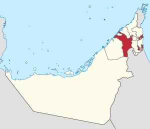
Emirate of Sharjah
Constituent Emirate of the United Arab Emirates
Distance: Approx. 1245 meters
Latitude and longitude: 25.3575,55.39083333
The Emirate of Sharjah (; Arabic: إِمَارَة ٱلشَّارِقَة Imārat Aš-Šāriqah) is one of the emirates of the United Arab Emirates, which covers 2,590 square kilometres (1,000 sq mi) and has a population of over 1,400,000 (2015). It comprises the capital city of Sharjah, after which it is named, and other minor towns and exclaves such as Kalba', Al Dhaid, Dibba Al-Hisn and Khor Fakkan. The emirate is an absolute monarchy.
Al Naba'ah
Area of the emirate of Sharjah in the United Arab Emirates
Distance: Approx. 1090 meters
Latitude and longitude: 25.3645,55.3961
Al Naba'ah is an area of the emirate of Sharjah in the United Arab Emirates.
Sharjah Indian School
Secondary school in UAE
Distance: Approx. 1475 meters
Latitude and longitude: 25.34471337,55.40841941
Sharjah Indian School is a senior secondary school in Sharjah, United Arab Emirates, having approximately 13,937 students and 588 teachers. It is owned and managed by Indian Association Sharjah, located in the United Arab Emirates. It expanded in 2016 to a new building in the Juwaiza area of Sharjah near Sajaa.

Sharjah
Capital of the Emirate of Sharjah, United Arab Emirates
Distance: Approx. 1245 meters
Latitude and longitude: 25.3575,55.39083333
Sharjah (; Arabic: ٱلشَّارقَة aš-Šāriqah, Gulf Arabic: aš-Šārja) is the third-most populous city in the United Arab Emirates, after Dubai and Abu Dhabi. It is the capital of the Emirate of Sharjah and forms part of the Dubai-Sharjah-Ajman metropolitan area. Sharjah is the capital of the eponymous emirate.

Sharjah Art Museum
Distance: Approx. 1697 meters
Latitude and longitude: 25.36143,55.38702
The Sharjah Art Museum is an art museum in the city of Sharjah, United Arab Emirates. It was housed in Bait Al Serkal in Al Shuwaihean Area. It is one of the leading art institutions in the Persian Gulf region.
Russian Orthodox Church, Sharjah
Distance: Approx. 796 meters
Latitude and longitude: 25.35,55.40416667
St. Philip the Apostle Russian Orthodox Church is a Russian Orthodox Church located in Sharjah, United Arab Emirates. The church is the biggest church in the country, with an area of 1,800 square metres (19,000 sq ft) capacity of 20,000 worshippers.

Dubai–Sharjah–Ajman metropolitan area
Metropolitan area in United Arab Emirates
Distance: Approx. 1245 meters
Latitude and longitude: 25.3575,55.39083333
Dubai–Sharjah–Ajman (DSA) is a metropolitan area in the United Arab Emirates. It consists of the combined, greater urban areas of Dubai, Ajman, and Sharjah. The urban areas at the northeast end of Dubai flow into those of Sharjah, which in turn are contiguous with those of Ajman.

Mahatta Fort
Distance: Approx. 1461 meters
Latitude and longitude: 25.346107,55.395265
Mahatta Fort ("the station" in Arabic) is located in central Sharjah in the United Arab Emirates. The fort was built by the Ruler of Sharjah in 1932 to afford protection for the passengers and staff of Imperial Airways. It was the first British establishment on the Trucial Coast, after an agreement was struck between the British government (on behalf of Imperial Airways) and the ruler of Sharjah in June 1932.

Sharjah Fort
19th century fort in the UAE
Distance: Approx. 1699 meters
Latitude and longitude: 25.35861111,55.38638889
Sharjah Fort (Al Hisn Sharjah) is a double story traditional rock, coral and adobe fortification in the centre of the city of Sharjah in the United Arab Emirates (UAE). The fort was originally constructed in 1820 by the then Ruler of Sharjah, Sheikh Sultan bin Saqr Al Qasimi. It was partially demolished in January 1970, the one remaining tower (called 'kubs', that to the far right of the fort as you stand at the entrance) lending its name to the square in which it sits, 'Al Burj', Arabic for 'tower'.
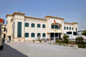
Al Zahra Hospital
Hospital in GCC, United Arab Emirates
Distance: Approx. 991 meters
Latitude and longitude: 25.360573,55.39413
Al Zahra Hospital, Sharjah, is a private general hospital in Sharjah, United Arab Emirates (UAE). Al Zahra serves some 400,000 outpatients and 23,000 inpatients annually, with a capacity of 137 beds. Facilities at the hospital include a 9-bed Intensive Care Unit and a 14-bed long term care and rehabilitation unit as well as seven operating theatres and a number of specialised units.
1987 Sharjawi coup attempt
Political crisis in the United Arab Emirates
Distance: Approx. 1245 meters
Latitude and longitude: 25.3575,55.390833
The 1987 Sharjawi coup or the 1987 Emirati crisis was a political crisis in the United Arab Emirates (UAE) when, due to economic recession due to the 1980s oil glut, the brother of Sultan bin Muhammad Al-Qasimi, the Sheikh of the Emirate of Sharjah, Sheikh `Abd al-`Aziz bin Muhammad Al Qasimi, attempted to stage a bloodless palace coup seizing key positions throughout Sharjah with military elements loyal to him. The coup destabilized the foundation of the still young UAE, and threatened to break the union back into its constituent Emirates, however, it would ultimately fail due to Mohammed bin Rashid Al Maktoum convincing the other Emirati leaders to reinstall the deposed Sultan bin Muhammad Al-Qasimi.

Rolla Sharjah
Place in Sharjah, United Arab Emirates
Distance: Approx. 1406 meters
Latitude and longitude: 25.35835,55.389294
Rolla or Rolla Sharjah (in Arabic: رولا) is a landmark and city within the city of Sharjah, United Arab Emirates.
Weather in this IP's area
clear sky
37 Celsius
43 Celsius
36 Celsius
37 Celsius
993 hPa
44 %
993 hPa
993 hPa
10000 meters
4.63 m/s
160 degree
05:43:56
19:05:34